West Lampung Regency
West Lampung Regency is a regency of Lampung Province, Sumatra, Indonesia. It had an area of 4,950.4 km² and a population of 418,560 people at the 2010 Census, which had risen to an estimated 439,076 by January 2014. The regency seat is Liwa. Administratively it was divided into 17 districts, subdivided into 111 administrative villages (105 desa and 6 kelurahan) administered by lurah.[1] However, on 25 October 2012 part of this area has separated from West Lampung regency to form the new West Pesisir Regency (with its administrative centre at the town of Krui). Forest occupies some 57.154% of the total area as of 2011.[1]
West Lampung Regency Kabupaten Lampung Barat | |
|---|---|
 Seal | |
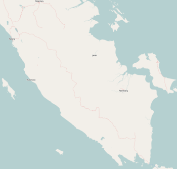
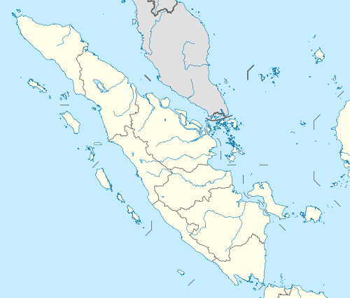
 Location within Lampung | |
| Coordinates: 5.1490°S 104.1931°E | |
| Country | Indonesia |
| Province | Lampung |
| Regency seat | Liwa |
| Government | |
| • Regent | Parosil Mabsus |
| • Vice Regent | Mad Hasnurin |
| Area | |
| • Total | 4,950.4 km2 (1,911.4 sq mi) |
| Population (2014) | |
| • Total | 439,076 |
| • Density | 89/km2 (230/sq mi) |
| Time zone | UTC+7 (IWST) |
| Area code | (+62) 721 |
| Website | lampungbaratkab |

Administrative Districts
West Lampung Regency consisted until 2012 of seventeen districts (kecamatan), tabulated below with their populations at the 2010 Census;[2] this table includes the eight districts split off in 2012 to form the new West Pesisir Regency. Since that removal, six new districts have been created within the residual area of the Regency, and the estimated populations of the resulting fifteen districts (as at mid 2014) are set out below:[3]
|
|
- (* district transferred to new West Pesisir Regency (Kabupaten Pesisir Barat) in 2012)
(a) new district; its 2010 Census population is included in the figure for the existing district(s) from which it was cut out
Airport
In early October 2011, the runway tested has been done and the testers concluded that the airport is ready for operation. The airport laid in 50 hectares of land with a 974-meter-long runway, an apron, taxi way, administration building and 1,800 meter road leading to the airport and is located at Seray village, Pesisir Tengah district. It hopes of boosting tourism and precaution in cases of natural disaster.[4]
Dolphin conservation
Inline with traditional wisdom which prohibits people from catching dolphins, there are hundreds of dolphins surrounding Betuah Island and Banana Island with a tendency to increase in number year by year.[5]
Tanjung Setia Beach
Tanjung Setia Beach is face up to Indian Ocean, 273 kilometers from Bandar Lampung and takes 6 to 7 hours drive. The waves is 6 to 7 meters height and 200 meters long in June to August every year suitable for world surfers and is categorized same as Hawaii. Several kilometers from the beach we can found blue marlin up to 70 kilograms (170 centimeters).[6]
Gallery
 Former emblem of West Lampung Regency, with the creation of West Pesisir Regency from its territory, this logo was deemed not reflecting the current reality and replaced in 2015.[7]
References
- "Profile of Regency of West Lampung". Indonesia Investment Coordinating Board. Retrieved 22 February 2011.
- Biro Pusat Statistik, Jakarta, 2011
- Badan Pusat Statistik, Jakarta, 2019.
- "Island in focus: New airport ready to serve West Lampung". October 10, 2011.
- http://suaramerdeka.com/v1/index.php/read/cetak/2011/07/13/152385/15/Pesona-Ratusan-Lumba-lumba-Lampung-Barat
- "Pantai Tanjung Setia, Mutiara Tersembunyi di Lampung". March 9, 2012.
- "Logo Lampung Barat Yang Baru Resmi Dipakai". www.polpplampungbarat.com. Satpol PP Lampung Barat.
Regencies and cities of Lampung | ||
|---|---|---|
Capital: Bandar Lampung | ||
| Regencies | ||
| Cities |
| |
| Authority control |
|
|---|