Waeng Yai District
Waeng Yai (Thai: แวงใหญ่, pronounced [wɛ̄ːŋ jàj]) is a district (amphoe) of Khon Kaen Province, northeastern Thailand.
Waeng Yai แวงใหญ่ | |
|---|---|
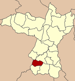 District location in Khon Kaen Province | |
| Coordinates: 15°57′34″N 102°32′52″E | |
| Country | Thailand |
| Province | Khon Kaen |
| Seat | Waeng Yai |
| Area | |
| • Total | 189.069 km2 (73.000 sq mi) |
| Population (2005) | |
| • Total | 29,424 |
| • Density | 155.6/km2 (403/sq mi) |
| Time zone | UTC+7 (ICT) |
| Postal code | 40330 |
| Geocode | 4013 |
Geography
Neighboring districts are (from the north clockwise): Khok Pho Chai, Chonnabot, Phon, and Waeng Noi of Khon Kaen Province; Khon Sawan of Chaiyaphum Province.
History
The minor district (king amphoe) Waeng Yai was established on 3 January 1977, when the three tambons Khon Chim, Non Thong, and Mai Na Phiang were split off from Phon District.[1] It was upgraded to a full district on 26 May 1980.[2]
Administration
The district is divided into five subdistricts (tambons), which are further subdivided into 50 villages (mubans). Waeng Yai is a township (thesaban tambon) which covers tambon Wang Yai. There are a further four tambon administrative organizations (TAO).
| No. | Name | Thai name | Villages | Pop. | |
|---|---|---|---|---|---|
| 1. | Khon Chim | คอนฉิม | 9 | 4,673 | |
| 2. | Mai Na Phiang | ใหม่นาเพียง | 14 | 7,912 | |
| 3. | Non Thong | โนนทอง | 11 | 5,588 | |
| 4. | Waeng Yai | แวงใหญ่ | 7 | 5,259 | |
| 5. | Non Sa-at | โนนสะอาด | 9 | 5,992 |
References
- ประกาศกระทรวงมหาดไทย เรื่อง แบ่งท้องที่อำเภอพล จังหวัดขอนแก่น ตั้งเป็นกิ่งอำเภอแวงใหญ่ (PDF). Royal Gazette (in Thai). 94 (6 ง): 191. January 18, 1977.
- พระราชกฤษฎีกาตั้งอำเภอแวงใหญ่ อำเภอหนองบุนนาก อำเภอโพนทราย อำเภอท่าหลวง และอำเภอศรีรัตนะ พ.ศ. ๒๕๓๒ (PDF). Royal Gazette (in Thai). 106 (83 ก special): 249–251. May 25, 1989.