Khok Pho Chai District
Khok Pho Chai (Thai: โคกโพธิ์ไชย, pronounced [kʰôːk pʰōː t͡ɕʰāj]) is a district (amphoe) of Khon Kaen Province, northeastern Thailand.
Khok Pho Chai โคกโพธิ์ไชย | |
|---|---|
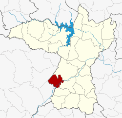 District location in Khon Kaen Province | |
| Coordinates: 16°5′1″N 102°23′56″E | |
| Country | Thailand |
| Province | Khon Kaen |
| Seat | Ban Khok |
| Area | |
| • Total | 238.824 km2 (92.210 sq mi) |
| Population (2005) | |
| • Total | 25,483 |
| • Density | 106.7/km2 (276/sq mi) |
| Time zone | UTC+7 (ICT) |
| Postal code | 40160 |
| Geocode | 4022 |
History
The minor district (king amphoe) was established on 30 April 1994 by splitting it from Mancha Khiri District.[1]
On 15 May 2007, all 81 minor districts were upgraded to full districts.[2] On 24 August the upgrade became official.[3]
Geography
Neighboring districts are (from the north clockwise): Mancha Khiri, Chonnabot, and Waeng Yai of Khon Kaen Province; Khon Sawan and Kaeng Khro of Chaiyaphum Province.
Administration
The district is divided into four subdistricts (tambons), which are further subdivided into 40 villages (mubans). The township (thesaban tambon) Ban Khok covers parts of tambon Ban Khok. There are a further four tambon administrative organizations (TAO).
| No. | Name | Thai name | Villages | Pop. | |
|---|---|---|---|---|---|
| 1. | Ban Khok | บ้านโคก | 11 | 7,141 | |
| 2. | Pho Chai | โพธิ์ไชย | 10 | 7,404 | |
| 3. | Sap Sombun | ซับสมบูรณ์ | 11 | 6,401 | |
| 4. | Na Phaeng | นาแพง | 8 | 4,537 |
References
- ประกาศกระทรวงมหาดไทย เรื่อง แบ่งเขตท้องที่อำเภอมัญจาคีรี จังหวัดขอนแก่น ตั้งเป็นกิ่งอำเภอโคกโพธิ์ไชย (PDF). Royal Gazette (in Thai). 111 (42 ง): 22. May 26, 1994.
- แถลงผลการประชุม ครม. ประจำวันที่ 15 พ.ค. 2550 (in Thai). Manager Online.
- พระราชกฤษฎีกาตั้งอำเภอฆ้องชัย...และอำเภอเหล่าเสือโก้ก พ.ศ. ๒๕๕๐ (PDF). Royal Gazette (in Thai). 124 (46 ก): 14–21. August 24, 2007.
External links
- https://web.archive.org/web/20070929060754/http://www.khokphochaidoc.com/ Website of district (Thai)
- amphoe.com