Villeloin-Coulangé
Villeloin-Coulangé is a commune in the Indre-et-Loire department in central France.

Former Saint-Sauveur abbey in Villeloin-Coulangé.
Villeloin-Coulangé | |
|---|---|
 An aerial view of Villeloin-Coulangé | |
Location of Villeloin-Coulangé 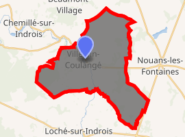
| |
 Villeloin-Coulangé  Villeloin-Coulangé | |
| Coordinates: 47°08′29″N 1°13′27″E | |
| Country | France |
| Region | Centre-Val de Loire |
| Department | Indre-et-Loire |
| Arrondissement | Loches |
| Canton | Loches |
| Intercommunality | CC Loches Sud Touraine |
| Government | |
| • Mayor (2008–2014) | Maryse Garnier |
| Area 1 | 34.62 km2 (13.37 sq mi) |
| Population (2017-01-01)[1] | 599 |
| • Density | 17/km2 (45/sq mi) |
| Time zone | UTC+01:00 (CET) |
| • Summer (DST) | UTC+02:00 (CEST) |
| INSEE/Postal code | 37277 /37460 |
| Elevation | 92–144 m (302–472 ft) |
| 1 French Land Register data, which excludes lakes, ponds, glaciers > 1 km2 (0.386 sq mi or 247 acres) and river estuaries. | |
Geography
The Indrois flows northwest through the commune and crosses the village.
Population
| Historical population | ||
|---|---|---|
| Year | Pop. | ±% |
| 1836 | 951 | — |
| 1841 | 873 | −8.2% |
| 1846 | 847 | −3.0% |
| 1851 | 847 | +0.0% |
| 1856 | 825 | −2.6% |
| 1861 | 926 | +12.2% |
| 1866 | 931 | +0.5% |
| 1872 | 928 | −0.3% |
| 1876 | 960 | +3.4% |
| 1881 | 972 | +1.2% |
| 1886 | 1,001 | +3.0% |
| 1891 | 1,006 | +0.5% |
| 1896 | 1,030 | +2.4% |
| 1901 | 1,025 | −0.5% |
| 1906 | 1,060 | +3.4% |
| 1911 | 988 | −6.8% |
| 1921 | 972 | −1.6% |
| 1926 | 1,011 | +4.0% |
| 1931 | 1,007 | −0.4% |
| 1936 | 1,111 | +10.3% |
| 1946 | 1,066 | −4.1% |
| 1954 | 978 | −8.3% |
| 1962 | 926 | −5.3% |
| 1968 | 830 | −10.4% |
| 1975 | 631 | −24.0% |
| 1982 | 573 | −9.2% |
| 1990 | 571 | −0.3% |
| 1999 | 618 | +8.2% |
| 2006 | 636 | +2.9% |
| 2009 | 652 | +2.5% |
References
- "Populations légales 2017". INSEE. Retrieved 6 January 2020.
| Wikimedia Commons has media related to Villeloin-Coulangé. |
| Authority control |
|
|---|
This article is issued from Wikipedia. The text is licensed under Creative Commons - Attribution - Sharealike. Additional terms may apply for the media files.