Avrillé-les-Ponceaux
Avrillé-les-Ponceaux is a commune in the Indre-et-Loire department in central France.
Avrillé-les-Ponceaux | |
|---|---|
 The church of Saint-Aubin, in Avrillé-les-Ponceaux | |
Location of Avrillé-les-Ponceaux 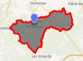
| |
 Avrillé-les-Ponceaux  Avrillé-les-Ponceaux | |
| Coordinates: 47°23′43″N 0°17′14″E | |
| Country | France |
| Region | Centre-Val de Loire |
| Department | Indre-et-Loire |
| Arrondissement | Chinon |
| Canton | Langeais |
| Intercommunality | CC Touraine Ouest Val Loire |
| Government | |
| • Mayor (2014-2020) | Jean-Jack Bordeau |
| Area 1 | 32.8 km2 (12.7 sq mi) |
| Population (2017-01-01)[1] | 481 |
| • Density | 15/km2 (38/sq mi) |
| Time zone | UTC+01:00 (CET) |
| • Summer (DST) | UTC+02:00 (CEST) |
| INSEE/Postal code | 37013 /37340 |
| Elevation | 57–95 m (187–312 ft) |
| 1 French Land Register data, which excludes lakes, ponds, glaciers > 1 km2 (0.386 sq mi or 247 acres) and river estuaries. | |
Population
| Historical population | ||
|---|---|---|
| Year | Pop. | ±% |
| 1793 | 353 | — |
| 1800 | 562 | +59.2% |
| 1806 | 225 | −60.0% |
| 1821 | 533 | +136.9% |
| 1831 | 530 | −0.6% |
| 1836 | 606 | +14.3% |
| 1841 | 630 | +4.0% |
| 1846 | 633 | +0.5% |
| 1851 | 584 | −7.7% |
| 1856 | 635 | +8.7% |
| 1861 | 639 | +0.6% |
| 1866 | 693 | +8.5% |
| 1872 | 700 | +1.0% |
| 1876 | 688 | −1.7% |
| 1881 | 711 | +3.3% |
| 1886 | 729 | +2.5% |
| 1891 | 694 | −4.8% |
| 1896 | 662 | −4.6% |
| 1901 | 684 | +3.3% |
| 1906 | 683 | −0.1% |
| 1911 | 693 | +1.5% |
| 1921 | 704 | +1.6% |
| 1926 | 625 | −11.2% |
| 1931 | 674 | +7.8% |
| 1936 | 581 | −13.8% |
| 1946 | 592 | +1.9% |
| 1954 | 591 | −0.2% |
| 1962 | 561 | −5.1% |
| 1968 | 512 | −8.7% |
| 1975 | 438 | −14.5% |
| 1982 | 372 | −15.1% |
| 1990 | 366 | −1.6% |
| 1999 | 384 | +4.9% |
| 2006 | 446 | +16.1% |
| 2009 | 448 | +0.4% |
| 2014 | 485 | +8.3% |
References
- "Populations légales 2017". INSEE. Retrieved 6 January 2020.
| Wikimedia Commons has media related to Avrillé-les-Ponceaux. |
| Authority control |
|
|---|
This article is issued from Wikipedia. The text is licensed under Creative Commons - Attribution - Sharealike. Additional terms may apply for the media files.