Manthelan
Manthelan is a commune in the Indre-et-Loire department in central France.
Manthelan | |
|---|---|
.jpg) The shops and church in the centre of Manthelan | |
Location of Manthelan 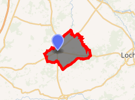
| |
 Manthelan  Manthelan | |
| Coordinates: 47°08′11″N 0°47′38″E | |
| Country | France |
| Region | Centre-Val de Loire |
| Department | Indre-et-Loire |
| Arrondissement | Loches |
| Canton | Descartes |
| Intercommunality | CC Loches Sud Touraine |
| Government | |
| • Mayor (2008–2014) | Dominique Braud |
| Area 1 | 39.58 km2 (15.28 sq mi) |
| Population (2017-01-01)[1] | 1,363 |
| • Density | 34/km2 (89/sq mi) |
| Time zone | UTC+01:00 (CET) |
| • Summer (DST) | UTC+02:00 (CEST) |
| INSEE/Postal code | 37143 /37240 |
| Elevation | 79–128 m (259–420 ft) |
| 1 French Land Register data, which excludes lakes, ponds, glaciers > 1 km2 (0.386 sq mi or 247 acres) and river estuaries. | |
Population
| Historical population | ||
|---|---|---|
| Year | Pop. | ±% |
| 1793 | 1,086 | — |
| 1800 | 1,246 | +14.7% |
| 1806 | 1,227 | −1.5% |
| 1821 | 1,198 | −2.4% |
| 1831 | 1,218 | +1.7% |
| 1836 | 1,275 | +4.7% |
| 1841 | 1,230 | −3.5% |
| 1846 | 1,303 | +5.9% |
| 1851 | 1,272 | −2.4% |
| 1856 | 1,347 | +5.9% |
| 1861 | 1,295 | −3.9% |
| 1866 | 1,306 | +0.8% |
| 1872 | 1,317 | +0.8% |
| 1876 | 1,245 | −5.5% |
| 1881 | 1,215 | −2.4% |
| 1886 | 1,230 | +1.2% |
| 1891 | 1,316 | +7.0% |
| 1896 | 1,299 | −1.3% |
| 1901 | 1,277 | −1.7% |
| 1906 | 1,296 | +1.5% |
| 1911 | 1,262 | −2.6% |
| 1921 | 1,203 | −4.7% |
| 1926 | 1,206 | +0.2% |
| 1931 | 1,239 | +2.7% |
| 1936 | 1,270 | +2.5% |
| 1946 | 1,270 | +0.0% |
| 1954 | 1,250 | −1.6% |
| 1962 | 1,243 | −0.6% |
| 1968 | 1,202 | −3.3% |
| 1975 | 1,100 | −8.5% |
| 1982 | 1,093 | −0.6% |
| 1990 | 1,075 | −1.6% |
| 1999 | 1,145 | +6.5% |
| 2006 | 1,308 | +14.2% |
| 2009 | 1,351 | +3.3% |
References
- "Populations légales 2017". INSEE. Retrieved 6 January 2020.
| Wikimedia Commons has media related to Manthelan. |
| Authority control |
|
|---|
This article is issued from Wikipedia. The text is licensed under Creative Commons - Attribution - Sharealike. Additional terms may apply for the media files.