Thiruttani
Thiruttani is a town in the state of Tamil Nadu, India. This town is famous for Thiruthani Murugan Temple which is one of the Arupadaiveedu and is dedicated to Kartikeya.
Thiruttani Thiruthanigai | |
|---|---|
Town | |
 Thiruttani Location in Tamil Nadu, India | |
| Coordinates: 13.18°N 79.63°E | |
| Country | |
| State | Tamil Nadu |
| District | Thiruvallur |
| Government | |
| • Type | Second Grade Municipality |
| • Body | Thiruttani Municipality |
| Elevation | 76 m (249 ft) |
| Population (2011) | |
| • Total | 44,781 |
| Languages | |
| • Official | Tamil |
| Time zone | UTC+5:30 (IST) |
| PIN | 631209 |
| Vehicle registration | TN-20 |
| Website | www |
Geography
Tiruttani is located at 13.18°N 79.63°E.[1] It has an average elevation of 76 metres (249 ft).
History
During the formation of Andhra state on 1 November 1953, Tirutani was part of Chittoor district of Andhra Pradesh state until 1960. On 1 April 1960, with the Andhra Pradesh and Madras Alteration of Boundaries Act of 1959, Tirutani and Ramakrishnarajupet assembly areas of Andhra Pradesh are transferred to Madras state in exchange for smaller area.[2]
Transport
Tiruttani has good transport links to the nearest cities, towns and villages. Its bus depot contains a total of 79 buses, including 42 operating in rural areas. During the festival season, additional buses are operated in order to keep up with the increased demand. The state of Tamil Nadu operates frequent buses to locations including Chennai, Salem, Bangalore, Tiruvallur, Vellore, Arakkonam, Chittoor, Chengalpet, Kanchipuram, Thiruvannamalai, Tiruvelpur alais Athimanjeripet, Pothatturpettai, Pallipattu and Tirupati.[3] Southern Railway also operates frequent passenger services to and from Chennai.Many electric trains are operated and some express trains which pass through this station stops here. The first local train from Chennai Central is 4:00 am and last train is at 8:15 pm.
Demographics
According to the 2011 census, Tiruttani had a population of 44,781 with a sex ratio of 1,003 females for every 1,000 males, well above the national average of 929.[4] A total of 4,656 were under the age of six, constituting 2,441 males and 2,215 females. Scheduled Castes and Scheduled Tribes accounted for 12.42% and 2.4% of the population respectively. The average literacy of the town was 75.32%, compared to the national average of 72.99%.[4] The town had a total of 11,122 households. There were a total of 16,451 workers, comprising 462 cultivators, 715 main agricultural labourers, 550 in household industries, 12,648 other workers, 2,076 marginal workers, 44 marginal cultivators, 180 marginal agricultural labourers, 202 marginal workers in household industries and 1,650 other marginal workers.[5] As per the religious census of 2011, Tiruttani had 91.85% Hindus, 6.35% Muslims, 1.61% Christians, 0.02% Sikhs, 0.04% Buddhists, 0.06% Jains, 0.06% following other religions and 0.% following no religion or did not indicate any religious preference.[6]
Politics
The Andhra Pradesh and Madras Alteration of Boundaries Act, enacted in 1959 by the Parliament of India under the provisions of article 3 of the constitution, went into effect from 1 April 1960. Under the act, Tirutani taluk and Pallipattu sub-taluk of the Chittoor district of Andhra Pradesh were transferred to Madras State in exchange for territories from the Chingelput (Chengalpattu) and Salem Districts.[7][8]
Tiruttani's assembly constituency is in Arakkonam (Lok Sabha constituency). [9]. It was part of Sriperumbudur (Lok Sabha constituency) earlier.
Climate
| Climate data for Thiruttani (1981–2010, extremes 1975–2009) | |||||||||||||
|---|---|---|---|---|---|---|---|---|---|---|---|---|---|
| Month | Jan | Feb | Mar | Apr | May | Jun | Jul | Aug | Sep | Oct | Nov | Dec | Year |
| Record high °C (°F) | 35.0 (95.0) |
39.6 (103.3) |
41.6 (106.9) |
45.2 (113.4) |
48.6 (119.5) |
46.0 (114.8) |
44.0 (111.2) |
41.0 (105.8) |
39.6 (103.3) |
40.0 (104.0) |
35.8 (96.4) |
34.8 (94.6) |
48.6 (119.5) |
| Average high °C (°F) | 30.5 (86.9) |
32.8 (91.0) |
35.5 (95.9) |
38.2 (100.8) |
40.5 (104.9) |
37.9 (100.2) |
35.9 (96.6) |
34.9 (94.8) |
34.4 (93.9) |
32.5 (90.5) |
30.2 (86.4) |
29.4 (84.9) |
34.4 (93.9) |
| Average low °C (°F) | 17.3 (63.1) |
18.9 (66.0) |
21.0 (69.8) |
24.2 (75.6) |
26.1 (79.0) |
25.9 (78.6) |
24.6 (76.3) |
24.0 (75.2) |
23.6 (74.5) |
22.5 (72.5) |
20.8 (69.4) |
18.9 (66.0) |
22.3 (72.1) |
| Record low °C (°F) | 10.0 (50.0) |
11.4 (52.5) |
14.0 (57.2) |
17.0 (62.6) |
18.8 (65.8) |
20.0 (68.0) |
18.0 (64.4) |
19.6 (67.3) |
19.8 (67.6) |
16.0 (60.8) |
13.0 (55.4) |
11.0 (51.8) |
10.0 (50.0) |
| Average rainfall mm (inches) | 16.0 (0.63) |
15.6 (0.61) |
9.7 (0.38) |
33.1 (1.30) |
56.7 (2.23) |
70.4 (2.77) |
114.2 (4.50) |
113.2 (4.46) |
222.0 (8.74) |
157.4 (6.20) |
229.9 (9.05) |
98.8 (3.89) |
1,136.9 (44.76) |
| Average rainy days | 0.9 | 0.7 | 0.3 | 1.7 | 3.2 | 4.6 | 7.8 | 6.9 | 9.0 | 8.8 | 8.0 | 4.4 | 56.3 |
| Average relative humidity (%) (at 17:30 IST) | 59 | 52 | 45 | 45 | 44 | 49 | 56 | 58 | 64 | 70 | 74 | 70 | 57 |
| Source: India Meteorological Department[10][11] | |||||||||||||
See also
- Santhanagopalapuram
- Pazhani, satellite murugan temple located in Dindugul district, Tamil Nadu.
References
- "Tiruttani, India Page". Falling Rain Genomics, Inc. Retrieved 17 July 2014.
- "THE ANDHRA PRADESH AND MADRAS (ALTERATION OF BOUNDARIES) ACT, 1959". India Legislative Department. Retrieved 24 September 2018.
- "Tamil Nadu State Transport Corporation (Villupuram) Ltd., Tiruvallur Region". Tiruvallur District Website. Retrieved 17 July 2014.
- "Census Info 2011 Final population totals". Office of The Registrar General and Census Commissioner, Ministry of Home Affairs, Government of India. 2013. Retrieved 26 January 2014.
- "Census Info 2011 Final population totals - Tiruttani". Office of The Registrar General and Census Commissioner, Ministry of Home Affairs, Government of India. 2013. Retrieved 26 January 2014.
- "Population By Religious Community - Tamil Nadu" (XLS). Office of The Registrar General and Census Commissioner, Ministry of Home Affairs, Government of India. 2011. Retrieved 13 September 2015.
- "Tamil Nadu Secretariat - Brief History". Government of Tamil Nadu. Archived from the original on 6 January 2007. Retrieved 17 July 2014.
- "Historical Importance of Kanchipuram". Gateway to Kanchipuram District. Archived from the original on 17 September 2008. Retrieved 17 July 2014.
- "Tamil Nadu" (PDF). List of Parliamentary & Assembly Constituencies. Election Commission of India. Archived from the original (PDF) on 4 March 2009. Retrieved 8 October 2008.
- "Station: Thiruttani Climatological Table 1981–2010" (PDF). Climatological Normals 1981–2010. India Meteorological Department. January 2015. pp. 753–754. Archived from the original (PDF) on 5 February 2020. Retrieved 30 March 2020.
- "Extremes of Temperature & Rainfall for Indian Stations (Up to 2012)" (PDF). India Meteorological Department. December 2016. p. M205. Archived from the original (PDF) on 5 February 2020. Retrieved 30 March 2020.
External links
![]()
| District Headquarters | 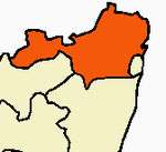 | |
|---|---|---|
| Country | ||
| State | ||
| Region |
| |
| Revenue Divisions | ||
| Taluks | ||
| Revenue blocks | ||
| Municipal Corporation |
| |
| Municipalities | ||
| Special Grade Town Panchayats | ||
| Town Panchayats | ||
| History |
| |
| Places of interest |
| |
| Universities |
| |