Thompsonville, Michigan
Thompsonville is a village in Benzie County in the U.S. state of Michigan. The population was 441 at the 2010 census. The village is located in the south of the county on the boundary between Weldon Township and Colfax Township.
Thompsonville, Michigan | |
|---|---|
%2C_MI_location.png) Location within Benzie County | |
 Thompsonville Location within the state of Michigan | |
| Coordinates: 44°31′13″N 85°56′30″W | |
| Country | United States |
| State | Michigan |
| County | Benzie |
| Townships | Colfax and Weldon |
| Area | |
| • Total | 1.00 sq mi (2.58 km2) |
| • Land | 1.00 sq mi (2.58 km2) |
| • Water | 0.00 sq mi (0.00 km2) |
| Elevation | 794 ft (242 m) |
| Population | |
| • Total | 441 |
| • Estimate (2018)[3] | 448 |
| • Density | 445.78/sq mi (172.16/km2) |
| Time zone | UTC-5 (Eastern (EST)) |
| • Summer (DST) | UTC-4 (EDT) |
| ZIP code(s) | 49683 |
| Area code(s) | 231 |
| FIPS code | 26-79600[4] |
| GNIS feature ID | 1614783[5] |
Geography
According to the United States Census Bureau, the village has a total area of 1.00 square mile (2.59 km2), all land.[6]
Points of interest
Thompsonville is best known for the ski resort located there, Crystal Mountain. Thompsonville is also known for its distillery, Iron Fish Distillery.[7]
Demographics
| Historical population | |||
|---|---|---|---|
| Census | Pop. | %± | |
| 1900 | 893 | — | |
| 1910 | 815 | −8.7% | |
| 1920 | 410 | −49.7% | |
| 1930 | 295 | −28.0% | |
| 1940 | 324 | 9.8% | |
| 1950 | 313 | −3.4% | |
| 1960 | 243 | −22.4% | |
| 1970 | 312 | 28.4% | |
| 1980 | 331 | 6.1% | |
| 1990 | 416 | 25.7% | |
| 2000 | 457 | 9.9% | |
| 2010 | 441 | −3.5% | |
| Est. 2018 | 448 | [3] | 1.6% |
| U.S. Decennial Census[8] | |||
2010 census
As of the census[2] of 2010, there were 441 people, 183 households, and 112 families living in the village. The population density was 441.0 inhabitants per square mile (170.3/km2). There were 245 housing units at an average density of 245.0 per square mile (94.6/km2). The racial makeup of the village was 94.8% White, 0.2% African American, 2.5% Native American, 0.2% Asian, 0.2% from other races, and 2.0% from two or more races. Hispanic or Latino of any race were 1.4% of the population.
There were 183 households of which 28.4% had children under the age of 18 living with them, 37.2% were married couples living together, 16.4% had a female householder with no husband present, 7.7% had a male householder with no wife present, and 38.8% were non-families. 30.6% of all households were made up of individuals and 12.6% had someone living alone who was 65 years of age or older. The average household size was 2.41 and the average family size was 2.99.
The median age in the village was 38.5 years. 23.1% of residents were under the age of 18; 9.1% were between the ages of 18 and 24; 28.1% were from 25 to 44; 24% were from 45 to 64; and 15.6% were 65 years of age or older. The gender makeup of the village was 49.9% male and 50.1% female.
2000 census
As of the census[4] of 2000, there were 457 people, 180 households, and 120 families living in the village. The population density was 454.5 per square mile (174.7/km²). There were 221 housing units at an average density of 219.8 per square mile (84.5/km²). The racial makeup of the village was 96.06% White, 2.41% Native American, 0.22% Asian, 1.09% from other races, and 0.22% from two or more races. Hispanic or Latino of any race were 0.22% of the population.
There were 180 households out of which 34.4% had children under the age of 18 living with them, 47.2% were married couples living together, 13.9% had a female householder with no husband present, and 33.3% were non-families. 28.9% of all households were made up of individuals and 15.0% had someone living alone who was 65 years of age or older. The average household size was 2.54 and the average family size was 3.12.
In the village, the population was spread out with 28.4% under the age of 18, 8.3% from 18 to 24, 27.6% from 25 to 44, 21.4% from 45 to 64, and 14.2% who were 65 years of age or older. The median age was 35 years. For every 100 females, there were 101.3 males. For every 100 females age 18 and over, there were 99.4 males.
The median income for a household in the village was $29,125, and the median income for a family was $31,103. Males had a median income of $22,500 versus $18,250 for females. The per capita income for the village was $12,104. About 12.8% of families and 13.3% of the population were below the poverty line, including 24.3% of those under age 18 and 7.1% of those age 65 or over.
Climate
This climatic region has large seasonal temperature differences, with warm to hot (and often humid) summers and cold (sometimes severely cold) winters. According to the Köppen Climate Classification system, Thompsonville has a humid continental climate, abbreviated "Dfb" on climate maps.[9]
| Climate data for Thompsonville, Michigan | |||||||||||||
|---|---|---|---|---|---|---|---|---|---|---|---|---|---|
| Month | Jan | Feb | Mar | Apr | May | Jun | Jul | Aug | Sep | Oct | Nov | Dec | Year |
| Average high °C (°F) | −6 (22) |
−4 (24) |
1 (34) |
9 (48) |
17 (62) |
22 (71) |
25 (77) |
24 (75) |
19 (66) |
12 (54) |
4 (39) |
−2 (28) |
10 (50) |
| Average low °C (°F) | −15 (5) |
−16 (4) |
−11 (12) |
−4 (25) |
3 (37) |
7 (44) |
10 (50) |
9 (49) |
6 (42) |
1 (33) |
−5 (23) |
−11 (12) |
−2 (28) |
| Average precipitation mm (inches) | 89 (3.5) |
46 (1.8) |
56 (2.2) |
56 (2.2) |
71 (2.8) |
81 (3.2) |
81 (3.2) |
91 (3.6) |
97 (3.8) |
89 (3.5) |
76 (3.0) |
76 (3.0) |
909 (35.8) |
| Source: Weatherbase [10] | |||||||||||||
References
- "2017 U.S. Gazetteer Files". United States Census Bureau. Retrieved Jan 3, 2019.
- "U.S. Census website". United States Census Bureau. Retrieved 2012-11-25.
- "Population and Housing Unit Estimates". Retrieved March 23, 2020.
- "U.S. Census website". United States Census Bureau. Retrieved 2008-01-31.
- "US Board on Geographic Names". United States Geological Survey. 2007-10-25. Retrieved 2008-01-31.
- "US Gazetteer files 2010". United States Census Bureau. Archived from the original on 2012-01-25. Retrieved 2012-11-25.
- Iron Fish Distillery
- "Census of Population and Housing". Census.gov. Retrieved June 4, 2015.
- Climate Summary Thompsonville
- "Weatherbase.com". Weatherbase. 2013. Retrieved on July 2, 2013.
Municipalities and communities of Benzie County, Michigan, United States | ||
|---|---|---|
| City | 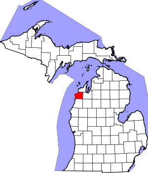 Map of Michigan highlighting Benzie County.svg | |
| Villages | ||
| Civil townships | ||
| CDPs | ||
| Indian reservation | ||
| Footnotes | ‡This populated place also has portions in an adjacent county or counties | |