Gilmore Township, Benzie County, Michigan
Gilmore Township is a civil township of Benzie County in the U.S. state of Michigan. The population was 821 at the 2010 census.[3] The L-shaped township contains the village of Elberta and is bordered on the north by the city of Frankfort. The narrow township is located between Crystal Lake Township to the north and Blaine Township to the south, as well as a short boundary with Benzonia Township to the east.
Gilmore Township, Michigan | |
|---|---|
%2C_MI_location.png) Location within Benzie County (red) and the administered village of Elberta (pink) | |
 Gilmore Township Location within the state of Michigan | |
| Coordinates: 44°36′16″N 86°12′40″W | |
| Country | United States |
| State | Michigan |
| County | Benzie |
| Organized | 1867 |
| Area | |
| • Total | 7.5 sq mi (19.4 km2) |
| • Land | 7.1 sq mi (18.5 km2) |
| • Water | 0.4 sq mi (1.0 km2) |
| Elevation | 584 ft (178 m) |
| Population (2010) | |
| • Total | 821 |
| • Density | 115/sq mi (44.4/km2) |
| Time zone | UTC-5 (Eastern (EST)) |
| • Summer (DST) | UTC-4 (EDT) |
| ZIP code(s) | 49616, 49628, 49635 |
| Area code(s) | 231 |
| FIPS code | 26-32180[1] |
| GNIS feature ID | 1626353[2] |
History
Gilmore Township was organized in 1867.[4]
Geography
According to the United States Census Bureau, the township has a total area of 7.5 square miles (19.5 km2), of which 7.1 square miles (18.5 km2) is land and 0.39 square miles (1.0 km2), or 4.89%, is water.[3]
Demographics
As of the census[1] of 2000, there were 850 people, 341 households, and 236 families residing in the township. The population density was 117.2 per square mile (45.3/km²). There were 439 housing units at an average density of 60.5 per square mile (23.4/km²). The racial makeup of the township was 97.06% White, 0.35% African American, 0.71% Native American, 0.35% from other races, and 1.53% from two or more races. Hispanic or Latino of any race were 0.94% of the population.
There were 341 households out of which 32.6% had children under the age of 18 living with them, 53.4% were married couples living together, 10.6% had a female householder with no husband present, and 30.5% were non-families. 26.1% of all households were made up of individuals and 11.1% had someone living alone who was 65 years of age or older. The average household size was 2.49 and the average family size was 2.98.
In the township the population was spread out with 27.8% under the age of 18, 6.8% from 18 to 24, 29.6% from 25 to 44, 21.2% from 45 to 64, and 14.6% who were 65 years of age or older. The median age was 37 years. For every 100 females, there were 101.4 males. For every 100 females age 18 and over, there were 98.7 males.
The median income for a household in the township was $29,712, and the median income for a family was $33,824. Males had a median income of $27,361 versus $21,591 for females. The per capita income for the township was $14,999. About 6.9% of families and 9.1% of the population were below the poverty line, including 10.8% of those under age 18 and 5.9% of those age 65 or over.
References
Notes
- "U.S. Census website". United States Census Bureau. Retrieved 2008-01-31.
- U.S. Geological Survey Geographic Names Information System: Gilmore Township, Benzie County, Michigan
- "Geographic Identifiers: 2010 Demographic Profile Data (G001): Gilmore township, Benzie County, Michigan". U.S. Census Bureau, American Factfinder. Archived from the original on February 12, 2020. Retrieved December 30, 2013.
- Romig 1986, p. 65.
Sources
- Romig, Walter (October 1, 1986) [1973]. Michigan Place Names: The History of the Founding and the Naming of More Than Five Thousand Past and Present Michigan Communities. Great Lakes Books Series (Paperback). Detroit, Michigan: Wayne State University Press. ISBN 978-0-8143-1838-6.CS1 maint: ref=harv (link)
Municipalities and communities of Benzie County, Michigan, United States | ||
|---|---|---|
| City | 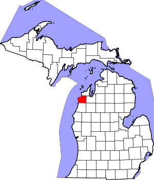 Map of Michigan highlighting Benzie County.svg | |
| Villages | ||
| Civil townships | ||
| CDPs | ||
| Indian reservation | ||
| Footnotes | ‡This populated place also has portions in an adjacent county or counties | |