Tha Luang District
Tha Luang (Thai: ท่าหลวง, pronounced [tʰâː lǔa̯ŋ]) is a district (amphoe) in eastern part of Lopburi Province, central Thailand.
Tha Luang ท่าหลวง | |
|---|---|
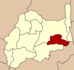 District location in Lopburi Province | |
| Coordinates: 15°4′6″N 101°6′25″E | |
| Country | Thailand |
| Province | Lopburi |
| Seat | Tha Luang |
| Tambon | 6 |
| Muban | 43 |
| District established | 1978 |
| Area | |
| • Total | 538.9 km2 (208.1 sq mi) |
| Population (2012) | |
| • Total | 29,059 |
| • Density | 52.0/km2 (135/sq mi) |
| Time zone | UTC+7 (ICT) |
| Postal code | 15130 |
| Geocode | 1607 |
History
The minor district (king amphoe) was created on 15 November 1978, when the four tambon Tha Luang, Sab Champha, Nong Phak Waen, and Kaeng Phak Kut were split off from Chai Badan District.[1] On 26 May 1989 it was upgraded to full district status.[2]
Geography
The Pa Sak Cholasit reservoir is the main water resource of the district, used for fishery and as well as irrigation.
Neighboring districts are (from the north clockwise) Chai Badan and Lam Sonthi of Lopburi, Muak Lek of Saraburi Province, and Phatthana Nikhom of Lopburi.
Administration
The district is divided into six sub-districts (tambons), which are further subdivided into 43 villages (mubans). Ban Tha Luang has sub-district municipality (thesaban tambon) status and covers parts of tambon Tha Luang. There are six tambon administrative organizations (TAO).
| No. | Name | Thai | Pop.[3] |
|---|---|---|---|
| 1. | Tha Luang | ท่าหลวง | 8,842 |
| 2. | Kaeng Phak Kut | แก่งผักกูด | 4,092 |
| 3. | Sap Champa | ซับจำปา | 4,418 |
| 4. | Nong Phak Waen | หนองผักแว่น | 4,639 |
| 5. | Thale Wang Wat | ทะเลวังวัด | 1,503 |
| 6. | Hua Lam | หัวลำ | 5,565 |
References
- ประกาศกระทรวงมหาดไทย เรื่อง แบ่งท้องที่อำเภอชัยบาดาล จังหวัดลพบุรี ตั้งเป็นกิ่งอำเภอท่าหลวง (PDF). Royal Gazette (in Thai). 95 (132 ง): 4235. November 28, 1978.
- พระราชกฤษฎีกาตั้งอำเภอแวงใหญ่ อำเภอหนองบุนนาก อำเภอโพนทราย อำเภอท่าหลวง และอำเภอศรีรัตนะ พ.ศ. ๒๕๓๒ (PDF). Royal Gazette (in Thai). 106 (83 ก special): 249–251. May 25, 1989.
- "Population statistics 2012". Department of Provincial Administration.
External links
Lopburi | ||
|---|---|---|
| Main article |  | |
| Capital | ||
| Districts (amphoe) | ||
| Royalty | ||
| Related topics |
| |
| Neighboring areas | ||