Highway 66 (Israel)
Highway 66 is a north-south highway in the Jezreel Valley in northern Israel. It extends along the eastern lowlands below the Menashe Heights and the Carmel. It is 17 km long. In the past the road continued south to Jenin, but today it ends at checkpoint.

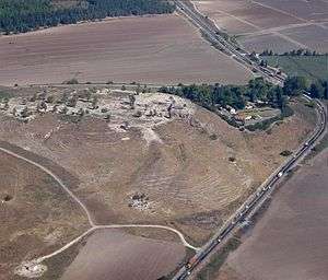
Tel Megiddo National Park and Highway 66
Interchanges & Junctions (South to North)
| Kilometers | Name | type | Location | Intersecting routes | |
|---|---|---|---|---|---|
| Green Line | |||||
| Security Checkpoint | |||||
| 0 | checkpoint | Salem, Zububa |
|||
| 1 | Givat Oz Junction | Giv'at Oz | entrance road | ||
| 3 | Megiddo junction | Megiddo | |||
| 4.8 | Megiddo | local road | |||
| 5.5 | HaYogev Junction | HaYogev | local road | ||
| 7.4 | Midrakh Oz Junction | Midrakh Oz | local road | ||
| 10 | Mishmar Ha'Emek Junction | Mishmar Ha'Emek | |||
| 14 | HaZore'a Junction | HaZore'a | local road | ||
| 17 | HaTishbi Junction | Yokneam | |||
| 18 | Tel Kashish Interchange | Yokneam | |||
Places of interest on Highway 66
- Tel Megiddo National Park
See also
- List of highways in Israel
| Roads |
| ||||
|---|---|---|---|---|---|
| Bus operators | |||||
| Rail transport |
| ||||
| Sea ports | |||||
| Aviation |
| ||||
| Cable cars | |||||
| By city | |||||
| Smart cards | |||||
This article is issued from Wikipedia. The text is licensed under Creative Commons - Attribution - Sharealike. Additional terms may apply for the media files.