Tanjung Selor
Tanjung Selor is a town and the capital of North Kalimantan province in Indonesia. It is also the capital of Bulungan Regency. The district has an area of 1,277.81 km² and a population of 39,439 at the 2010 Census. The district is served by the Tanjung Harapan Airport.
Tanjung Selor | |
|---|---|
 A view of Tanjung Selor | |
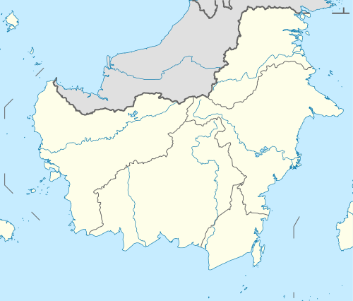 Tanjung Selor Location in Kalimantan and Indonesia  Tanjung Selor Tanjung Selor (Indonesia) | |
| Coordinates: 2°51′0″N 117°23′0″E | |
| Country | |
| Province | |
| Regency | Bulungan |
| Area | |
| • Total | 1,277.81 km2 (493.37 sq mi) |
| Elevation | 24 m (79 ft) |
| Population (2010 Census) | |
| • Total | 51,996 |
| • Density | 41/km2 (110/sq mi) |
| Time zone | UTC+8 (Indonesia Central Time) |
| Area code | (+62) 553 |
Climate
Tanjung Selor has a tropical rainforest climate (Af) with heavy rainfall year-round.
| Climate data for Tanjung Selor | |||||||||||||
|---|---|---|---|---|---|---|---|---|---|---|---|---|---|
| Month | Jan | Feb | Mar | Apr | May | Jun | Jul | Aug | Sep | Oct | Nov | Dec | Year |
| Average high °C (°F) | 30.0 (86.0) |
30.0 (86.0) |
30.2 (86.4) |
30.5 (86.9) |
30.8 (87.4) |
30.5 (86.9) |
30.7 (87.3) |
30.8 (87.4) |
30.9 (87.6) |
31.0 (87.8) |
30.8 (87.4) |
30.3 (86.5) |
30.5 (87.0) |
| Daily mean °C (°F) | 26.5 (79.7) |
26.5 (79.7) |
26.7 (80.1) |
27.0 (80.6) |
27.2 (81.0) |
26.8 (80.2) |
26.9 (80.4) |
26.9 (80.4) |
27.0 (80.6) |
27.0 (80.6) |
27.1 (80.8) |
26.8 (80.2) |
26.9 (80.4) |
| Average low °C (°F) | 23.0 (73.4) |
23.0 (73.4) |
23.3 (73.9) |
23.5 (74.3) |
23.6 (74.5) |
23.2 (73.8) |
23.1 (73.6) |
23.1 (73.6) |
23.1 (73.6) |
23.1 (73.6) |
23.4 (74.1) |
23.3 (73.9) |
23.2 (73.8) |
| Average precipitation mm (inches) | 235 (9.3) |
235 (9.3) |
212 (8.3) |
186 (7.3) |
222 (8.7) |
189 (7.4) |
207 (8.1) |
213 (8.4) |
229 (9.0) |
229 (9.0) |
281 (11.1) |
278 (10.9) |
2,716 (106.8) |
| Source: [1] | |||||||||||||
References
External links
- Official website Bulungan Regency Official Website
Regencies and cities of North Kalimantan | ||
|---|---|---|
Capital: Tanjung Selor | ||
| Regencies | ||
| Cities | ||
This article is issued from Wikipedia. The text is licensed under Creative Commons - Attribution - Sharealike. Additional terms may apply for the media files.