Tamot District
Tamot (Thai: ตะโหมด, pronounced [tā.mòːt]) is a district (amphoe) of Phatthalung Province, southern Thailand.
Tamot ตะโหมด | |
|---|---|
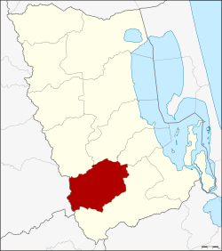 District location in Phatthalung Province | |
| Coordinates: 7°20′24″N 100°6′42″E | |
| Country | Thailand |
| Province | Phatthalung |
| Seat | Mae Khari |
| Area | |
| • Total | 264.2597 km2 (102.0312 sq mi) |
| Population (2005) | |
| • Total | 27,982 |
| • Density | 105.9/km2 (274/sq mi) |
| Time zone | UTC+7 (ICT) |
| Postal code | 93160 |
| Geocode | 9304 |
Geography
Neighboring districts are (from the north clockwise) Kong Ra, Khao Chaison, Bang Kaeo, and Pa Bon of Phatthalung Province, Palian of Trang Province.
History
The district was established on 1 August 1977, when it was split off from Khao Chaison District.[1] It was upgraded to a full district on 20 March 1986.[2]
Environment
As of August 2019, the district is the site of a proposed rock quarry that has been opposed by some environmental groups and locals. Human Rights Watch has reported that opponents of the quarry and journalists covering the story have been threatened and intimidated.[3]
Administration
The district is divided into three sub-districts (tambons), which are further subdivided into 33 villages (mubans). There are two townships (thesaban tambons): Tamot covers parts of tambons Tamot and Khlong Yai, and Mae Khari parts of the same-named tambon. There are a further three tambon administrative organizations (TAO).
| No. | Name | Thai name | Villages | Pop. | |
|---|---|---|---|---|---|
| 1. | Mae Khari | แม่ขรี | 11 | 11,514 | |
| 2. | Tamot | ตะโหมด | 12 | 9,489 | |
| 3. | Khlong Yai | คลองใหญ่ | 10 | 6,979 |
References
- ประกาศกระทรวงมหาดไทย เรื่อง แบ่งท้องที่อำเภอเขาชัยสน จังหวัดพัทลุง ตั้งเป็นกิ่งอำเภอตะโหมด (PDF). Royal Gazette (in Thai). 94 (70 ง): 3188. August 2, 1977.
- พระราชกฤษฎีกาตั้งอำเภอคลองลาน อำเภอสุคิริน อำเภอตะโหมด อำเภอห้วยทับทัน และอำเภอปากคาด พ.ศ. ๒๕๒๙ (PDF). Royal Gazette (in Thai). 103 (45 ก special): 4–7. March 20, 1986.
- "HRW calls for Thai authorities to investigate activist's abduction in Phatthalung". Prachatai English. 16 August 2019. Retrieved 17 August 2019.