Kong Ra District
Kong Ra (Thai: กงหรา, pronounced [kōŋ rǎː]) is a district (amphoe) of Phatthalung Province, southern Thailand.
Kong Ra กงหรา | |
|---|---|
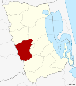 District location in Phatthalung Province | |
| Coordinates: 7°24′12″N 99°57′0″E | |
| Country | Thailand |
| Province | Phatthalung |
| Seat | Kong Ra |
| Area | |
| • Total | 255.856 km2 (98.787 sq mi) |
| Population (2005) | |
| • Total | 33,413 |
| • Density | 130.6/km2 (338/sq mi) |
| Time zone | UTC+7 (ICT) |
| Postal code | 93180 |
| Geocode | 9302 |
Geography
Neighboring districts are (from the north clockwise) Srinagarindra, Mueang Phatthalung, Khao Chaison, and Tamot of Phatthalung Province, Palian and Yan Ta Khao of Trang Province.
History
The minor district (king amphoe) was created on 1 October 1975, when the three tambons Kong Ra, Khlong Chaloem, and Charat were split off from Mueang Phatthalung District.[1] It was upgraded to a full district on 13 July 1981.[2]
Administration
The district is divided into five sub-districts (tambons), which are further subdivided into 45 villages (mubans). There are no municipal (thesaban) areas. There are five tambon administrative organizations (TAO).
| No. | Name | Thai name | Villages | Pop. | |
|---|---|---|---|---|---|
| 1. | Kong Ra | กงหรา | 7 | 3,982 | |
| 2. | Charat | ชะรัด | 9 | 6,662 | |
| 3. | Khlong Chaloem | คลองเฉลิม | 14 | 12,118 | |
| 4. | Khlong Sai Khao | คลองทรายขาว | 8 | 6,144 | |
| 5. | Som Wang | สมหวัง | 7 | 4,507 |
References
- ประกาศกระทรวงมหาดไทย เรื่อง แบ่งท้องที่อำเภอเมืองพัทลุง จังหวัดพัทลุง ตั้งเป็นกิ่งอำเภอกงหรา (PDF). Royal Gazette (in Thai). 92 (202 ง): 2411. September 13, 1975.
- พระราชกฤษฎีกาตั้งอำเภอหนองใหญ่ อำเภอบ่อไร่ อำเภอพรหมคีรี อำเภอนาบอน อำเภอบางสะพานน้อย อำเภอนาดี อำเภอกงหรา อำเภอวังทรายพูน อำเภอธารโต อำเภอคำตากล้า อำเภอศรีนคร อำเภอด่านช้าง อำเภอพรเจริญ อำเภอวังสามหมอ และอำเภอลานสัก พ.ศ. ๒๕๒๔ (PDF). Royal Gazette (in Thai). 98 (115 ก Special): 7–10. July 13, 1981.
This article is issued from Wikipedia. The text is licensed under Creative Commons - Attribution - Sharealike. Additional terms may apply for the media files.