Pa Bon District
Pa Bon (Thai: ป่าบอน, pronounced [pàː bɔ̄ːn]) is a district (amphoe) of Phatthalung Province, southern Thailand.
Pa Bon ป่าบอน | |
|---|---|
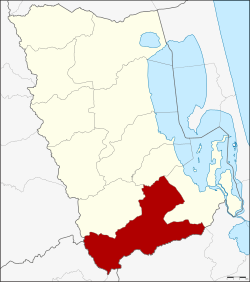 District location in Phatthalung Province | |
| Coordinates: 7°16′12″N 100°10′12″E | |
| Country | Thailand |
| Province | Phatthalung |
| Seat | Wang Mai |
| Area | |
| • Total | 380.844 km2 (147.045 sq mi) |
| Population (2005) | |
| • Total | 43,981 |
| • Density | 115.5/km2 (299/sq mi) |
| Time zone | UTC+7 (ICT) |
| Postal code | 93170 |
| Geocode | 9308 |
Geography
Neighboring districts are (from the north clockwise) Tamot, Bang Kaeo, and Pak Phayun of Phatthalung Province, Rattaphum of Songkhla Province, Khuan Kalong of Satun Province and Palian of Trang Province.
History
The minor district was established on 1 May 1983, when the three tambons Pa Bon, Nong Thong, and Khok Sai were split off from Pak Phayun District.[1] It was upgraded to a full district on 21 May 1990.[2]
Administration
The district is divided into five sub-districts (tambons), which are further subdivided into 48 villages (mubans). Pa Bon is a township (thesaban tambon) which covers parts of the tambon Pa Bon, Nong Thong and Wang Mai. There are a further five tambon administrative organizations (TAO).
| No. | Name | Thai name | Villages | Pop. | |
|---|---|---|---|---|---|
| 1. | Pa Bon | ป่าบอน | 10 | 9,542 | |
| 2. | Khok Sai | โคกทราย | 12 | 10,020 | |
| 3. | Nong Thong | หนองธง | 9 | 9,074 | |
| 4. | Thung Nari | ทุ่งนารี | 9 | 8,765 | |
| 6. | Wang Mai | วังใหม่ | 8 | 6,580 |
Geocode 5 is not used.
References
- ประกาศกระทรวงมหาดไทย เรื่อง แบ่งท้องที่อำเภอปากพะยูน จังหวัดพัทลุง ตั้งเป็นกิ่งอำเภอป่าบอน (PDF). Royal Gazette (in Thai). 100 (65 ง): 1318. April 26, 1983.
- พระราชกฤษฎีกาตั้งอำเภอห้วยผึ้ง อำเภอวังวิเศษ อำเภอคลองหาด อำเภอป่าบอน อำเภอหนองหญ้าปล้อง อำเภอวังโป่ง อำเภอควนเนียง อำเภอหนองหญ้าไซ อำเภอบ้านนาเดิม อำเภอทุ่งฝน อำเภอสร้างคอม และอำเภอทองแสนขัน พ.ศ. ๒๕๓๓ (PDF). Royal Gazette (in Thai). 107 (83 ก special): 1–4. May 21, 1994.