Talas Region
Talas Region (Kyrgyz: Талас облусу, Talas oblusu Russian: Таласская область) is a region (oblast) of Kyrgyzstan. Its capital is Talas. It is bordered on the west and north by Jambyl Region of Kazakhstan, on the east by Chuy Region, on the south by Jalal-Abad Region and on the southwest by a finger of Uzbekistan. It is basically a U-shaped valley open to the west. The northern border is defined by the Kyrgyz Ala-Too, which also form the southern border of Chuy Region. At the eastern end, the Talas Ala-Too Range splits off and marks the southern border. The Talas River flows through the center of the valley. The main highway (A361) enters from the east over the Ötmök Pass (Can become impassible during winter due to weather) and goes down the valley to Taraz in Kazakhstan. Near the mouth of the valley at Kyzyl-Adyr, one road goes north toward Taraz and the other south over the Kara-Buura Pass to Jalal-Abad Province. Before independence most trade links were with Taraz. The historic Battle of Talas occurred here.
Talas Region Талас облусу Таласская область | |
|---|---|
 Flag  Coat of arms | |
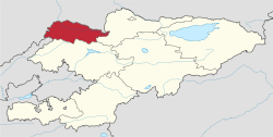 Map of Kyrgyzstan, location of Talas Province highlighted | |
| Coordinates: 42°30′N 72°30′E | |
| Country | |
| Capital | Talas |
| Government | |
| • Gubernator | Koisun Kurmanalieva |
| Area | |
| • Total | 11,400 km2 (4,400 sq mi) |
| Population (2020-01-01)[1] | |
| • Total | 267,360 |
| • Density | 23/km2 (61/sq mi) |
| Time zone | UTC+6 (East) |
| • Summer (DST) | UTC+6 (not observed) |
| ISO 3166 code | KG-T |
| Districts | 4 |
| Cities | 1 |
| Townships | 1 |
| Villages | 90 |
Basic Socio-Economic Indicators
Demographics
As of 2009, Talas Region contained 1 town, 1 urban-type settlement, and 90 villages. Its population, according to the Population and Housing Census of 2009 amounted to 219.6 thousand (enumerated de facto population) or 226.8 thousand (de jure population).[6]The region's estimated population for the beginning of 2020 was 267,360. [1]
| Historical populations in Talas Region | ||
|---|---|---|
| Year | Pop. | ±% |
| 1970 | 141,169 | — |
| 1979 | 163,288 | +15.7% |
| 1989 | 193,814 | +18.7% |
| 1999 | 200,269 | +3.3% |
| 2009 | 219,615 | +9.7% |
| Note: de jure population; Source:[6] | ||
Ethnic composition
According to the 2009 Census, the ethnic composition of the Talas Region (de jure population) was:[6]
| Ethnic group | Population | Proportion of Talas Province population |
|---|---|---|
| Kyrgyz | 208,399 | 91.9% |
| Kurds | 5,547 | 2.5% |
| Russians | 4,356 | 1.9% |
| Kazakhs | 3,049 | 1.3% |
| Uzbeks | 1,779 | 0.8% |
| Turks | 1,547 | 0.7% |
| Ukrainians | 500 | 0.2% |
| Germans | 384 | 0.2% |
| Tatars | 299 | 0.1% |
| other groups | 919 | 0.4% |
Districts of Talas
Talas Region is divided administratively into 4 districts:[7]
| District | Capital |
|---|---|
| Bakay-Ata District | Bakay-Ata[8] |
| Kara-Buura District | Kyzyl-Adyr |
| Manas District | Pokrovka |
| Talas District | Manas |
See also
References
- Population of regions,districts, towns, urban-type settlements, rural communities and villages of Kyrgyz Republic (National Statistical Committee estimate as of the beginning of 2020) Численность населения областей, районов, городов, поселков городского типа,айылных аймаков и сел Кыргызской Республики (оценка НСК на начало 2020г)
- National Committee on Statistics (in Kyrgyz/Russian) Archived 2010-11-14 at the Wayback Machine
- National Committee on Statistics (in Kyrgyz/Russian) Archived 2010-11-14 at the Wayback Machine
- National Committee on Statistics (in Kyrgyz/Russian) Archived 2011-07-22 at the Wayback Machine
- National Committee on Statistics (in Kyrgyz/Russian) Archived 2011-07-22 at the Wayback Machine
- "2009 population census of the Kyrgyz Republic: Talas Region" (PDF). Archived from the original (PDF) on 21 March 2012. Retrieved 2012-03-21.
- Kyrgyzstan - Джалал-Абадская область
- "Archived copy". Archived from the original on 2011-07-22. Retrieved 2009-03-01.CS1 maint: archived copy as title (link)
- Works cited
- Laurence Mitchell, Kyrgyzstan, Bradt Travel Guides, 2008
External links
Places adjacent to Talas Region | ||||||||||
|---|---|---|---|---|---|---|---|---|---|---|
| ||||||||||