Syaulibang
Syaulibang is a village and Village Development Committee in Pyuthan, a Middle Hills district of Rapti Zone, western Nepal.
Syaulibang स्याउलीबाङ | |
|---|---|
Village Development Committee | |
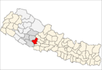
 Syaulibang Location in Nepal | |
| Coordinates: 28°18′45″N 82°56′54″E | |
| Country | |
| Region | Mid-Western |
| Zone | Rapti Zone |
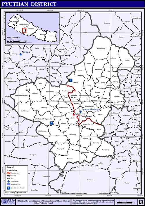
| District | Pyuthan District |
| VDC | Syaulibang |
| Elevation --Syaulibang Village | 1,706 m (5,597 ft) |
| Highest elevation | 3,612 m (11,850 ft) |
| Lowest elevation | 1,500 m (4,900 ft) |
| Population (2001 Census[1]) | |
| • Total | 2,741 |
| 462 households | |
| Time zone | UTC+5:45 (Nepal Time) |
Etymology
In Khamkura Syauli means apple. Bang means a high field or pasture, usually above 2,000 meters where snow can fall, suggesting a climate with enough winter cold for cultivating apples, so 'Apple Orchard' is a reasonable translation of this place name.
Geography and Climate
Syaulibang is Pyuthan district's northernmost VDC, bordering Gaam VDC in Rolpa to the northwest and Baglung district's Bowang and Taman VDCs to the northeast. Syaulibang is also Pyuthan's highest VDC, ranging from about 1,500 metres (4,900 ft) up to a 3,612 metres (11,850 ft) summit at the meeting point of Syaulibang, Gaam and Bowang VDCs[2] on the lekh that is the Rapti-Gandaki divide.
Syaulibang's climate is mostly subtropical below 2,000 metres (6,600 ft) and temperate up to 3,000 metres (10,000 ft) with a small subalpine zone above.
Villages in this VDC
| Ward | Lat. | Lon | Elev. | ||
|---|---|---|---|---|---|
| Banchare | बञ्चरे | 28°20'N | 82°57'E | 2,426m | |
| Bansing | बानसिङ | 28°19'N | 82°56'E | 2,210 | |
| Bansthala | बाँस्थला | 28°19'N | 82°57'E | 2,190 | |
| Bhegni | भेग्नी | 28°19'N | 82°58'E | 2,110 | |
| Bhungja | भुङजा | 28°18'N | 82°56'E | 2,210 | |
| Chautara | चौतारा | 28°17'N | 82°56'E | 2,010 | |
| Chhepte Odar | छेप्टे ओडार | 28°18'N | 82°56'E | 2,070 | |
| Dakhara | डाखारा | 28°18'N | 82°59'E | 2,170 | |
| Dharamjim | धरमजिम | 3 | 28°18'N | 82°56'E | 2,070 |
| Dimechaur | डिमेचौर | 28°19'N | 82°57'E | 1,730 | |
| Dodrebhir | डोड्रेभिर | 28°17'N | 82°58'E | 2,355 | |
| Gadera | गडेरा | 28°19'N | 82°58'E | 2,070 | |
| Hastungdanda | हस्तुङडाँडा | 28°19'N | 82°55'E | 2,530 | |
| Jhibang | झिबाङ | 28°18'N | 82°58'E | 1,870 | |
| Khal | खाल | 28°19'N | 82°56'E | 1,950 | |
| Khalibang | खालीबाङ | 28°18'N | 82°57'E | 1,730 | |
| Khardanda | खारडाँडा | 28°20'N | 83°00'E | 2,170 | |
| Kharkholagaun | खारखोलागाउँ | 8 | 28°18'N | 82°58'E | 2,030 |
| Kothibhir | कोठीभिर | 28°21'N | 82°57'E | 2,845 | |
| Kuser | कुसेर | 28°19'N | 82°56'E | 1,875 | |
| Langlet | लङलेट | 28°19'N | 82°56'E | 2,290 | |
| Manggra | माङग्रा | 28°20'N | 82°56'E | 2,130 | |
| Masing | मसिङ | 28°20'N | 82°57'E | 1,950 | |
| Mathillo Bhegni | माथिल्लो भेग्नी | 28°19'N | 82°59'E | 2,775 | |
| Modhara | मोधारा | 28°19'N | 82°56'E | 1,910 | |
| Narga | नार्गा | 28°18'N | 82°57'E | 1,775 | |
| Paharadanda | पहराडाँडा | 28°18'N | 82°58'E | 2,230 | |
| Ransing | रानसिङ | 28°21'N | 82°57'E | 2,412 | |
| Sarima | सरिमा | 1 | 28°17'N | 82°57'E | 1,910 |
| Shahi Bisauna | शाही बिसौना | 28°17'N | 82°59'E | 2,245 | |
| Syaulibang | स्याउलीबाङ | 5 | 28°19'N | 82°57'E | 1,706 |
| Tarebhir | तारेभिर | 28°20'N | 82°57'E | 2,770 | |
| Thoklang | थोकलाङ | 28°20'N | 82°59'E | 2,390 | |
| Totke | टोट्के | 28°19'N | 82°56'E | 2,290 | |
| Tumpa | तुम्प | 28°19'N | 82°58'E | 2,290 | |
| Uttise | उत्तिसे | 28°19'N | 82°58'E | 2,123 |
References
- "Nepal Census 2001". Nepal's Village Development Committees. Digital Himalaya. Retrieved 21 September 2008.
- Peak and triple boundary point at 28°21′35″N 82°57′18″E
- "Index of Geographical Names of Nepal, Volume IV: Mid Western Development Region, List of Settlements, Pyuthan" (PDF). Government of Nepal, National Geographic Information Infrastructure Program. Archived from the original (PDF) on 2011-07-24. Retrieved 2011-03-12.