Bangesal
Bangesal is both a town and Pyuthan District, Nepal's southernmost Village Development Committee; also Pyuthan's lowest in elevation. This VDC is in the Siwalik hills north of Deukhuri Valley.
Bangesal वांगेशाल | |
|---|---|
Village Development Committee | |
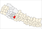
 Bangesal Location in Nepal | |
| Coordinates: 27°54′43″N 82°50′59″E | |
| Country | |
| Region | Mid-Western |
| Zone | Rapti Zone |
| District | Pyuthan District |
| VDC | Bangesal |
| Elevation -- at Bangesal village | 368 m (1,207 ft) |
| Highest elevation | 1,080 m (3,540 ft) |
| Lowest elevation | 323 m (1,060 ft) |
| Population (2001 Census[1]) | |
| • Total | 3,759 |
| 638 households | |
| Time zone | UTC+5:45 (Nepal Time) |
Elevations range from 323 metres (1,060 ft) at the confluence of Rangle Khola with the West Rapti River bordering Dang district, up to 1,080 metres (3,540 ft) on the crest of the Siwaliks. Except for a few hectares exceeding 1,000 metres elevation, Bangesal falls into Nepal's upper tropical climate zone.[2]
Villages in VDC
| Ward | Lat. | Lon | Elev. | ||
|---|---|---|---|---|---|
| Aatitar | आटीटार | 27°55'N | 82°51'E | 390m | |
| Aduwabari | अदुवाबारी | 27°55'N | 82°47'E | 430 | |
| Amiladhik | अमिलाढिक | 27°54'N | 82°47'E | 390 | |
| Auleni | औलेनी | 27°55'N | 82°50'E | 350 | |
| Badanekhola gaun | बदनेखोलागाउँ | 27°55'N | 82°51'E | 370 | |
| Baghkhor | बाघखोर | 27°53'N | 82°48'E | 410 | |
| Bahunpata | बाहुनपाटा | 27°54'N | 82°47'E | 390 | |
| Bangesal | बाङ्गेसाल | 27°54'N | 82°51'E | 368 | |
| Barnabir | बर्नबिर | 27°56'N | 82°50'E | 390 | |
| Bhampali | भमपाली | 27°56'N | 82°50'E | 510 | |
| Bhulke | भुल्के | 27°56'N | 82°50'E | 470 | |
| Bribagar | बृबगर | 27°55'N | 82°47'E | 390 | |
| Budhigara | बुढिगरा | 27°54'N | 82°47'E | 390 | |
| Charingge | चरिङ्गे | 27°54'N | 82°47'E | 370 | |
| Chhekka | छेक्का | 27°54'N | 82°47'E | 410 | |
| Chisapani | चिसापानी | 27°54'N | 82°49'E | 350 | |
| Dadari | ददरी | 7 | 27°53'N | 82°49'E | 330 |
| Darbhan | दरभान | 27°55'N | 82°50'E | 358 | |
| Dhadra | धाद्र | 27°55'N | 82°52'E | 381 | |
| Dhandgaun | ढाँडगाउँ | 27°54'N | 82°48'E | 410 | |
| Gal Kharkhola gaun | गल खारखोलागाउँ | 27°53'N | 82°48'E | 350 | |
| Ganahakhola gaun | गनाहाखोलागाउँ | 9 | 27°54'N | 82°48'E | 350 |
| Jhilibang | झिलीबाङ | 27°55'N | 82°53'E | 410 | |
| Jogi Dhungga | जोगी ढुङ्गा | 27°53'N | 82°48'E | 350 | |
| Kalibang | कालीबाङ | 27°55'N | 82°53'E | 368 | |
| Kaskot | कासकोट | 27°57'N | 82°52'E | 990 | |
| Kharpani | खारपानी | 27°55'N | 82°51'E | 370 | |
| Maidan | मैदान | 27°55'N | 82°50'E | 416 | |
| Masure | मसुरे | 27°55'N | 82°50'E | 390 | |
| Mathillo Dhanda | माथिल्लो ढाँड | 27°55'N | 82°49'E | 370 | |
| Phoshrabang | फोश्राबाङ | 2 | 27°55'N | 82°52'E | 388 |
| Ratne | रत्ने | 27°55'N | 82°50'E | 370 | |
| Rato Pahara | रातो पहरा | 27°53'N | 82°48'E | 370 | |
| Sano Khoriya | सानो खोरिया | 27°55'N | 82°51'E | 350 | |
| Tala | ताल | 27°54'N | 82°51'E | 350 | |
| Tallo Dhanda | तल्लो ढाँड | 27°54'N | 82°49'E | 370 |
References
- "Nepal Census 2001". Nepal's Village Development Committees. Digital Himalaya. Archived from the original on 12 October 2008. Retrieved 21 September 2008.
- The Map of Potential Vegetation of Nepal - a forestry/agroecological/biodiversity classification system (PDF), . Forest & Landscape Development and Environment Series 2-2005 and CFC-TIS Document Series No.110., 2005, ISBN 87-7903-210-9, retrieved Jan 3, 2014
- "Index of Geographical Names of Nepal, Volume IV: Mid Western Development Region, List of Settlements, Pyuthan" (PDF). Government of Nepal, National Geographic Information Infrastructure Program. Archived from the original (PDF) on 2011-07-24. Retrieved 2011-03-12.
Damodar Pokhrel. Bangesal,2 (Tal) Pyuthan Nepal.
External links
This article is issued from Wikipedia. The text is licensed under Creative Commons - Attribution - Sharealike. Additional terms may apply for the media files.