Damri, Nepal
Damri is a town and Village Development Committee in Pyuthan, a Middle Hills district of Rapti Zone, western Nepal.
Damri डाम्री | |
|---|---|
Village Development Committee | |
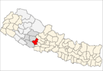
 Damri Location in Nepal | |
| Coordinates: 28.24°N 82.87°E | |
| Country | |
| Region | Mid-Western |
| Zone | Rapti Zone |
| District | Pyuthan District |
| VDC | Damri |
| Population (2001 Census[1]) | |
| • Total | 3,629 |
| 681 households | |
| Time zone | UTC+5:45 (Nepal Time) |
Villages in VDC
| Ward | Lat. | Lon | |||
|---|---|---|---|---|---|
| Barebang | बरेबाङ | 28°14'N | 82°53'E | 1,770m | |
| Basai | बसै | 28°15'N | 82°52'E | 1,910 | |
| Bhalang | भलाङ | 28°14'N | 82°52'E | 1,870 | |
| Damri | डाम्री | 28°15'N | 82°53'E | 1,810 | |
| Dangdul | डाङडुल | 28°15'N | 82°53'E | 1,770 | |
| Dihi | डिही | 28°14'N | 82°53'E | 1,498 | |
| Gaibang | गाइबाङ | 28°13'N | 82°55'E | 1,435 | |
| Galdung | गल्डुङ | 28°14'N | 82°52'E | 1,650 | |
| Gawai | गावै | 8 | 28°13'N | 82°54'E | 1,492 |
| Jhulechaur | झूलेचौर | 28°16'N | 82°53'E | 2,160 | |
| Kadhe | काढे | 28°14'N | 82°51'E | 2,090 | |
| Kante | काँटे | 28°15'N | 82°53'E | 1,805 | |
| Kantegaun | काँटेगाउँ | 28°15'N | 82°53'E | 2,010 | |
| Latighot | लाटिघोट | 28°14'N | 82°53'E | 1,410 | |
| Musigade | मुसीगाडे | 28°14'N | 82°54'E | 1,450 | |
| Narsinge | नारसिङ्गे | 28°13'N | 82°53'E | 1,830 | |
| Patal | पातल | 28°13'N | 82°52'E | 1,890 | |
| Pokhara | पोखरा | 4 | 28°14'N | 82°52'E | 1,670 |
| Sano Damri | सानो डाम्री | 28°15'N | 82°52'E | 1,638 | |
| Thulo Damri | ठूलो डाम्री | 3 | 28°15'N | 82°52'E | 1,750 |
References
- "Nepal Census 2001". Nepal's Village Development Committees. Digital Himalaya. Archived from the original on October 12, 2008. Retrieved 21 September 2008.
- "Index of Geographical Names of Nepal, Volume IV: Mid Western Development Region, List of Settlements, Pyuthan" (PDF). Government of Nepal, National Geographic Information Infrastructure Program. Archived from the original (PDF) on July 24, 2011. Retrieved 2011-03-12.
External links
This article is issued from Wikipedia. The text is licensed under Creative Commons - Attribution - Sharealike. Additional terms may apply for the media files.