Dhubang
Dhubang is a town and village development committee in Pyuthan, a Middle Hills district of Rapti Zone, western Nepal.
Dhubang धुबाङ | |
|---|---|
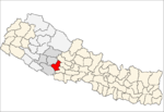
 Dhubang Location in Nepal | |
| Coordinates: 28.01°N 82.85°E | |
| Country | |
| Region | Mid-Western |
| Zone | Rapti Zone |
| District | Pyuthan District |
| VDC | Dhubang |
| Population (2001 Census[1]) | |
| • Total | 3,002 |
| 517 households | |
| Time zone | UTC+5:45 (Nepal Time) |
Villages in VDC
| Ward | Lat. | Lon | Elev. | ||
|---|---|---|---|---|---|
| Ambare | अम्बरे | 27°59'N | 82°51'E | 790m | |
| Budhichaur | बुढीचौर | 28°01'N | 82°51'E | 1,639 | |
| Chhap | छाप | 28°02'N | 82°50'E | 750 | |
| Chhatiun Damar | छतिउन दमार | 7 | 27°59'N | 82°50'E | 530 |
| Chhatunkholagaun | छतुनखोलागाउँ | 28°00'N | 82°50'E | 790 | |
| Chuna | चुना | 27°58'N | 82°51'E | 570 | |
| Chutreni | चुत्रेनी | 28°00'N | 82°53'E | 1,630 | |
| Dahachaur | दहचौर | 27°59'N | 82°50'E | 790 | |
| Dhubang | धुबाङ | 2 | 28°02'N | 82°51'E | 730 |
| Gaujikholagaun | गौजीखोलागाउँ | 28°00'N | 82°50'E | 710 | |
| Golja | गोल्जा | 28°01'N | 82°53'E | 1,155 | |
| Habrukholagaun | हाब्रुखोलागाउँ | 28°00'N | 82°52'E | 1,675 | |
| Hapurkholagaun | हपुरखोलागाउँ | 28°00'N | 82°51'E | 950 | |
| Harnaghat | हर्नाघाट | 3 | 28°02'N | 82°53'E | 730 |
| Jangale | जङ्गले | 28°00'N | 82°51'E | 930 | |
| Kairan | कैरान | 3 | 28°02'N | 82°52'E | 712 |
| Kharka | खर्क | 28°00'N | 82°51'E | 1,535 | |
| Khumchi | खुम्ची | 28°03'N | 82°50'E | 718 | |
| Kumring | कुम्रिङ | 28°00'N | 82°53'E | 1,050 | |
| Maha Pokhari | मह पोखरी | 28°01'N | 82°50'E | 1,633 | |
| Ratmata | रातमाटा | 28°00'N | 82°50'E | 650 | |
| Sansare | सनसरे | 28°00'N | 82°52'E | 1,130 | |
| Sirubari | सिरुबारी | 7 | 27°59'N | 82°51'E | 1,143 |
| Tigra Patal | तिग्रा पाताल | 28°01'N | 82°50'E | 1,399 | |
| Tilkeni | तिलकेनी | 6 | 28°01'N | 82°51'E | 1,230 |
| Tori Bhanjyang | तोरी भज्ञ्याङ | 28°00'N | 82°50'E | 910 | |
| Yarikholagaun | यारीखोलागाउँ | 28°02'N | 82°50'E | 1,110 |
References
- "Nepal Census 2001". Nepal's Village Development Committees. Digital Himalaya. Archived from the original on 12 October 2008. Retrieved 21 September 2008.
- "Index of Geographical Names of Nepal, Volume IV: Mid Western Development Region, List of Settlements, Pyuthan" (PDF). Government of Nepal, National Geographic Information Infrastructure Program. Archived from the original (PDF) on 2011-07-24. Retrieved 2011-03-12.
External links
This article is issued from Wikipedia. The text is licensed under Creative Commons - Attribution - Sharealike. Additional terms may apply for the media files.