Ste. Rita, Manitoba
Ste. Rita is an unincorporated community east of Winnipeg on Manitoba Highway 15. The Post Office was established there as Rita in 1934 and officially became Ste. Rita in 1965 and closed a few years later, and was also a lumber yard that has been closed for many years now. The CN railway passes through the community and the Railway point was known as Craig or Craig Siding. It is part of the Rural Municipality of Reynolds.
Ste. Rita | |
|---|---|
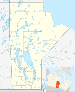 Ste. Rita Location of Ste. Rita in Manitoba | |
| Coordinates: 49°52′48″N 96°17′44″W | |
| Country | |
| Province | |
| Region | Eastman Region |
| Census Division | No. 1 |
| Government | |
| • Governing Body | Rural Municipality of Reynolds Council |
| • MP | Vic Toews |
| • MLA | Dennis Smook |
| Time zone | UTC−6 (CST) |
| • Summer (DST) | UTC−5 (CDT) |
| Area code(s) | 204, 431 |
| NTS Map | 062H16 |
| GNBC Code | GAXXN |
There is a community centre still in operation that was built in 1984.
Ste Rita was named after the local church. The School District of Craig Siding was located on SE4-11-9E.
References
- Geographical Names of Manitoba - Ste. Rita (page 238) - the Millennium Bureau of Canada
Division No. 1, Manitoba (Eastern Manitoba) | ||
|---|---|---|
| Towns | 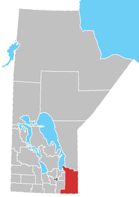 | |
| Local government districts | ||
| Rural municipalities | ||
| First Nations | ||
| Indian reserves |
| |
| Unorganized areas | ||
| Unincorporated communities | ||
This article is issued from Wikipedia. The text is licensed under Creative Commons - Attribution - Sharealike. Additional terms may apply for the media files.