Springboro, Pennsylvania
Springboro is a borough in Crawford County, Pennsylvania, United States, located 35 miles southwest of Erie. The population was 477 at the 2010 census.[4]
Springboro, Pennsylvania | |
|---|---|
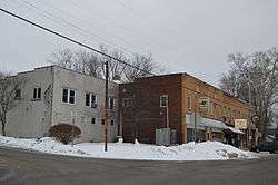 Commercial district at the crossroads | |
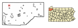 Location of Springboro in Crawford County, Pennsylvania. | |
 Springboro Location of Springboro in Pennsylvania | |
| Coordinates: 41°48′0″N 80°22′16″W | |
| Country | United States |
| State | Pennsylvania |
| County | Crawford County |
| Founded | 1800 |
| Area | |
| • Total | 0.83 sq mi (2.15 km2) |
| • Land | 0.83 sq mi (2.15 km2) |
| • Water | 0.00 sq mi (0.00 km2) |
| Elevation [2] (middle of borough) | 940 ft (290 m) |
| Highest elevation [2] (northeast corner of borough) | 1,100 ft (300 m) |
| Lowest elevation [2] (Conneaut Creek) | 890 ft (270 m) |
| Population (2010) | |
| • Total | 477 |
| • Estimate (2018)[3] | 449 |
| • Density | 548.85/sq mi (211.95/km2) |
| Time zone | UTC-4 (EST) |
| • Summer (DST) | UTC-5 (EDT) |
| Area code(s) | 814 |
History
Incorporated as a borough in the spring of 1866, the crossroads officially became Springboro in 1840. 2015 is the 175th year.
Geography
Springboro is located in northwestern Crawford County at 41°48′0″N 80°22′16″W (41.800055, -80.371031).[5] It is surrounded by Spring Township, a separate municipality.
Pennsylvania Route 18 passes through the center of town, leading north 6 miles (10 km) to Albion and south 3 miles (5 km) to Conneautville.
According to the United States Census Bureau, the borough has a total area of 0.83 square miles (2.15 km2), all of it land.[4] Conneaut Creek flows northward through the western side of the borough on its way to Lake Erie.
Demographics
| Historical population | |||
|---|---|---|---|
| Census | Pop. | %± | |
| 1870 | 323 | — | |
| 1880 | 379 | 17.3% | |
| 1890 | 490 | 29.3% | |
| 1900 | 603 | 23.1% | |
| 1910 | 614 | 1.8% | |
| 1920 | 542 | −11.7% | |
| 1930 | 487 | −10.1% | |
| 1940 | 570 | 17.0% | |
| 1950 | 611 | 7.2% | |
| 1960 | 583 | −4.6% | |
| 1970 | 584 | 0.2% | |
| 1980 | 557 | −4.6% | |
| 1990 | 471 | −15.4% | |
| 2000 | 491 | 4.2% | |
| 2010 | 477 | −2.9% | |
| Est. 2018 | 449 | [3] | −5.9% |
| Sources:[6][7][8][9] | |||
At the 2000 census there were 491 people in 183 households, including 133 families, in the borough. The population density was 577.5 people per square mile (223.0/km²). There were 208 housing units at an average density of 244.6 per square mile (94.5/km²). The racial makeup of the borough was 96.33% White, 3.46% African American and 0.20% Native American.[7] There were 183 households, 32.8% had children under the age of 18 living with them, 51.4% were married couples living together, 12.6% had a female householder with no husband present, and 27.3% were non-families. 24.0% of households were made up of individuals, and 9.8% were one person aged 65 or older. The average household size was 2.68 and the average family size was 3.17.
The age distribution was 27.3% under the age of 18, 9.2% from 18 to 24, 30.1% from 25 to 44, 20.2% from 45 to 64, and 13.2% 65 or older. The median age was 34 years. For every 100 females there were 99.6 males. For every 100 females age 18 and over, there were 89.9 males.
The median household income was $36,875 and the median family income was $40,694. Males had a median income of $29,632 versus $18,750 for females. The per capita income for the borough was $14,258. About 6.5% of families and 9.7% of the population were below the poverty line, including 11.0% of those under age 18 and 5.6% of those age 65 or over.
Religion
The Monastery of the Nativity of the Most Holy Theotokos is located 1 mile (1.6 km) north of Springboro. The monastery is under the jurisdiction of the Serbian Orthodox Church.
References
- "2017 U.S. Gazetteer Files". United States Census Bureau. Retrieved Mar 24, 2019.
- "Springboro Station Topo Map, Crawford County PA (Beaver Center Area)". TopoZone. Locality, LLC. Retrieved 2 September 2019.
- "Population and Housing Unit Estimates". Retrieved March 19, 2020.
- "Geographic Identifiers: 2010 Census Summary File 1 (G001): Springboro borough, Pennsylvania". U.S. Census Bureau, American Factfinder. Archived from the original on February 13, 2020. Retrieved June 5, 2015.
- "US Gazetteer files: 2010, 2000, and 1990". United States Census Bureau. 2011-02-12. Retrieved 2011-04-23.
- "Census of Population and Housing". U.S. Census Bureau. Retrieved 11 December 2013.
- "U.S. Census website". United States Census Bureau. Retrieved 2008-01-31.
- "Incorporated Places and Minor Civil Divisions Datasets: Subcounty Resident Population Estimates: April 1, 2010 to July 1, 2012". Population Estimates. U.S. Census Bureau. Archived from the original on 11 June 2013. Retrieved 11 December 2013.
- Bureau, U. S. Census. "U.S. Census website". United States Census Bureau. US Census Bureau. Retrieved 17 July 2019.
Municipalities and communities of Crawford County, Pennsylvania, United States | ||
|---|---|---|
| Cities | 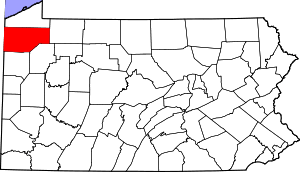 | |
| Boroughs | ||
| Townships |
| |
| CDPs | ||
| Unincorporated communities | ||