Conneaut Creek
Conneaut Creek /ˈkɒni.ɒt/ is a 43.5-mile (70.0 km) tributary of Lake Erie in northwestern Pennsylvania and northeastern Ohio in the United States.[3] Via Lake Erie, the Niagara River and Lake Ontario, it is part of the watershed of the St. Lawrence River, which flows to the Atlantic Ocean.
| Conneaut Creek | |
|---|---|
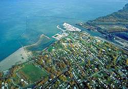 Mouth of Conneaut Creek on Lake Erie at Conneaut, Ohio | |
 Location of the mouth of Conneaut Creek in Ohio 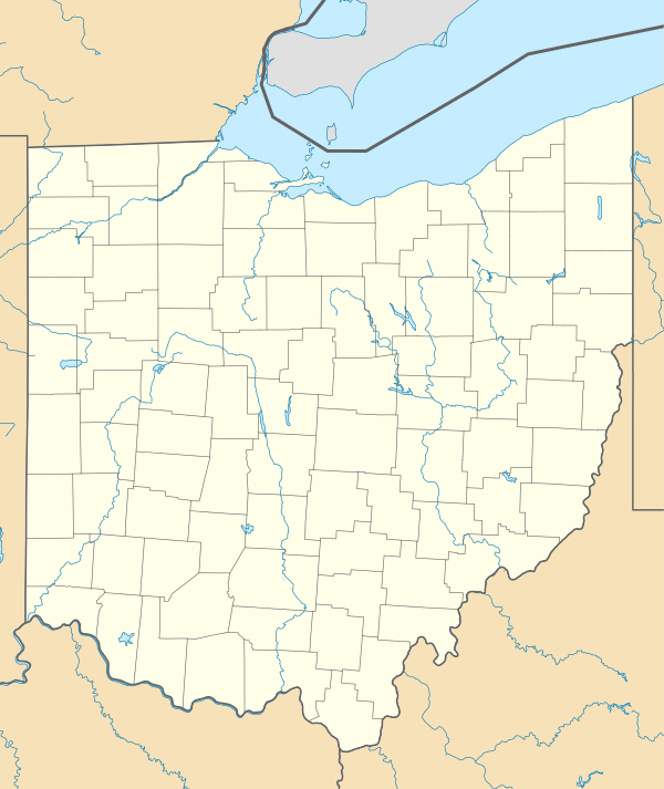 Conneaut Creek (Ohio)  Conneaut Creek (Pennsylvania) | |
| Location | |
| Country | United States |
| State | Ohio, Pennsylvania |
| Counties | Ashtabula, Erie, Crawford |
| Physical characteristics | |
| Source | |
| ⁃ location | Linesville, Crawford County, Pennsylvania |
| ⁃ coordinates | 41°40′41″N 80°23′19″W[1] |
| ⁃ elevation | 1,273 ft (388 m)[2] |
| Mouth | Lake Erie |
⁃ location | Ohio–Pennsylvania border |
⁃ coordinates | 41°58′11″N 80°32′53″W[1] |
⁃ elevation | 768 ft (234 m)[2] |
| Length | 43.5 mi (70.0 km)[2] |
| Basin size | 152 sq mi (390 km2)[2] |
| Basin features | |
| Tributaries | |
| ⁃ left | West Branch Conneaut Creek |
| ⁃ right | East Branch Conneaut Creek |
Conneaut Creek rises in western Crawford County, Pennsylvania, and initially flows north-northwestwardly past Conneautville into western Erie County. Near Albion, it turns to the west-southwest and roughly parallels the shoreline of Lake Erie for some length, at a distance of about 5 mi (8 km) inland, into northeastern Ashtabula County, Ohio, where, at Kingsville, it turns to the northeast to flow into Lake Erie at the city of Conneaut.[4][5]
Variant names and spellings
According to the Geographic Names Information System, Conneaut Creek has also been known historically as:[1]
- Caneaught Creek
- Conneaut River
- Coneaught Creek
- Conneaugh River
- Conneought Creek
- Conyeayout Creek
- Counite Riviere
References
- "Conneaut Creek". Geographic Names Information System. 2008. Retrieved 2008-09-25.
- Shaw, L. C.; W. F. Busch (June 1984). Pennsylvania Gazetteer of Streams, Part II. Water Resources Bulletin. 16. Prepared in Cooperation with the United States Department of the Interior Geological Survey. Harrisburg, PA: Pennsylvania Department of Forest and Waters. p. 382.
- "Columbia Gazetteer of North America entry". Archived from the original on 2007-03-10. Retrieved 2006-05-12.
- DeLorme (2003). Pennsylvania Atlas & Gazetteer. Yarmouth, ME: DeLorme. ISBN 0-89933-280-3.
- DeLorme (1991). Ohio Atlas & Gazetteer. Yarmouth, ME: DeLorme. ISBN 0-89933-233-1.