Athens Township, Crawford County, Pennsylvania
Athens Township is a township in Crawford County, Pennsylvania, United States. The population was 734 at the 2010 census.[4]
Athens Township, Crawford County, Pennsylvania | |
|---|---|
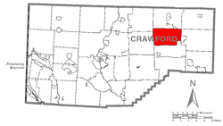 Location of Athens Township in Crawford County | |
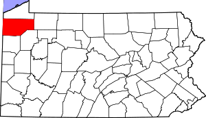 Location of Crawford County in Pennsylvania | |
| Country | United States |
| State | Pennsylvania |
| County | Crawford County |
| Area | |
| • Total | 28.32 sq mi (73.36 km2) |
| • Land | 28.29 sq mi (73.26 km2) |
| • Water | 0.04 sq mi (0.09 km2) |
| Highest elevation [2] (East of Grange Hall road) | 1,650 ft (500 m) |
| Lowest elevation [2] (Muddy Creek at Township line) | 1,180 ft (360 m) |
| Population (2010) | |
| • Total | 734 |
| • Estimate (2018)[3] | 726 |
| • Density | 25.74/sq mi (9.94/km2) |
| Time zone | UTC-4 (EST) |
| • Summer (DST) | UTC-5 (EDT) |
| Area code(s) | 814 |
Geography
According to the United States Census Bureau, the township has a total area of 28.3 square miles (73.3 km2), of which 28.3 square miles (73.2 km2) is land and 0.04 square miles (0.1 km2), or 0.12%, is water.[4] The township is in eastern Crawford County. The unincorporated community of Little Cooley is in the western part of the township.
Natural Features
Athens Township is located in the Glaciated Plateau of Northwest Pennsylvania. Oil Creek drains the eastern side and Muddy Creek, a tributary to French Creek, drains the western side of the township. The lowest elevation, 1,080 ft (330 m), is located where Muddy Creek leaves the township, while the highest elevation, 1,650 ft (500 m), is located just east of Grange Hall Road. Lakes in the township include Puckerbush Lake and Spring Lake, both of which are impounded.
Demographics
| Historical population | |||
|---|---|---|---|
| Census | Pop. | %± | |
| 2000 | 775 | — | |
| 2010 | 734 | −5.3% | |
| Est. 2018 | 726 | [5] | −1.1% |
| U.S. Decennial Census[6] | |||
As of the census[7] of 2000, there were 775 people, 265 households, and 209 families residing in the township. The population density was 27.4 people per square mile (10.6/km²). There were 326 housing units at an average density of 11.5/sq mi (4.5/km²). The racial makeup of the township was 98.32% White, 0.52% African American, 0.65% Native American, and 0.52% from two or more races. Hispanic or Latino of any race were 0.39% of the population.
There were 265 households, out of which 37.4% had children under the age of 18 living with them, 66.4% were married couples living together, 6.4% had a female householder with no husband present, and 20.8% were non-families. 17.7% of all households were made up of individuals, and 8.7% had someone living alone who was 65 years of age or older. The average household size was 2.87 and the average family size was 3.21.
In the township the population was spread out, with 28.8% under the age of 18, 6.7% from 18 to 24, 27.5% from 25 to 44, 22.7% from 45 to 64, and 14.3% who were 65 years of age or older. The median age was 36 years. For every 100 females, there were 95.7 males. For every 100 females age 18 and over, there were 98.6 males.
The median income for a household in the township was $34,000, and the median income for a family was $36,607. Males had a median income of $32,188 versus $21,250 for females. The per capita income for the township was $14,509. About 6.4% of families and 9.5% of the population were below the poverty line, including 10.7% of those under age 18 and 10.1% of those age 65 or over.
References
- "2016 U.S. Gazetteer Files". United States Census Bureau. Retrieved Aug 13, 2017.
- "Forest Home Corners Topo Map, Crawford County PA (Millers Station Area)". TopoZone. Locality, LLC. Retrieved 1 September 2019.
- Bureau, U. S. Census. "U.S. Census website". United States Census Bureau. US Census Bureau. Retrieved 18 July 2019.
- "Geographic Identifiers: 2010 Census Summary File 1 (G001): Athens township, Crawford County, Pennsylvania". U.S. Census Bureau, American Factfinder. Archived from the original on February 13, 2020. Retrieved June 5, 2015.
- "Population and Housing Unit Estimates". Retrieved June 9, 2017.
- "Census of Population and Housing". Census.gov. Retrieved June 4, 2016.
- "U.S. Census website". United States Census Bureau. Retrieved 2008-01-31.
External links
Municipalities and communities of Crawford County, Pennsylvania, United States | ||
|---|---|---|
| Cities | | |
| Boroughs | ||
| Townships |
| |
| CDPs | ||
| Unincorporated communities | ||