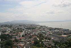
Songkhla
Songkhla (Thai: สงขลา, pronounced [sǒŋ.kʰlǎː]), also known as Singgora or Singora (Pattani Malay: ซิงกอรอ), is a city (thesaban nakhon) in Songkhla Province of southern Thailand, near the border with Malaysia. As of 2006 it had a population of 75,048. Songkhla lies 968 km (601 mi) south of Bangkok.[1]
Songkhla สงขลา | |
|---|---|
| City of Songkhla เทศบาลนครสงขลา | |
 Songkhla City | |
 Seal | |
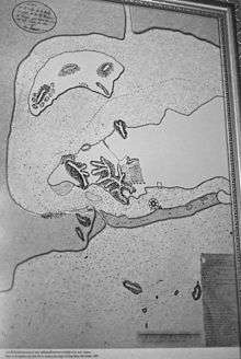
 Songkhla Location in Thailand | |
| Coordinates: 7°12′22″N 100°35′48″E | |
| Country | Thailand |
| Province | Songkhla |
| District | Mueang Songkhla |
| Government | |
| • Type | City Municipality |
| • Mayor | Somsak Tantiseranet |
| Area | |
| • Total | 9.27 km2 (3.58 sq mi) |
| Elevation | 11 m (36 ft) |
| Population (2006) | 75,048 |
| Time zone | UTC+7 (ICT) |
| Area code | (+66) 74 |
| Website | songkhlacity |
Despite being smaller than the neighboring city Hat Yai, Songkhla is the capital of Songkhla Province as well as the Mueang Songkhla District (Songkhla town district).
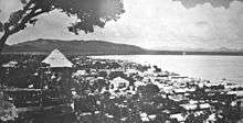
At the opening of Songkhla Lake to the Gulf of Thailand, Songkhla is a fishing town and also an important harbour. It is the major seaport on the east side of the Isthmus of Kra.
History

The name Songkhla is the Thai variant of "Singgora" (Jawi: سيڠڬورا); its original name means 'the city of lions' in Malay (not to be confused with Singapura). This refers to a lion-shaped mountain near the city of Songkhla. Archaeological excavations on the isthmus between Lake Songkhla and the sea reveal that in the 10th through the 14th century this was a major urbanized area, and a center of international maritime trade, in particular with Quanzhou in China. The long Sanskrit name of the state that existed there has been lost; its short Sanskrit name was Singhapura ('Lion City') (not to be confused with Singapura), a city state. The short vernacular name was Satingpra, coming from the Mon-Khmer sting/steng/stang (meaning 'river') and the Sanskrit pura ('city').[2]:320-321
The ruins of the ancient port city of Satingpra are just few kilometres north of Songkhla. It was one of the most important trading centres of the Tambralinga Kingdom. Archaeological digs and investigations conducted toward the end of the 20th century testify the existence of a fortified citadel protected by a moat and a quadrangular surrounding wall made of brick. A sophisticated system of canals connected the sea to the Songkhla Lake permitting the circulations of ships. The excavations brought to light artifacts of great historical and artistic value.[3]
On 8 December 1941 local time, hours before the 7 December (Hawaii time) attack on Pearl Harbor, the Imperial Japanese army landed in Songkhla invading Thailand. It then moved south towards Perlis and Penang as part of the Malayan campaign which culminated in the capture of Singapore.[4]
Since 2003, Songhkla has been affected by separatist insurgencies in neighboring Narathiwat, Pattani, and Yala.[5]
The municipality's mayor, Peera Tantiserane, was murdered there in 2012.[6]
Climate
Songkhla has a tropical monsoon climate (Köppen climate classification Am). Temperatures are very warm to hot throughout the year with only minor variation. There is a short dry season in February and March; the rest of the year is wet, with especially heavy rainfall from October to December.
| Climate data for Songkhla (1981–2010) | |||||||||||||
|---|---|---|---|---|---|---|---|---|---|---|---|---|---|
| Month | Jan | Feb | Mar | Apr | May | Jun | Jul | Aug | Sep | Oct | Nov | Dec | Year |
| Record high °C (°F) | 32.4 (90.3) |
34.3 (93.7) |
35.3 (95.5) |
36.8 (98.2) |
38.6 (101.5) |
37.1 (98.8) |
36.6 (97.9) |
37.3 (99.1) |
35.8 (96.4) |
38.5 (101.3) |
34.0 (93.2) |
32.6 (90.7) |
38.6 (101.5) |
| Average high °C (°F) | 29.6 (85.3) |
30.3 (86.5) |
31.4 (88.5) |
32.5 (90.5) |
33.0 (91.4) |
33.1 (91.6) |
32.9 (91.2) |
33.0 (91.4) |
32.3 (90.1) |
31.4 (88.5) |
29.8 (85.6) |
29.2 (84.6) |
31.5 (88.7) |
| Daily mean °C (°F) | 27.1 (80.8) |
27.5 (81.5) |
28.1 (82.6) |
28.9 (84.0) |
28.8 (83.8) |
28.6 (83.5) |
28.3 (82.9) |
28.2 (82.8) |
27.8 (82.0) |
27.3 (81.1) |
26.9 (80.4) |
26.7 (80.1) |
27.9 (82.2) |
| Average low °C (°F) | 24.7 (76.5) |
24.7 (76.5) |
25.0 (77.0) |
25.4 (77.7) |
25.4 (77.7) |
25.1 (77.2) |
24.8 (76.6) |
24.7 (76.5) |
24.5 (76.1) |
24.3 (75.7) |
24.3 (75.7) |
24.4 (75.9) |
24.8 (76.6) |
| Record low °C (°F) | 20.8 (69.4) |
20.4 (68.7) |
19.7 (67.5) |
21.1 (70.0) |
22.1 (71.8) |
21.1 (70.0) |
21.1 (70.0) |
21.9 (71.4) |
21.4 (70.5) |
21.1 (70.0) |
20.4 (68.7) |
20.7 (69.3) |
19.7 (67.5) |
| Average rainfall mm (inches) | 74.8 (2.94) |
48.6 (1.91) |
59.7 (2.35) |
75.1 (2.96) |
119.6 (4.71) |
99.9 (3.93) |
95.0 (3.74) |
109.4 (4.31) |
136.9 (5.39) |
257.1 (10.12) |
545.9 (21.49) |
444.7 (17.51) |
2,066.7 (81.37) |
| Average rainy days | 10.0 | 5.3 | 7.1 | 8.5 | 13.0 | 13.2 | 12.7 | 13.8 | 15.5 | 19.9 | 22.6 | 20.4 | 162.0 |
| Average relative humidity (%) | 78 | 77 | 78 | 78 | 78 | 77 | 77 | 76 | 79 | 82 | 84 | 82 | 79 |
| Mean monthly sunshine hours | 179.8 | 183.6 | 204.6 | 201.0 | 151.9 | 150.0 | 151.9 | 151.9 | 144.0 | 111.6 | 105.0 | 142.6 | 1,877.9 |
| Mean daily sunshine hours | 5.8 | 6.5 | 6.6 | 6.7 | 4.9 | 5.0 | 4.9 | 4.9 | 4.8 | 3.6 | 3.5 | 4.6 | 5.2 |
| Source 1: Thai Meteorological Department[7] | |||||||||||||
| Source 2: Office of Water Management and Hydrology, Royal Irrigation Department (sun and humidity)[8] | |||||||||||||
Population
The majority of the population is Buddhist with a large proportion of Muslims, especially in the rural areas fringing the Malaysian border. These Muslims speak Yawi language, a Malay-related language which has some Thai influence especially loan words borrowed from the Thai language.[9]
Songkhla's district (amphoe) has five tambon administrative organizations (องค์การบริหารส่วนตำบล). Songkhla town takes up the whole of Bo Yang division.
| No. | Name | Thai | Villages | Pop. | |
|---|---|---|---|---|---|
| 1. | Bo Yang | บ่อยาง | - | 74,875 | |
| 2. | Khao Rup Chang | เขารูปช้าง | 10 | 38,662 | |
| 3. | Ko Taeo | เกาะแต้ว | 9 | 10,608 | |
| 4. | Phawong | พะวง | 8 | 24,130 | |
| 5. | Thung Wang | ทุ่งหวัง | 10 | 10,343 | |
| 6. | Ko Yo | เกาะยอ | 9 | 4,454 |
Gallery
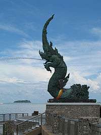
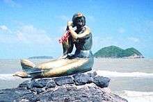 Songkhla mermaid
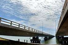 Tinsulanonda Bridge
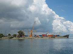 Songkhla seaport
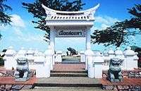
 Songkhla Lak Mueang
See also
- Sultanate of Singgora
- Mahavajiravudh Songkhla School
References
- "Distance: Bangkok to Songkhla". Google Maps. Retrieved 23 May 2015.
- Stargardt, Janice (2001). "Behind the Shadows: Archaeological Data on Two-Way Sea Trade Between Quanzhou and Satingpra, South Thailand, 10th-14th century". In Schottenhammer, Angela (ed.). The Emporium of the World: Maritime Quanzhou, 1000-1400. Volume 49 of Sinica Leidensia. Brill. pp. 309–393. ISBN 90-04-11773-3.
- Michel Jacq-Hergoualc'h (2002). BRILL (ed.). The Malay Peninsula: Crossroads of the Maritime Silk-Road (100 Bc-1300 Ad). Translated by Victoria Hobson. pp. 411–416. ISBN 90-04-11973-6.
- Parfitt, Allen. "Bicycle Blitzkreig [sic] The Japanese Conquest of Malaya and Singapore 1941-1942". MilitaryHistoryOnline.com. Retrieved 9 Aug 2012.
- Morch, Maximillian (2018-02-06). "The Slow Burning Insurgency in Thailand's Deep South". The Diplomat. Retrieved 3 July 2018.
- "'Hitman' sought in Peera murder". Bangkok Post. 2012-11-13. Retrieved 2013-02-20.
- "Climatological Data for the Period 1981–2010". Thai Meteorological Department. p. 25. Retrieved 8 August 2016.
- "ปริมาณการใช้น้ำของพืชอ้างอิงโดยวิธีของ Penman Monteith (Reference Crop Evapotranspiration by Penman Monteith)" (PDF) (in Thai). Office of Water Management and Hydrology, Royal Irrigation Department. p. 121. Retrieved 8 August 2016.
- Yegar, Moshe (2002). Between Integration and Secession; The Muslim Communities of the Southern Philippines, Southern Thailand, and Western Burma/Myanmar (eBook). Lexington Books. ISBN 9780739103562. Retrieved 2013-02-20.
External links

| Wikimedia Commons has media related to Songkhla. |
- Official website (in Thai)
| Authority control |
|
|---|