Khon Kaen
Khon Kaen (Thai: ขอนแก่น, pronounced [kʰɔ̌(ː)n kɛ̀n]) is one of the four major cities of Isan, Thailand, also known as the "big four of Isan", the others being Udon Thani, Nakhon Ratchasima, and Ubon Ratchathani. It is the capital of Khon Kaen Province and the Mueang Khon Kaen District. Khon Kaen lies 450 kilometres (280 mi) north-northeast of Bangkok.[2]
Khon Kaen ขอนแก่น | |
|---|---|
| City of Khon Kaen เทศบาลนครขอนแก่น | |
 Rama IV monument, Khon Kaen University | |
 Seal | |
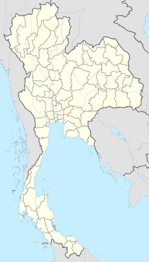 Khon Kaen Location in Thailand | |
| Coordinates: 16°26′N 102°50′E | |
| Country | Thailand |
| Province | Khon Kaen |
| District | Muang Khon Kaen |
| Town municipality | 20 Aug 1935 |
| City municipality | 24 Sept 1995 |
| Government | |
| • Type | City Municipality |
| • Mayor | Thirasak Thikhayuphan (since Sept 2012) |
| Area | |
| • Total | 46 km2 (18 sq mi) |
| Area rank | 10th |
| Elevation | 187 m (614 ft) |
| Population (2019)[1] | |
| • Total | 114,459 |
| • Rank | 11th |
| • Density | 2,488/km2 (6,440/sq mi) |
| Registered residents | |
| Time zone | UTC+7 (ICT) |
| Postcode | 40000 |
| Calling ode | 043 |
| Website | www |
Geography and demography
Khon Kaen is on the Khorat Plateau, elevation 187 m,[3] and is the center of the mid-northeastern provincial group of Thailand, according to the Thai government. Its coordinates are 16°26′N 102°50′E. The city has a population of 114,459.[1]
Regional importance
Khon Kaen is a city in the northern region of Thailand. The city is bisected by Mithraphap Road, also known as the "Friendship Highway", or "Highway 2", the road linking Bangkok to the Thai-Lao Friendship Bridge. A modern, multi-lane by-pass enables through-traffic to avoid the city centre to the west, and connects to the airport, the new main bus station (BKS3),[4] and to the main roads to Kalasin and Maha Sarakham in the east, and Udon Thani in the north.
The city can be easily navigated by driving along either of the two north-south main roads: Na Muang and Klang Muang, which are east and parallel to the Friendship Highway. In addition, there are two main east-west roads: Srichan Road and Prachasamosorn Road, leading east to the city of Kalasin, and west to the airport, as well as to other small villages.
Smart City initiative
The province of Khon Kaen's 2017 population was 1.8 million with a GDP of 190 billion baht.[5] Its Smart City development plan aims to double its GDP per person to 394,000-493,000 baht by 2029 from an average of about 192,000 baht in 2016. Khon Kaen's plan has been incorporated into Thailand's 12th national social and economic plan (2017-2021). The plan has been driven largely by the Khon Kaen Think Tank (KKTT), a group of involved citizens. The Smart City's signature project is the Khon Kaen Transit System Co (KKTS), founded in 2017. Its plans for a 26 km light rail network from Samran to Tha Phra in the Mueang Khon Kaen District are complete and awaiting Thai Cabinet approval before bidding on the project can begin. The light rail system will feature 18 to 21 stations, take two years to complete, and will cost 15 billion baht. The Land Traffic Management Commission (LTMC), a national think tank for transportation policy, has already blessed the plan.[5]
Climate
Khon Kaen's climate is categorised as tropical savanna (Köppen climate classification Aw), with winters that are dry and very warm. Temperatures rise until April—a very hot month, with an average daily maximum of 36.4 °C (97.5 °F). The monsoon season runs from May until October, with heavy rain and somewhat cooler temperatures during the day although nights remain warm.
| Climate data for Khon Kaen (1981–2010) | |||||||||||||
|---|---|---|---|---|---|---|---|---|---|---|---|---|---|
| Month | Jan | Feb | Mar | Apr | May | Jun | Jul | Aug | Sep | Oct | Nov | Dec | Year |
| Record high °C (°F) | 37.3 (99.1) |
39.2 (102.6) |
41.7 (107.1) |
42.6 (108.7) |
41.9 (107.4) |
39.6 (103.3) |
37.3 (99.1) |
37.0 (98.6) |
36.3 (97.3) |
35.7 (96.3) |
37.5 (99.5) |
35.7 (96.3) |
42.6 (108.7) |
| Average high °C (°F) | 30.8 (87.4) |
33.1 (91.6) |
35.3 (95.5) |
36.4 (97.5) |
34.5 (94.1) |
33.6 (92.5) |
33.0 (91.4) |
32.4 (90.3) |
31.9 (89.4) |
31.6 (88.9) |
31.2 (88.2) |
30.1 (86.2) |
32.8 (91.0) |
| Daily mean °C (°F) | 23.4 (74.1) |
26.0 (78.8) |
28.5 (83.3) |
29.9 (85.8) |
28.9 (84.0) |
28.6 (83.5) |
28.1 (82.6) |
27.7 (81.9) |
27.2 (81.0) |
26.5 (79.7) |
25.0 (77.0) |
23.0 (73.4) |
26.9 (80.4) |
| Average low °C (°F) | 17.4 (63.3) |
20.1 (68.2) |
22.8 (73.0) |
24.9 (76.8) |
24.9 (76.8) |
25.0 (77.0) |
24.6 (76.3) |
24.4 (75.9) |
23.9 (75.0) |
22.8 (73.0) |
20.1 (68.2) |
17.2 (63.0) |
22.3 (72.1) |
| Record low °C (°F) | 8.2 (46.8) |
11.9 (53.4) |
11.1 (52.0) |
18.5 (65.3) |
20.6 (69.1) |
21.1 (70.0) |
21.0 (69.8) |
21.9 (71.4) |
20.3 (68.5) |
14.6 (58.3) |
10.3 (50.5) |
6.4 (43.5) |
6.4 (43.5) |
| Average rainfall mm (inches) | 4.0 (0.16) |
21.4 (0.84) |
42.1 (1.66) |
89.6 (3.53) |
168.7 (6.64) |
161.6 (6.36) |
173.3 (6.82) |
216.4 (8.52) |
232.0 (9.13) |
117.7 (4.63) |
15.9 (0.63) |
4.1 (0.16) |
1,246.8 (49.09) |
| Average rainy days | 1.0 | 2.7 | 4.2 | 7.7 | 14.5 | 14.4 | 15.9 | 17.8 | 17.7 | 9.7 | 2.5 | 0.7 | 108.8 |
| Average relative humidity (%) | 65 | 63 | 61 | 64 | 74 | 77 | 78 | 81 | 83 | 78 | 70 | 65 | 72 |
| Mean monthly sunshine hours | 275.9 | 243.0 | 275.9 | 204.0 | 198.4 | 156.0 | 120.9 | 117.8 | 144.0 | 198.4 | 219.0 | 257.3 | 2,410.6 |
| Mean daily sunshine hours | 8.9 | 8.6 | 8.9 | 6.8 | 6.4 | 5.2 | 3.9 | 3.8 | 4.8 | 6.4 | 7.3 | 8.3 | 6.6 |
| Source 1: Thai Meteorological Department[6] | |||||||||||||
| Source 2: Office of Water Management and Hydrology, Royal Irrigation Department (sun and humidity)[3] | |||||||||||||
Administration
| Nai Mueang | 33,644 | Village no.2 | 6,148 |
| Village no.16 | 21,161 | Village no.3 | 4,707 |
| Village no.4 | 11,245 | Village no.17 | 4,669 |
| Village no.13 | 8,897 | Village no.7 | 3,780 |
| Village no.6 | 8,463 | Village no.12 | 2,268 |
| Village no.14 | 8,460 | Village no.1 | 1,017 |
On 20 August 1935 Khon Kaen town municipality (thesaban mueang) was established, with an area of 4.031 sq.km. On 24 September 1995 Khon Kaen was upgraded to city municipality (thesaban nakhon).[7] The administration of the city is responsible for an area that covers approximately 46 sq.km. and consists of 66,179 households. There are 95 communities (chumchon) divided as follows: zone 1 - 17, zone 2 - 28, zone 3 - 31 and zone 4 - 19 communities.
Culture
Thailand's 2014 EU Film Festival included Khon Kaen, together with Chiang Mai and Bangkok, as host locations. A selection of six films was shown in the city, including the Spanish film The Pelayos and the Polish film Walesa, Man of Hope.[8]
References
- "รายงานสถิติจำนวนประชากรและบ้านประจำปี พ.ศ.2562" [Statistics, population and house statistics for the year 2019]. Registration Office Department of the Interior, Ministry of the Interior (in Thai). 31 December 2019. Retrieved 10 March 2020, archiving is not necessary because DOPA provides data from 1993 to future years.
- "Distance: Bangkok to Khon Kaen". Google Maps. Retrieved 25 June 2015.
- "ปริมาณการใช้น้ำของพืชอ้างอิงโดยวิธีของ Penman Monteith (Reference Crop Evapotranspiration by Penman Monteith)" (PDF) (in Thai). Office of Water Management and Hydrology, Royal Irrigation Department. p. 48. Retrieved 1 August 2016.
- "Khon Kaen City's central bus terminal shuts down after 44 years". The Isaan Record. 2017-12-26. Retrieved 27 December 2017.
- Natanri, Chakkrapan; Kongrut, Anchalee (14 October 2018). "Khon Kaen takes lead in Thailand's race to smarten up". Bangkok Post. Retrieved 14 October 2018.
- "Climatological Data for the Period 1981–2010". Thai Meteorological Department. p. 10. Retrieved 1 August 2016.
- "พระราชกฤษฎีกา จัดตั้งเทศบาลนครขอนแก่น จังหวัดขอนแก่น พุทธศักราช ๒๔๗๘" [Royal Decree of Khon Kaen City Municipality, Khon Kaen Province, Buddhist Era 2538 (1995)] (PDF). Royal Thai Government Gazette. 112 (40 Kor): 24–28. 24 September 1995. Retrieved 5 April 2020.
- "Showtimes EU Film Festival 2014". SFX Cinemas. SFX Cinemas. 23 May 2014. Archived from the original on 25 May 2014. Retrieved 24 May 2014.
External links

- Tourism Thailand official website
| Wikimedia Commons has media related to Khon Kaen. |
| 1,000,000 and more |
|
|---|---|
| 500,000–999,999 |
|
| 200,000–499,999 |
|
| 100,000–299,999 | |
| Authority control |
|
|---|