Si Wilai District
Si Wilai (Thai: ศรีวิไล, pronounced [sǐː wí.lāj]) is a district (amphoe) in the eastern part of Bueng Kan Province, northeastern Thailand.
Si Wilai ศรีวิไล | |
|---|---|
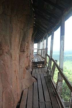 Walkway on the side of Phu Thok mountain | |
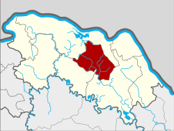 District location in Bueng Kan Province | |
| Coordinates: 18°10′36″N 103°45′0″E | |
| Country | Thailand |
| Province | Bueng Kan |
| Seat | Si Wilai |
| Subdistrict | 5 |
| Muban | 50 |
| District established | 1988 |
| Area | |
| • Total | 327.9 km2 (126.6 sq mi) |
| Population (2010) | |
| • Total | 38,899 |
| • Density | 151.5/km2 (392/sq mi) |
| Time zone | UTC+7 (ICT) |
| Postal code | 43210 |
| Geocode | 3807 |
Geography
Neighboring districts are (from the north clockwise): Mueang Bueng Kan, Seka, and Phon Charoen. Phu Thok, the emblematic mountain of the province, is in this district.[1]
History
The minor district (king amphoe) Si Wilai was established on 1 January 1988, when four tambons, Si Wilai, Chumphu Phon, Na Saeng, and Na Sabaeng were split off from Bueng Kan District.[2] It was upgraded to a full district on 4 July 1994.[3]
Administration
The district is divided into five sub-districts (tambons), which are further subdivided into 50 villages (mubans). The sub-district municipality (thesaban tambon) Si Wilai covers the whole tambon Si Wilai. There are a further four tambon administrative organizations (TAO).
| No. | Name | Thai | Villages | Pop.[4] |
|---|---|---|---|---|
| 1. | Si Wilai | ศรีวิไล | 12 | 10,846 |
| 2. | Chumphu Phon | ชุมภูพร | 12 | 7,475 |
| 3. | Na Saeng | นาแสง | 9 | 7,920 |
| 4. | Na Sabaeng | นาสะแบง | 9 | 6,188 |
| 5. | Na Sing | นาสิงห์ | 8 | 6,470 |
References
- Wat Phu Thok (in Thai)
- ประกาศกระทรวงมหาดไทย เรื่อง แบ่งเขตท้องที่อำเภอบึงกาฬ จังหวัดหนองคาย ตั้งเป็นกิ่งอำเภอศรีวิไล (PDF). Royal Gazette (in Thai). 105 (5 ง): 106. January 7, 1988.
- พระราชกฤษฎีกาตั้งอำเภอเปือยน้อย ... และอำเภอศรีวิไล พ.ศ. ๒๕๓๗ (PDF). Royal Gazette (in Thai). 111 (21 ก): 32–35. June 3, 1994.
- "Population statistics 2010". Department of Provincial Administration. Archived from the original on 2011-09-10.