Pak Khat District
Pak Khat (Thai: ปากคาด, pronounced [pàːk kʰâːt]) is a district (amphoe) in the eastern part of Bueng Kan Province, northeastern Thailand.
Pak Khat ปากคาด | |
|---|---|
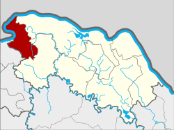 District location in Bueng Kan Province | |
| Coordinates: 18°17′54″N 103°18′24″E | |
| Country | Thailand |
| Province | Bueng Kan |
| Seat | Non Sila |
| Subdistricts | 6 |
| Mubans | 64 |
| District established | 1978 |
| Area | |
| • Total | 218.10 km2 (84.21 sq mi) |
| Population (2010) | |
| • Total | 33,973 |
| • Density | 151.5/km2 (392/sq mi) |
| Time zone | UTC+7 (ICT) |
| Postal code | 38190 |
| Geocode | 3805 |
Geography
Neighboring districts are (from the east clockwise) Bueng Kan and So Phisai of Bueng Kan Province, and Rattanawapi of Nong Khai Province. To the northwest across the Mekong river is the Laotian province Bolikhamxai.
History
The minor district (king amphoe) was established on 1 October 1978, when it was split off from Phon Phisai District.[1] It was upgraded on 20 March 1986.[2]
Administration
The district is divided into six sub-districts (tambons), which are further subdivided into 64 villages (mubans). The township (thesaban tambon) Pak Khat covers parts of tambons Pak Khat and Non Sila. There are a further six tambon administrative organizations (TAO).
| No. | Name | Thai | Villages | Pop.[3] |
|---|---|---|---|---|
| 1. | Pak Khat | ปากคาด | 18 | 8,058 |
| 2. | Nong Yong | หนองยอง | 11 | 6,197 |
| 3. | Na Kang | นากั้ง | 7 | 3,979 |
| 4. | Non Sila | โนนศิลา | 12 | 6,502 |
| 5. | Som Sanuk | สมสนุก | 8 | 5,355 |
| 6. | Na Dong | นาดง | 8 | 3,882 |
References
- ประกาศกระทรวงมหาดไทย เรื่อง แบ่งท้องที่อำเภอโพนพิสัย จังหวัดหนองคาย ตั้งเป็นกิ่งอำเภอปากคาด (PDF). Royal Gazette (in Thai). 95 (130 ง): 4081. November 21, 1978.
- พระราชกฤษฎีกาตั้งอำเภอคลองลาน อำเภอสุคิริน อำเภอตะโหมด อำเภอห้วยทับทัน และอำเภอปากคาด พ.ศ. ๒๕๒๙ (PDF). Royal Gazette (in Thai). 103 (45 ก special): 4–7. March 20, 1986.
- "Population statistics 2010". Department of Provincial Administration. Archived from the original on 2011-09-10.