Phon Charoen District
Phon Charoen (Thai: พรเจริญ, pronounced [pʰɔ̄ːn t͡ɕā.rɤ̄ːn]) is a district (amphoe) of Bueng Kan Province, northeastern Thailand.
Phon Charoen พรเจริญ | |
|---|---|
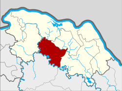 District location in Bueng Kan Province | |
| Coordinates: 18°1′54″N 103°42′30″E | |
| Country | Thailand |
| Province | Bueng Kan |
| Seat | Phon Charoen |
| Tambons | 7 |
| Mubans | 58 |
| District established | 1976 |
| Area | |
| • Total | 362.4 km2 (139.9 sq mi) |
| Population (2010) | |
| • Total | 42,109 |
| • Density | 113.0/km2 (293/sq mi) |
| Time zone | UTC+7 (ICT) |
| Postal code | 38180 |
| Geocode | 3802 |
History
The minor district (king amphoe) Phon Charoen was established on 16 November 1976 by splitting two tambons from Bueng Kan District.[1] It was upgraded to a full district on 13 July 1981.[2]
Geography
Neighboring districts are (from the west clockwise) So Phisai, Mueang Bueng Kan, Si Wilai, and Seka of Bueng Kan Province, and Kham Ta Kla and Ban Muang of Sakon Nakhon Province.
Administration
The district is divided into seven sub-districts (tambons), which are further subdivided into 58 villages (mubans). There are two sub-district municipalities (thesaban tambons): Phon Charoen covers parts of tambon Phon Charoen, and Don Ya Nang the whole tambon Don Ya Nang. There are a further six tambon administrative organizations (TAO).
| No. | Name | Thai | Villages | Pop.[3] |
|---|---|---|---|---|
| 1. | Si Chomphu | ศรีชมภู | 7 | 4,755 |
| 2. | Don Ya Nang | ดอนหญ้านาง | 7 | 4,979 |
| 3. | Phon Charoen | พรเจริญ | 11 | 10,254 |
| 4. | Nong Hua Chang | หนองหัวช้าง | 11 | 7,721 |
| 5. | Wang Chomphu | วังชมภู | 8 | 4,375 |
| 6. | Pa Faek | ป่าแฝก | 7 | 5,519 |
| 7. | Si Samran | ศรีสำราญ | 7 | 4,506 |
References
- ประกาศกระทรวงมหาดไทย เรื่อง แบ่งท้องที่อำเภอบึงกาฬ จังหวัดหนองคาย ตั้งเป็นกิ่งอำเภอพรเจริญ (PDF). Royal Gazette (in Thai). 93 (146 ง): 3464. November 23, 1976.
- พระราชกฤษฎีกาตั้งอำเภอหนองใหญ่ อำเภอบ่อไร่ อำเภอพรหมคีรี อำเภอนาบอน อำเภอบางสะพานน้อย อำเภอนาดี อำเภอกงหรา อำเภอวังทรายพูน อำเภอธารโต อำเภอคำตากล้า อำเภอศรีนคร อำเภอด่านช้าง อำเภอพรเจริญ อำเภอวังสามหมอ และอำเภอลานสัก พ.ศ. ๒๕๒๔ (PDF). Royal Gazette (in Thai). 98 (115 ก Special): 7–10. July 13, 1981.
- "Population statistics 2010". Department of Provincial Administration. Archived from the original on 2011-09-10.