Satuek District
Satuek (Thai: สตึก, pronounced [sā.tɯ̀k]) is a district (amphoe) in the northeastern part of Buriram Province, northeastern Thailand.
Satuek สตึก | |
|---|---|
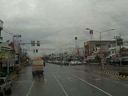 National Hwy 219 in Satuek District | |
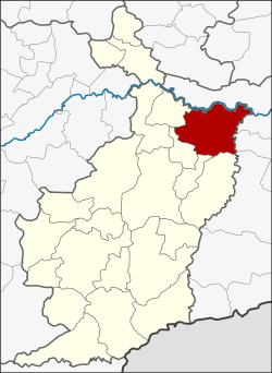 District location in Buriram Province | |
| Coordinates: 15°17′51″N 103°17′31″E | |
| Country | Thailand |
| Province | Buriram |
| Area | |
| • Total | 803.0 km2 (310.0 sq mi) |
| Population (2005) | |
| • Total | 109,221 |
| • Density | 136.0/km2 (352/sq mi) |
| Time zone | UTC+7 (ICT) |
| Postal code | 31150 |
| Geocode | 3111 |
Geography
Neighboring districts are (from the south clockwise) Krasang, Huai Rat, Ban Dan, Khu Mueang, Khaen Dong of Buriram Province, Chumphon Buri, Tha Tum, Chom Phra, and Mueang Surin District of Surin Province.
History
Originally a tambon of Mueang Buriram District, the minor district (king amphoe) Satuek was created in 1938. It was upgraded to a full district on 1 November 1947.
Administration
The district is divided into 12 sub-districts (tambons), which are further subdivided into 190 villages (mubans). Satuek is a township (thesaban tambon) which covers parts of tambons Satuek and Nikhom. There are a further 12 tambon administrative organizations (TAO).
| No. | Name | Thai name | Villages | Pop. |
|---|---|---|---|---|
| 1. | Satuek | สตึก | 25 | 11,481 |
| 2. | Nikhom | นิคม | 24 | 16,322 |
| 3. | Thung Wang | ทุ่งวัง | 15 | 8,480 |
| 4. | Mueang Kae | เมืองแก | 19 | 11,517 |
| 5. | Nong Yai | หนองใหญ่ | 16 | 9,153 |
| 6. | Ron Thong | ร่อนทอง | 18 | 11,839 |
| 9. | Don Mon | ดอนมนต์ | 10 | 5,609 |
| 10. | Chum Saeng | ชุมแสง | 18 | 10,175 |
| 11. | Tha Muang | ท่าม่วง | 12 | 6,375 |
| 12. | Sakae | สะแก | 13 | 7,170 |
| 14. | Sanam Chai | สนามชัย | 12 | 6,469 |
| 15. | Krasang | กระสัง | 8 | 4,631 |
Missing numbers are tambon which now form Khaen Dong District.