Sargodha
Sargodha (Punjabi and Urdu: سرگودھا) is a city and capital of Sargodha Division, located in Punjab province, Pakistan. It is Pakistan's 12th largest city by population[11] and one of the fastest growing cities of the country.[12] Sargodha is also known as the City of Eagles.[1]
Sargodha سرگودھا | |
|---|---|
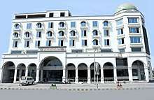
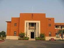
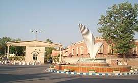    Clockwise from top: Queen Chowk (Intersection), Central Library, Shaheen Enclave, University of Sargodha | |
 Flag | |
| Nickname(s): | |
 Sargodha  Sargodha 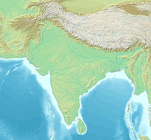 Sargodha  Sargodha .svg.png) Sargodha | |
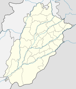
| Coordinates: 32°5′1″N 72°40′16″E | |
| Country | |
| Province | |
| Division | Sargodha[3] |
| District | Sargodha |
| Government | |
| • Type | Metropolitan Corporation[4] |
| Area | |
| • City | 155 km2 (60 sq mi) |
| • Metro | 5,854 km2 (2,260 sq mi) |
| Elevation | 190 m (620 ft) |
| Population | |
| • City | 659,862 |
| • Rank | 12th, Pakistan |
| • Density | 4,300/km2 (11,000/sq mi) |
| • Demonym | Sargodhian |
| Time zone | UTC+5 (PST) |
| Postal code | 40100[8] |
| Dialling code | 048[9] |
| Number of union councils | 60[10] |
| Number of towns | 59 |
| Website | www |
It is one of the few planned cities of Pakistan (others include Faisalabad, Islamabad & Gwadar).[13]
History
Sargodha was established by the British as a canal-colony in 1903, and was initially spelt Sargoda.[14] Sargodha was badly affected by an outbreak of the bubonic plague in 1903, and experienced a milder outbreak in 1904.[15] Although it was a small town in the beginning, the British Royal Air Force built an airport here due to its strategic location.[16] The term “Sargodha” has its origin in the words “Sar” meaning “pond” and “Godha” meaning “Sadhu”, which means “Pond of Godha”. This city was founded by Lady Trooper by the supervision of Sir Charles Montgomery Rivaz KCSI (1845 – 7 October 1926), a colonial administrator in British India and Lieutenant-Governor of the Punjab from 1902–1907.[17][18]
Geography
Location
Location of Sargodha with respect to five major cities of Pakistan is as follows:
- 1,202 km (747 mi) North of Karachi[19]
- 187 km (116 mi) West of Lahore[20]
- 241 km (150 mi) South of Islamabad[21]
- 91 km (57 mi) North-West of Faisalabad
- 223 km (139 mi) South of Rawalpindi[23]
Sargodha is situated in Pakistani province of Punjab. It is located 187 kilometres (116 mi) northwest of Lahore, in Sargodha District.[20] It lies about 48 kilometres (30 mi) from the M-2 motorway, which connects Lahore and Islamabad. It is connected to the M-2 by several interchanges at different locations. Sargodha is roughly 91 km (57 mi) from Faisalabad, due southeast. Directly east connected by the M-2 motorway are Lahore and the route to Rawalpindi and Islamabad. Due east is the city of Jhang; toward the west are the city of Mianwali and the Chashma Barrage.
Topography
Sargodha mainly comprises flat, fertile plains, although here are a few small hills on the Sargodha-Faisalabad Road. The River Jhelum flows on the western and northern sides, and the River Chenab lies on the eastern side of the city.[24] The city is located 190 metres above sea level.[25]
Climate
The city has a climate of extreme heat in the summers and moderate cold in the winters. The maximum temperature reaches 50 °C (122 °F) in the summer while the minimum temperature recorded is as low as freezing point in the winter.
| Climate data for Sargodha (1960–2012) | |||||||||||||
|---|---|---|---|---|---|---|---|---|---|---|---|---|---|
| Month | Jan | Feb | Mar | Apr | May | Jun | Jul | Aug | Sep | Oct | Nov | Dec | Year |
| Average high °C (°F) | 20 (68) |
22 (72) |
26 (79) |
32 (90) |
38 (100) |
39 (102) |
38 (100) |
37 (99) |
36 (97) |
32 (90) |
26 (79) |
22 (72) |
30.6 (87.1) |
| Average low °C (°F) | 8 (46) |
11 (52) |
15.5 (59.9) |
19 (66) |
25 (77) |
27 (81) |
26 (79) |
26 (79) |
25 (77) |
20 (68) |
14 (57) |
9 (48) |
18.8 (65.8) |
| Average precipitation mm (inches) | 18 (0.7) |
36 (1.4) |
24 (0.9) |
13 (0.5) |
17 (0.7) |
48 (1.9) |
82 (3.2) |
87 (3.4) |
43 (1.7) |
9 (0.4) |
11 (0.4) |
12 (0.5) |
400 (15.7) |
| Average precipitation days (≥ 1.0 mm) | 5 | 4 | 5 | 4 | 3 | 3 | 7 | 7 | 4 | 1 | 1 | 1 | 45 |
| Source: Weather2,[26] | |||||||||||||
Demographics
The total population of the city was 458,440[27] according to the 1998 census. The majority of the people in the city speak Punjabi.[16] According to the 2017 Census of Pakistan, the population of city was recorded as 872,557 with a rise of 43.94% from 1998. The population of the metropolitan area (City District) reached 3,903,588, in which around 1 million forms the urban population.[28] The population of Sargodha Division was recorded as 8,181,499 by the 2017 Census of Pakistan.
Economy
The majority of Sargodha's economy is based on agriculture. Sargodha is considered the best citrus-producing area of Pakistan and therefore is also known as the California of Pakistan. Sargodha is largest Kinnow-producing district of the world. It produces oranges that are considered high-quality, and supplies them to the different parts of the country. These oranges are also exported to other countries.[29] Sargodha produces a large amount of wheat, cotton, rice and vegetables that are transported to other parts of country and exported to other countries.
There are also Textile mills, Rice processing plants and Nestle and Shezan juice factories.
The Sargodha Chamber of Commerce and Industry monitors industrial activity in the city and reports their findings to the Federation of Pakistan Chamber of Commerce and Industry and provincial government.[30] A dry port is also under construction in Sargodha.[31]
There are also several shopping malls and trade centres with both international and national outlets. Some of them include:[32]

- Mall of Sargodha
- Burj Ismail Mall
- Chenone Tower
- Rehman Trade Centre
- Burj Huraira Mall
- Trust Plaza
- Galaxy Mobile Tower
- Toheed Mall
- Apna Cash & Carry
- Dreamland Shopping Mall
- Shaheen Shopping Mall
- Modern Shopping Mall
- Punjab Mega Mall
The fifteen bazaars (markets) of Sargodha remain major trading zones in the city. Each of the fifteen bazaars has a particular name and is known for selling certain goods.[33][5]
- The Model Bazaar contains food court, joyland and shops of grocery and garments.
- The Urdu Bazaar contains shops of stationery and books.
- The Kachehry Bazaar contains bakeries, street food restaurants and shops of shoes, garments and general stores.
- The Amin Bazaar contains shops of fabrics, boutiques, garments and electric appliances.
- The Muslim Bazaar contains sanitary items and motorcycle repair shops.
- The Anarkali Bazaar contains shops of household items.
- The Sarafa Bazaar contains gold and jewellery shops.
- Thw Rail Bazaar contains fabric shops.
- The Liaquat Bazaar provides shops for new bicycles and sports cycles.
- The Faisal Bazar provides shops for spices, oil, meat and poultry.
- The Karkhana Bazaar provides shops for crockery and cutlery products.
- The Bans Bazaar supplies dairy and milk products.
- The Kabaarhi Bazaar contains shops of brokers.
- The Fruit Mandi is a fruit market.
- The Sabzi Mandi is a vegetable, meat, fish and grocery market.
Administration
Sargodha is the capital of Sargodha Tehsil. As of October 2012, the division system in Punjab Province has been restored and Sargodha became the divisional headquarters of districts Sargodha, Khushab, Mianwali and Bhakkar. Sargodha became the administrative capital of the Sargodha Division, handling over a population of about 8.1 Million.[28] The Municipal Committee of Sargodha city was upgraded into Municipal Corporation in 1981 when the population of city was increased over half a million.[34] In December 2019, Sargodha Municipal Corporation was upgraded into Metropolitan Corporation under Punjab Local Government Act 2019.[4]
Safe City Project
Sargodha was announced as one of six cities in Punjab whose security would be improved by the Punjab Safe Cities Authority. 5.5 billion Rupees have been allocated for the project,[35] which will be modeled along the lines of the Lahore Safe City project in which 8,000 CCTV cameras were installed throughout the city at a cost of 12 billion rupees to record and send images to Integrated Command and Control Centres.[36]
Health
Hospitals
| Hospital[37] | Type | Location |
|---|---|---|
| Combined Military Hospital | Army | Sargodha Garrison |
| DHQ Teaching Hospital | Public | Mianwali Road |
| PAF Hospital | Air force | PAF Base Mushaf |
| Fauji Foundation Hospital | Army | Satellite Town A-Block |
| Halal-e-Ahmar Hospital | Public | Satellite Town B-Block |
| University Medical and Research Centre | Public | University of Sargodha |
Education
According to the census of 1998, the literacy rate of Sargodha was 67.8%, while in 2017 the literacy rate was recorded as 80.5%.[38] The city is considered the educational hub of Sargodha Division, handling a population of about 8.1 million.[28] Sargodha Division has its own Education Board for Secondary School Certificate (SSC) and Higher Secondary School Certificate (HSSC) Examinations. There are about four universities and numerous colleges of Medical Sciences, Law, IT, Commerce, Engineering and Intermediate Courses.
Board of Intermediate and Secondary Education
The Board of Intermediate & Secondary Education, Sargodha[39] handles the whole Sargodha Division. It was established in 1968 under the West Pakistan Board of Intermediate & Secondary Education (Multan and Board of Intermediate and Secondary Education, Sargodha) Ordinance No. VII of 1968, with the jurisdiction of Sargodha and Rawalpindi Civil Divisions.
Educational institutes
| Institute | Type | Location | Established | Website |
|---|---|---|---|---|
| University of Sargodha | Public | University Road | 2002 | [40] |
| University College of Agriculture | Public | Sargodha Bypass near Jhal Chakian | 2002 | |
| University of Lahore, Sargodha Campus | Private | Lahore Road | 2002 | [41] |
| University of Central Punjab, Sargodha Campus | Private | Lahore Road | 2002 | [42] |
| Sargodha Medical College | Public | Faisalabad Road | 2006 | [43] |
| Army Public College | Army | Mianwali Road | 1975 | |
| PAF College | Air force | PAF Base Mushaf | 1953 | [44] |
| Cornelius Law College | Private | Fatima Jinnah Road | 2015 | [45] |
| Quaid-e-Azam Law College | Private | Lahore Road | 1998 | [46] |
| Punjab College of Science | Private | Khayaban-e-Sadiq (Main Campus) | 1985 | [47] |
| The Superior College | Private | Satellite Town A-Block | 2000 | [48] |
| Dar-e-Arqam College | Private | Satellite Town A-Block | 2002 | [49] |
| Sargodha Institute of Technology | University Road | 1927 | ||
| American Lycetuff School | Private | Queens Road | 1996 | |
| Root Millennium School | Private | Queens Road | 1988 | [50] |
| Beaconhouse School System | Private | University Road | 1975 | [51] |
| The City School | Private | Queens Road | 1978 | [52] |
| Lahore Grammar School | Private | Mushaf Ali Mir Road | 1979 | |
| Army Public School | Army | Mianwali Road | 1975 | |
| Fauji Foundation School | Army | Civil Lines | 1954 | [53] |
| Allied School | Private | Main Garden Town Road | 1985 | [54] |
| KIPS Academy | Private | Satellite Town A-Block | 1992 | [55] |
Transportation
Road
Roads and flyovers
The 4 km (2.5 mi) long University Road runs from 47 Pull to Khayyam Chowk. Other main roads include 6 km (3.7 mi) long Fatima Jinnah Road & City Road, Canal Road, Katchery Road, Stadium Road, Club Road, Jail Road, Queens Road, Mushaf Ali Mir Road, Railway Road, Lahore Road, Faisalabad Road, Eid Gah Road, Mianwali Road, Sillanwali Road, Bhalwal Road, and Shaheenabad Road.
There are 3 flyovers located in the city area to regulate the flow of traffic:
- Khayyam Chowk's flyover has a length of 1 km (0.62 mi) that leads to Mianwali Road.
- Fatima Jinnah Road's flyover also has a length of 1 km (0.62 mi).
- A 0.4 km (0.25 mi) long flyover is located on Kachehry Road.
Motorways and highways
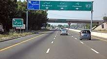
Sargodha lies about 45 km (28 mi) from the M-2 Motorway, which connects Lahore and Islamabad. The N-60 National Highway runs from Sargodha to Lahore through Pindi Bhattian and Sheikhupura. It is also connected to Faisalabad by a highway.
Buses
General Bus Stand is located on Fatima Jinnah Road that provides bus service from Sargodha to almost every part of the country. Daewoo Bus Service drives regular routes from Sargodha to the rest of the country.[56] Others include Niazi Express, Faisal Movers, Bilal Travels, Islamabad Express and Skyways etc.
Taxi and Rickshaws
The online cab services Uber and Careem are available in the city.[57] Many auto rickshaws are also available throughout the city, which are often used by those who cannot afford the cab services.
Rail
Sargodha is also connected by the rest of the country through the rail.[58] Sargodha Junction railway station is located on Shorkot-Lala Musa branch railway line.
Air Base
Pakistan's largest airbase, PAF Base Mushaf (formerly PAF Base Sargodha), is situated in Sargodha and hosts the headquarters of the Pakistan Air Force's Central Air Command. The airbase is also home to the Combat Commanders School (CCS), formerly the Fighter Leader's School.[59]
Recreation
Points of interest
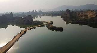 Lake of Kirana Hills
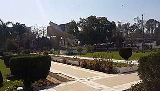 Antique fighter jet mounted at Company Bagh
 Centre point of famous Company Bagh
Kirana Hills
The Kirana Hills are a small and extensive rocky mountain range located in Sargodha.[60][61][62][63] They are a commonly-visited tourist attraction in Sargodha City. Locally known as the Black Mountains[64] due to their brownish landscape, their highest peak is about 980 feet (300 m).[65]
Jinnah Hall
Jinnah Hall is a historical landmark in Sargodha.[66] Jinnah Hall was built in 1949. It was named for Muhammad Ali Jinnah, the founder of Pakistan. Jinnah Hall was originally built as a town hall and library in Company Bagh, Sargodha; now it is currently used as an exhibition hall, event space, and library.
Sports
Sargodha is home to the Sargodha Cricket Stadium.[67] Sargodha's cricket team was a first-class cricket team that represented Sargodha Division. They competed in Pakistan's first-class tournaments in 1961–62 and 2002–03.
Mela Mandi Ground is a multi-use historic stadium in Sargodha. It is mostly used for cricket and football.[68] The Mela Mandi Ground was constructed to provide a vast ground for outdoor sports and activities. During March, every year (the country's spring season), several competitions are held here. Almost all Pakistani people watch these annual games.[69]
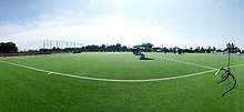
Sargodha is also home to Sargodha Astroturf Hockey Stadium, located near Mela Mandi Ground. It is home to the Sargodha District Hockey Team, and provides a reliable platform for the city's youth.[70] Galaxy Sports Complex is a renowned Sports Academy of the city.[71]
Food and drink
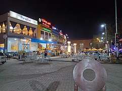 Food Steet on Stadium Road, Sargodha
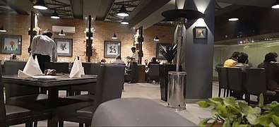 A local restaurant in Sargodha
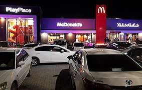 A McDonald's outlet in Sargodha
Traditional food and drink
The cuisine of Sargodha is similar to that of other regions of South Asia, with some of it originating from the royal kitchens of 16th-century Mughal emperors.[72] Most of those dishes have their roots in British, Indian, Central Asian and Middle Eastern cuisine.[73] Pakistani cooking uses large quantities of spices, herbs, and seasoning. Garlic, ginger, turmeric, red chili, and garam masala are used in most dishes, and home cooking regularly includes curry. Roti, a thin flatbread made from wheat, is a staple food, usually served with curry, meat, vegetables, and lentils. Rice is also common; it is served plain, fried with spices, and in sweet dishes.[74][75][76]
Lassi is a traditional drink in Punjab, including Sargodha. Black tea with milk and sugar is also popular throughout the city and is consumed daily by most of the population.[77][78]
Awards
In 1966, the Government of Pakistan awarded a special flag of Hilal-e-Istaqlal to Sargodha, along with Lahore and Sialkot in the Indo-Pakistani War of 1965 for showing severe resistance in front of India, as these cities were target of India's advances.[83] Every year, on Defence Day, this flag is hoisted in these cities as a symbol of recognition of the will, courage and perseverance of the dwellers of these cities.[84]
Notable people
- Ali Haider Noor Khan Niazi, politician
- Feroz Khan Noon, former Prime Minister Pakistan
- Anwer Ali Noon, former Parliamentarian of Pakistan and army Officer
- Amjad Ali Noon, former Ambassador / High Commissioner of Pakistan
- Imtiaz Bhatti, former Ambassador / High Commissioner of Pakistan
- Wazir Agha, Urdu Scholar
- Hameed Gul, former ISI Chief
- Chaudhry Anwar Ali Cheema, politician, PML-Q
- Chaudhary Ghias Ahmed Mela, politician, PML-Q
- Hafiz Muhammad Saeed, Amir Jama'at-ud-Da'wah
- Mohammad Hafeez, cricketer
- Aizaz Cheema, cricketer
- Rafiq Anjum, actor
- Farhat Hashmi, Islamic Scholar
References
- http://visitpak.com/useful-info-about-sargodha-pakistan-the-city-of-eagles/
- https://tribune.com.pk/story/1903186/1-pakistans-california-ways-grow/?amp=1
- "Sargodha Division". getamap.net.
- https://www.dawn.com/news/1524621
- http://www.urbanunit.gov.pk/PublicationDocs/Punjab%20city%20profiles/Sargodha%20City%20Profile.pdf
- https://elevationmap.net/sargodha-district-pakistan
- http://www.pbs.gov.pk/sites/default/files/bwpsr/punjab/SARGODHA_BLOCKWISE.pdf
- "Pakistan Post Office Department". Web.archive.org. Archived from the original on 20 December 2011. Retrieved 12 March 2016.
- "National Dialing Codes". Ptcl.com.pk. Archived from the original on 9 November 2015. Retrieved 12 March 2016.
- http://tmasargodha.lgpunjab.org.pk/Union-Councils.html
- "Pakistan: Provinces and Major Cities – Population Statistics, Maps, Charts, Weather and Web Information". Citypopulation.de.
- "Commercial Real Estate Property in Sargodha Pakistan – Ghar47". Ghar47. Archived from the original on 16 February 2016. Retrieved 12 March 2016.
- http://sargodha.dc.lhc.gov.pk/PublicPages/HistoryOfDistrict.aspx
- Masud, Tariq (1989). Pakistan: a historical and cultural panorama. Al-Waqar Publishers. ISBN 9789698054021.
- Cell, J.W.; Cell, J.W. (2002). Hailey: A Study in British Imperialism, 1872–1969. Cambridge University Press. ISBN 978-0-521-52117-8. Retrieved 9 April 2020.
- "District Website". Lhc.gov.pk.
- http://sargodha.dc.lhc.gov.pk/PublicPages/HistoryOfDistrict.aspx
- List of governors of Punjab (British India)
- https://www.rome2rio.com/s/Karachi/Sargodha
- https://www.distancecalculator.net/from-lahore-to-sargodha
- https://www.distancesto.com/road-map/pk/sargodha-to-islamabad/history/598090.html
- https://www.distancecalculator.net/from-rawalpindi-to-sargodha
- "District at Glance". sargodha.gop.pk. Archived from the original on 26 June 2015.
- "Where is Sargodha, Pakistan?". WorldAtlas.com. Retrieved 17 February 2018.
- "Weather2 – Sargodha". Retrieved 8 July 2012.
- "Population size and growth of major cities" (PDF). Pakistan Bureau of Statistics. 1998.
- "DISTRICT WISE CENSUS RESULTS CENSUS 2017" (PDF). www.pbscensus.gov.pk. Archived from the original (PDF) on 29 August 2017. Retrieved 3 September 2017.
- https://www.academia.edu/7790985/Orange_Economy_of_Sargodha
- https://www.scci.pk
- https://tribune.com.pk/story/1111172/facilitating-exports-dry-port-established-sargodha/
- http://www.mallofsargodha.com
- https://pmbmc.punjab.gov.pk/sargodha
- http://tmasargodha.lgpunjab.org.pk
- "After Lahore, six others to become 'safer cities'". Express Tribune. 20 February 2017. Retrieved 23 February 2017.
- "Punjab Safe City Project inaugurated". Dawn. 12 October 2016. Retrieved 23 February 2017.
- https://www.marham.pk/hospitals/sargodha
- https://www.urbanunit.gov.pk › ...PDF Sargodha City Profile – The Urban Unit
- "BISE SARGODHA".
- https://www.uos.edu.pk
- https://www.uol.edu.pk/about-us
- https://www.ucp.edu.pk
- https://www.uos.edu.pk/department/profile/14
- www
.pafcollegesargodha .com - http://pu.edu.pk/affiliation/collegeinfo/1270/Cornelius-Law-College-Lahore-Road-Sargodha
- https://qlc.edu.pk/sargodha-campus/
- https://www.pgc.edu/about-pgc
- https://superiorcolleges.edu.pk/sargodha/
- https://www.das.edu.pk
- "About Roots Millennium Schools". Retrieved on 26 February 2015.
- www
.beaconhouse .net - https://thecityschool.edu.pk
- www
.fauji .org .pk - https://alliedschools.edu.pk
- https://kips.edu.pk
- "Archived copy". Archived from the original on 6 July 2015. Retrieved 6 July 2015.CS1 maint: archived copy as title (link)
- "Countries of Operation".
- "Pakistan Railway Time Table". railpk.com.
- "About Sargodha". glowpakistan.com.
- (Mahajan 2009, pp. 100–110)
- (Ali 2002, pp. 25–26)
- (Smith 2007, pp. 92–93)
- Wikimaps. "Kirana Hills". Wikimapia.org. Retrieved 14 June 2015.
- DoE&ES, Department of Earth and Environmental Sciences (2012). "Special report: Field report on Kirana Hills" (.net). Karachi, Sindh, Pakistan: Bahria University Press. p. 33. Retrieved 15 June 2015.CS1 maint: ref=harv (link)
- (DoE&ES 2012, pp. 4–5)
- "Google Maps". Google.com. Retrieved 17 September 2016.
- "Sports Stadium – Pakistan – Cricket Grounds – ESPN Cricinfo". Cricinfo.
- "Google Maps". Google Maps.
- "Cheap flights to Sargodha". Flighthub.com.
- https://www.urdupoint.com/en/sports/trials-for-hockey-team-selection-at-astroturf-539537.html
- http://wikimapia.org/3443348/Galaxy-ground
- Goodwin, William (2002). Pakistan. Lucent Books. p. 79. ISBN 978-1-59018-218-5.
Pakistani food is similar to that of northern India, with a splash of Middle Eastern influence derived from other Muslim cultures over the centuries.
- Lee, Jonathan H.X.; Nadeau, Kathleen M. (2011). Encyclopedia of Asian American Folklore and Folklife. ABC-CLIO. p. 973. ISBN 978-0-313-35066-5.
Pakistani cuisine—a fusion of Central Asian, Middle Eastern, Persian, and Indian traditions—is known for being spicy and for its aromatic and flavorful richness.
- Yasmeen Niaz Mohiuddin (2006). Pakistan: a global studies handbook. ABC-CLIO. pp. 3, 317, 323–324. ISBN 978-1-85109-801-9.
- Kathleen W. Deady (2001). Countries of the world :Pakistan. Capstone Press. pp. 13–15. ISBN 978-0-7368-0815-6.
- American Geriatrics Society. Ethnogeriatrics Committee (2006). Doorway thoughts: cross-cultural health care for older adults. Jones & Bartlett Learning. pp. 119–120. ISBN 978-0-7637-4355-0.
- Sarina Singh; Lindsay Brow; Paul Clammer; Rodney Cocks; John Mock (2008). Pakistan & the Karakoram Highway. Lonely Planet. pp. 60, 128, 376. ISBN 978-1-74104-542-0.
- Tarla Dalal (2007). Punjabi Khana. Sanjay & Co. p. 8. ISBN 978-81-89491-54-3.
- https://nation.com.pk/17-Dec-2017/the-fried-chicken-turnaround
- https://www.kfcpakistan.com
- https://mcdonalds.com.pk
- https://www.pizzahut.com.pk
- https://tribune.com.pk/story/601035/commemorating-sept-1965-nation-celebrates-defence-day-with-fervour/?amp=1
- https://www.dawn.com/news/56110/defence-day-celebrated-with-renewed-pledges
Neighbourhoods of Sargodha | ||
|---|---|---|
Administrations: Sargodha Division and Sargodha District | ||
| Tehsils | 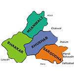 | |
| Cities |
| |
| Towns & councils | ||
| Localities |
| |
Website: Sargodha District at NRB | ||