Sandia Knolls, New Mexico
Sandia Knolls is a census-designated place (CDP) in Bernalillo County, New Mexico, United States. The population was 1,208 at the 2010 census.[1] It is part of the Albuquerque Metropolitan Statistical Area.
Sandia Knolls, New Mexico | |
|---|---|
 Sandia Knolls | |
| Coordinates: 35°9′46″N 106°18′23″W | |
| Country | United States |
| State | New Mexico |
| County | Bernalillo |
| Area | |
| • Total | 2.8 sq mi (7.2 km2) |
| • Land | 2.8 sq mi (7.2 km2) |
| • Water | 0.0 sq mi (0.0 km2) |
| Elevation | 6,820 ft (2,080 m) |
| Population (2010) | |
| • Total | 1,208 |
| • Density | 435/sq mi (167.9/km2) |
| Time zone | UTC-7 (Mountain (MST)) |
| • Summer (DST) | UTC-6 (MDT) |
| Area code(s) | 505 |
| FIPS code | 35-66890 |
| GNIS feature ID | 0929164 |
Geography
Sandia Knolls is located in northeastern Bernalillo County, at the southern end of a small mountain known as Monte Largo, east of the Sandia Mountains. It is bordered to the north by an undeveloped portion of the town of Edgewood, and the CDPs of San Antonito and Sandia Park are 3 miles (5 km) to the west.
According to the United States Census Bureau, the Sandia Knolls CDP has a total area of 2.8 square miles (7.2 km2), all of it land.[1]
References
- "Geographic Identifiers: 2010 Demographic Profile Data (G001): Sandia Knolls CDP, New Mexico". U.S. Census Bureau, American Factfinder. Archived from the original on February 12, 2020. Retrieved January 30, 2014.
Municipalities and communities of Bernalillo County, New Mexico, United States | ||
|---|---|---|
| Cities | 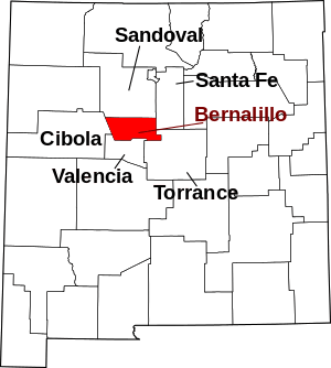 Map of New Mexico highlighting Bernalillo County | |
| Town | ||
| Villages | ||
| CDPs | ||
| Other unincorporated communities | ||
| Indian reservations | ||
| Footnotes | ‡This populated place also has portions in an adjacent county or counties | |
This article is issued from Wikipedia. The text is licensed under Creative Commons - Attribution - Sharealike. Additional terms may apply for the media files.