Sand Ridge Township, Jackson County, Illinois
Sand Ridge Township is one of sixteen townships in Jackson County, Illinois, USA. As of the 2010 census, its population was 816 and it contained 354 housing units.[2]
Sand Ridge Township | |
|---|---|
 Location in Jackson County | |
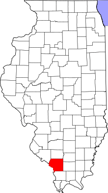 Jackson County's location in Illinois | |
| Coordinates: 37°44′21″N 89°26′18″W | |
| Country | United States |
| State | Illinois |
| County | Jackson |
| Established | November 4, 1884 |
| Area | |
| • Total | 36.38 sq mi (94.2 km2) |
| • Land | 35.45 sq mi (91.8 km2) |
| • Water | 0.93 sq mi (2.4 km2) 2.56% |
| Elevation | 358 ft (109 m) |
| Population (2010) | |
| • Estimate (2016)[1] | 786 |
| • Density | 23/sq mi (9/km2) |
| Time zone | UTC-6 (CST) |
| • Summer (DST) | UTC-5 (CDT) |
| ZIP codes | 62907, 62940, 62942, 62966 |
| FIPS code | 17-077-67522 |
Geography
According to the 2010 census, the township has a total area of 36.38 square miles (94.2 km2), of which 35.45 square miles (91.8 km2) (or 97.44%) is land and 0.93 square miles (2.4 km2) (or 2.56%) is water.[2]
Cities, towns, villages
Unincorporated towns
- Grimsby at 37.750329°N 89.449261°W
- Sand Ridge at 37.740051°N 89.442594°W
(This list is based on USGS data and may include former settlements.)
Adjacent townships
- Levan Township (north)
- Somerset Township (northeast)
- Murphysboro Township (east)
- Pomona Township (southeast)
- Grand Tower Township (south)
- Fountain Bluff Township (west)
- Kinkaid Township (northwest)
Cemeteries
The township contains Creath Morris Cemetery.
I believe that the location of the Creath Morris Cemetery is just above the old Grimsby Illinois Elementary School. As a child I lived on the lane that is now called Sarensen. We used to play over on that hill above the school. I don't believe any of the markers are still there because the weather has badly eroded the steep slope. Melissa Janean [Reames] Holt - Note added 2017
Major highways
Landmarks
- Lake Murphysboro State Park (southwest edge)
Kincaid Spillway https://www.dnr.illinois.gov/Parks/Pages/KinkaidLake.aspx
Notable Persons
School districts
- Murphysboro Community Unit School District 166
- Trico Community Unit School District 176
Political districts
- Illinois' 12th congressional district
- State House District 115
- State Senate District 58
References
- "Sand Ridge Township, Jackson County, Illinois". Geographic Names Information System. United States Geological Survey. Retrieved 2010-01-17.
- United States Census Bureau 2007 TIGER/Line Shapefiles
- United States National Atlas
- "Population and Housing Unit Estimates". Retrieved June 9, 2017.
- "Population, Housing Units, Area, and Density: 2010 - County -- County Subdivision and Place -- 2010 Census Summary File 1". United States Census. Archived from the original on 2020-02-12. Retrieved 2013-05-28.
- Gary Geiger
- "Census of Population and Housing". Census.gov. Retrieved June 4, 2016.
External links
Municipalities and communities of Jackson County, Illinois, United States | ||
|---|---|---|
| Cities | Map of Illinois highlighting Jackson County | |
| Villages | ||
| Townships | ||
| CDP | ||
| Other unincorporated communities | ||
| Ghost town | ||
| Footnotes | ‡This populated place also has portions in an adjacent county or counties | |