Dowell, Illinois
Dowell is a village in Jackson County, Illinois, United States. The population was 408 at the 2010 census,[3] down from 441 at the 2000 census.
Dowell, Illinois | |
|---|---|
Village | |
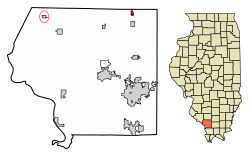 Location of Dowell in Jackson County, Illinois | |
.svg.png) Location of Illinois in the United States | |
| Coordinates: 37°56′22″N 89°14′22″W | |
| Country | United States |
| State | Illinois |
| County | Jackson |
| Township | Elk |
| Area | |
| • Total | 0.39 sq mi (1.01 km2) |
| • Land | 0.39 sq mi (1.01 km2) |
| • Water | 0.00 sq mi (0.00 km2) |
| Elevation | 400 ft (100 m) |
| Population (2010) | |
| • Total | 408 |
| • Estimate (2018)[2] | 386 |
| • Density | 997.44/sq mi (385.02/km2) |
| Time zone | UTC-6 (CST) |
| • Summer (DST) | UTC-5 (CDT) |
| ZIP Code(s) | 62927 |
| Area code(s) | 618 |
| FIPS code | 17-20565 |
| GNIS ID | 2398744 |
| Wikimedia Commons | Dowell, Illinois |
Geography
Dowell is located in northeastern Jackson County at 37°56′22″N 89°14′22″W (37.939545, -89.239553).[4] U.S. Route 51 passes through the eastern side of the village, leading south 9 miles (14 km) to De Soto and north 5 miles (8 km) to Du Quoin.
According to the 2010 census, Dowell has a total area of 0.391 square miles (1.01 km2), of which 0.39 square miles (1.01 km2) (or 99.74%) is land and 0.001 square miles (0.00 km2) (or 0.26%) is water.[5]
History
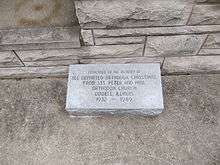
Dowell was founded as a coal town and named by Du Quoin attorney George Dowell and William Lafont. They requested bids for property development as early as 1917.[6] In 1922, the town's population was over 2,000.[7]
The town has supported miners from local coal mines.[8] The Kathleen Coal Mine was located east of the town. It was the scene of a disaster in 1921 and again in 1936.[9] At one time, the Kathleen Mine produced 5,000 tons of coal per day. The mine was closed in 1946 after the coal vein was no longer accessible.
Coal mining brought many immigrants to the village. At one time there was a Russian Orthodox church which is now closed. The area is still served by a church in nearby Royalton.[10]
Dowell today
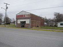
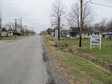
With the departure of the Kathleen Mine, Dowell has become a quiet residential community. The mine has been suspected of causing sinkholes in the village.[11]
Demographics
| Historical population | |||
|---|---|---|---|
| Census | Pop. | %± | |
| 1920 | 422 | — | |
| 1930 | 832 | 97.2% | |
| 1940 | 704 | −15.4% | |
| 1950 | 616 | −12.5% | |
| 1960 | 453 | −26.5% | |
| 1970 | 423 | −6.6% | |
| 1980 | 480 | 13.5% | |
| 1990 | 465 | −3.1% | |
| 2000 | 441 | −5.2% | |
| 2010 | 408 | −7.5% | |
| Est. 2018 | 386 | [2] | −5.4% |
| U.S. Decennial Census[12] | |||
As of the census[13] of 2000, there were 441 people, 199 households, and 125 families residing in the village. The population density was 1,188.0 people per square mile (460.2/km²). There were 217 housing units at an average density of 584.6 per square mile (226.4/km²). The racial makeup of the village was 98.41% White, 0.23% African American, 0.91% Native American, and 0.45% from two or more races. Hispanic or Latino of any race were 0.45% of the population.
There were 199 households out of which 28.1% had children under the age of 18 living with them, 47.2% were married couples living together, 12.6% had a female householder with no husband present, and 36.7% were non-families. 29.1% of all households were made up of individuals and 17.6% had someone living alone who was 65 years of age or older. The average household size was 2.22 and the average family size was 2.75.
In the village, the population was spread out with 21.5% under the age of 18, 8.6% from 18 to 24, 26.5% from 25 to 44, 22.2% from 45 to 64, and 21.1% who were 65 years of age or older. The median age was 40 years. For every 100 females, there were 83.8 males. For every 100 females age 18 and over, there were 89.1 males.
The median income for a household in the village was $24,750, and the median income for a family was $28,958. Males had a median income of $24,821 versus $16,719 for females. The per capita income for the village was $12,464. About 10.3% of families and 13.3% of the population were below the poverty line, including 21.7% of those under age 18 and 10.6% of those age 65 or over.
References
- "2016 U.S. Gazetteer Files". United States Census Bureau. Retrieved Jun 29, 2017.
- "Population and Housing Unit Estimates". Retrieved March 27, 2020.
- "Geographic Identifiers: 2010 Census Summary File 1 (G001): Dowell village, Illinois". American Factfinder. U.S. Census Bureau. Archived from the original on February 13, 2020. Retrieved May 9, 2018.
- "US Gazetteer files: 2010, 2000, and 1990". United States Census Bureau. 2011-02-12. Retrieved 2011-04-23.
- "G001 - Geographic Identifiers - 2010 Census Summary File 1". United States Census Bureau. Archived from the original on 2020-02-13. Retrieved 2015-08-02.
- P. Wiseman (August 8, 1984). "The Village of Dowell". Murphysboro American.
- "The Small Neighbor". Southern Illinoisan. January 11, 1990.
- "Archived copy". Archived from the original on 2006-12-14. Retrieved 2006-12-29.CS1 maint: archived copy as title (link)
- "Archived copy". Archived from the original on 2015-10-06. Retrieved 2014-12-11.CS1 maint: archived copy as title (link)
- "The Small Neighbor". Southern Illinoisan. January 11, 1990.
- "Dowell Sinking- no longer slowly". Southern Illinoisan. February 18, 1971.
- "Census of Population and Housing". Census.gov. Retrieved June 4, 2015.
- "U.S. Census website". United States Census Bureau. Retrieved 2008-01-31.
- "Rudolph Wanderone reference". Archived from the original on 2012-04-19. Retrieved 2006-12-29.
External links
Municipalities and communities of Jackson County, Illinois, United States | ||
|---|---|---|
| Cities | Map of Illinois highlighting Jackson County | |
| Villages | ||
| Townships | ||
| CDP | ||
| Other unincorporated communities | ||
| Ghost town | ||
| Footnotes | ‡This populated place also has portions in an adjacent county or counties | |