Grand Tower Township, Jackson County, Illinois
Grand Tower Township is one of sixteen townships in Jackson County, Illinois, USA. As of the 2010 census, its population was 707 and it contained 336 housing units.[2]
Grand Tower Township | |
|---|---|
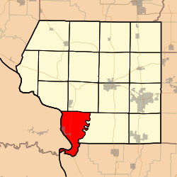 Location in Jackson County | |
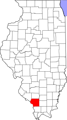 Jackson County's location in Illinois | |
| Coordinates: 37°38′14″N 89°28′24″W | |
| Country | United States |
| State | Illinois |
| County | Jackson |
| Established | November 4, 1884 |
| Area | |
| • Total | 33.42 sq mi (86.6 km2) |
| • Land | 31.56 sq mi (81.7 km2) |
| • Water | 1.86 sq mi (4.8 km2) 5.57% |
| Elevation | 361 ft (110 m) |
| Population (2010) | |
| • Estimate (2016)[1] | 681 |
| • Density | 22.4/sq mi (8.6/km2) |
| Time zone | UTC-6 (CST) |
| • Summer (DST) | UTC-5 (CDT) |
| ZIP codes | 62940, 62942, 62966 |
| FIPS code | 17-077-30783 |
Geography
According to the 2010 census, the township has a total area of 33.42 square miles (86.6 km2), of which 31.56 square miles (81.7 km2) (or 94.43%) is land and 1.86 square miles (4.8 km2) (or 5.57%) is water.[2]
A small portion of Missouri, known as Grand Tower Island, lies on the Mississippi River's eastern side adjacent to Grand Tower Township. Partially surrounded by an oxbow lake, the island can only be accessed by water or by a road that begins and ends in Illinois.[3]
Cities, towns, villages
Unincorporated towns
(This list is based on USGS data and may include former settlements.)
Adjacent townships
- Sand Ridge Township (north)
- Pomona Township (east)
- Fountain Bluff Township (northwest)
Cemeteries
The township contains these four cemeteries: Goodbread, Henson, Hudson and Walker Hill.
Major highways
Rivers
School districts
- Murphysboro Community Unit School District 186
- Shawnee Community Unit School District 84
Political districts
- Illinois' 12th congressional district
- State House District 115
- State Senate District 58
References
- "Grand Tower Township, Jackson County, Illinois". Geographic Names Information System. United States Geological Survey. Retrieved 2010-01-17.
- United States Census Bureau 2007 TIGER/Line Shapefiles
- United States National Atlas
- "Population and Housing Unit Estimates". Retrieved June 9, 2017.
- "Population, Housing Units, Area, and Density: 2010 - County -- County Subdivision and Place -- 2010 Census Summary File 1". United States Census. Archived from the original on 2020-02-12. Retrieved 2013-05-28.
- DeLorme. Illinois Atlas & Gazetteer. 6th ed. Yarmouth: DeLorme, 2010, 88. ISBN 978-0-89933-321-2.
- "Census of Population and Housing". Census.gov. Retrieved June 4, 2016.
External links
Municipalities and communities of Jackson County, Illinois, United States | ||
|---|---|---|
| Cities | Map of Illinois highlighting Jackson County | |
| Villages | ||
| Townships | ||
| CDP | ||
| Other unincorporated communities | ||
| Ghost town | ||
| Footnotes | ‡This populated place also has portions in an adjacent county or counties | |