Saint-Pierre-de-Frugie
Saint-Pierre-de-Frugie is a commune in the Dordogne department in Nouvelle-Aquitaine in southwestern France.
Saint-Pierre-de-Frugie | |
|---|---|
 The town hall in Saint-Pierre-de-Frugie | |
.svg.png) Coat of arms | |
Location of Saint-Pierre-de-Frugie 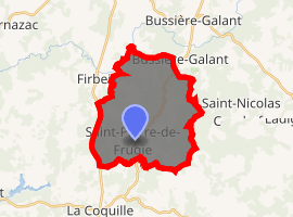
| |
 Saint-Pierre-de-Frugie  Saint-Pierre-de-Frugie | |
| Coordinates: 45°34′27″N 0°59′59″E | |
| Country | France |
| Region | Nouvelle-Aquitaine |
| Department | Dordogne |
| Arrondissement | Nontron |
| Canton | Thiviers |
| Intercommunality | 2008–2014 |
| Government | |
| • Mayor (Gilbert Chabaud) | Monsieur Fayol |
| Area 1 | 21.74 km2 (8.39 sq mi) |
| Population (2017-01-01)[1] | 398 |
| • Density | 18/km2 (47/sq mi) |
| Time zone | UTC+01:00 (CET) |
| • Summer (DST) | UTC+02:00 (CEST) |
| INSEE/Postal code | 24486 /24450 |
| Elevation | 305–491 m (1,001–1,611 ft) (avg. 318 m or 1,043 ft) |
| 1 French Land Register data, which excludes lakes, ponds, glaciers > 1 km2 (0.386 sq mi or 247 acres) and river estuaries. | |
The village is dependent on tourism. The heart of the town contains a central office, staffed only part-time, a single restaurant ('L'Escargot'), and one hotel.
Geography
Saint-Pierre-de-Frugie is nestled among rolling hills. The characteristic farm-land is special and rich in history of this particular region. Many of the farms have been abandoned, and have no crop yield, but are maintained by the people as fields. These fields are still private property, and much of the area is off limits to tourists, but roads often run in between the farms, and one can see the expansiveness of the unused, but spectacular landscape.
Population
| Historical population | ||
|---|---|---|
| Year | Pop. | ±% |
| 1962 | 679 | — |
| 1968 | 584 | −14.0% |
| 1975 | 516 | −11.6% |
| 1982 | 487 | −5.6% |
| 1990 | 413 | −15.2% |
| 1999 | 373 | −9.7% |
| 2008 | 404 | +8.3% |
See also
References
- "Populations légales 2017". INSEE. Retrieved 6 January 2020.
| Wikimedia Commons has media related to Saint-Pierre-de-Frugie. |
| Authority control |
|
|---|
This article is issued from Wikipedia. The text is licensed under Creative Commons - Attribution - Sharealike. Additional terms may apply for the media files.