Mialet, Dordogne
Mialet is a commune in the Dordogne department in Nouvelle-Aquitaine in southwestern France.
Mialet | |
|---|---|
_mairie_(1).JPG) The town hall in Mialet | |
 Coat of arms | |
Location of Mialet 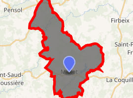
| |
 Mialet  Mialet | |
| Coordinates: 45°33′02″N 0°54′17″E | |
| Country | France |
| Region | Nouvelle-Aquitaine |
| Department | Dordogne |
| Arrondissement | Nontron |
| Canton | Thiviers |
| Intercommunality | Périgord vert |
| Government | |
| • Mayor (2008–2014) | Pierrette Razé |
| Area 1 | 37.30 km2 (14.40 sq mi) |
| Population (2017-01-01)[1] | 613 |
| • Density | 16/km2 (43/sq mi) |
| Time zone | UTC+01:00 (CET) |
| • Summer (DST) | UTC+02:00 (CEST) |
| INSEE/Postal code | 24269 /24450 |
| Elevation | 250–391 m (820–1,283 ft) (avg. 320 m or 1,050 ft) |
| 1 French Land Register data, which excludes lakes, ponds, glaciers > 1 km2 (0.386 sq mi or 247 acres) and river estuaries. | |
Geography
The Côle flows southwest through the southern part of the commune.
Population
| Historical population | ||
|---|---|---|
| Year | Pop. | ±% |
| 1793 | 1,485 | — |
| 1800 | 1,457 | −1.9% |
| 1806 | 1,426 | −2.1% |
| 1821 | 1,809 | +26.9% |
| 1831 | 1,863 | +3.0% |
| 1836 | 1,823 | −2.1% |
| 1841 | 1,905 | +4.5% |
| 1846 | 2,007 | +5.4% |
| 1851 | 1,989 | −0.9% |
| 1856 | 1,830 | −8.0% |
| 1861 | 1,763 | −3.7% |
| 1866 | 1,790 | +1.5% |
| 1872 | 1,768 | −1.2% |
| 1876 | 1,777 | +0.5% |
| 1881 | 1,872 | +5.3% |
| 1886 | 2,027 | +8.3% |
| 1891 | 2,033 | +0.3% |
| 1896 | 2,096 | +3.1% |
| 1901 | 2,191 | +4.5% |
| 1906 | 2,092 | −4.5% |
| 1911 | 2,021 | −3.4% |
| 1921 | 1,676 | −17.1% |
| 1926 | 1,601 | −4.5% |
| 1931 | 1,532 | −4.3% |
| 1936 | 1,454 | −5.1% |
| 1946 | 1,414 | −2.8% |
| 1954 | 1,369 | −3.2% |
| 1962 | 1,287 | −6.0% |
| 1968 | 1,094 | −15.0% |
| 1975 | 1,006 | −8.0% |
| 1982 | 888 | −11.7% |
| 1990 | 795 | −10.5% |
| 1999 | 718 | −9.7% |
| 2008 | 669 | −6.8% |
See also
References
- "Populations légales 2017". INSEE. Retrieved 6 January 2020.
| Wikimedia Commons has media related to Mialet (Dordogne). |
| Authority control |
|
|---|
This article is issued from Wikipedia. The text is licensed under Creative Commons - Attribution - Sharealike. Additional terms may apply for the media files.