Saint-Michel-de-Bannières
Saint-Michel-de-Bannières is a commune in the Lot department in south-western France. There is one restaurant called "La Table du Fermier" and a twelfth-century church fortified during the later 15th century. The post code is 46110, the current mayor is Pierre Prangère.
Saint-Michel-de-Bannières | |
|---|---|
Location of Saint-Michel-de-Bannières 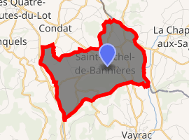
| |
 Saint-Michel-de-Bannières  Saint-Michel-de-Bannières | |
| Coordinates: 44°58′37″N 1°41′23″E | |
| Country | France |
| Region | Occitanie |
| Department | Lot |
| Arrondissement | Gourdon |
| Canton | Martel |
| Intercommunality | Pays du Haut-Quercy Dordogne |
| Government | |
| • Mayor (2014–2020) | Pierre Prangère |
| Area 1 | 7.74 km2 (2.99 sq mi) |
| Population (2017-01-01)[1] | 318 |
| • Density | 41/km2 (110/sq mi) |
| Time zone | UTC+01:00 (CET) |
| • Summer (DST) | UTC+02:00 (CEST) |
| INSEE/Postal code | 46283 /46110 |
| Elevation | 112–277 m (367–909 ft) (avg. 172 m or 564 ft) |
| 1 French Land Register data, which excludes lakes, ponds, glaciers > 1 km2 (0.386 sq mi or 247 acres) and river estuaries. | |
The population was 300 according to the last census in 2007 (-9% as compared to the 1999 census), with 48% men and 52% women, 26.5% of the total population is single. About 8.3% of the population was unemployed in 2007 as compared to 11.2% in 1999.
See also
References
- "Populations légales 2017". INSEE. Retrieved 6 January 2020.
| Wikimedia Commons has media related to Saint-Michel-de-Bannières. |
| Authority control |
|
|---|
This article is issued from Wikipedia. The text is licensed under Creative Commons - Attribution - Sharealike. Additional terms may apply for the media files.