Montvalent
Montvalent is a commune in the Lot department in south-western France.
Montvalent | |
|---|---|
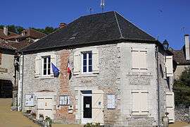 The town hall in Montvalent | |
Location of Montvalent 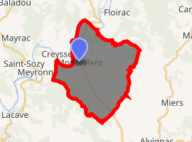
| |
 Montvalent  Montvalent | |
| Coordinates: 44°52′56″N 1°37′09″E | |
| Country | France |
| Region | Occitanie |
| Department | Lot |
| Arrondissement | Gourdon |
| Canton | Martel |
| Intercommunality | Pays de Martel |
| Government | |
| • Mayor (2008–2014) | Catherine Calvy |
| Area 1 | 27.61 km2 (10.66 sq mi) |
| Population (2017-01-01)[1] | 286 |
| • Density | 10/km2 (27/sq mi) |
| Time zone | UTC+01:00 (CET) |
| • Summer (DST) | UTC+02:00 (CEST) |
| INSEE/Postal code | 46208 /46600 |
| Elevation | 95–322 m (312–1,056 ft) (avg. 170 m or 560 ft) |
| 1 French Land Register data, which excludes lakes, ponds, glaciers > 1 km2 (0.386 sq mi or 247 acres) and river estuaries. | |
Geography
Montvalent is located in the north of the Lot. It is situated on the D840 between the towns of Martel and Gramat. The commune is in the valley of the River Dordogne, and is easily reached from the autoroute A20 (Junctions 54, Martel or 55, Souillac).
Demography
The inhabitants of Monvalent are known as Monvalentais.
| 1962 | 1968 | 1975 | 1982 | 1990 | 1999 | 2008 |
|---|---|---|---|---|---|---|
| 196 | 212 | 214 | 197 | 233 | 267 | 299 |
| Census enumeration : Population without double-counting | ||||||
Places and monuments
At the bottom of the cliffs below the village of Montvalent, the underground river from the Gouffre de Padirac resurfaces near the Dordogne.
Montvalent is just 10 minutes by car to the famous pilgrimage site of Rocamadour and pilgrims often stopped in the village on their way.
See also
| Wikimedia Commons has media related to Montvalent. |
| Authority control |
|
|---|
- "Populations légales 2017". INSEE. Retrieved 6 January 2020.
This article is issued from Wikipedia. The text is licensed under Creative Commons - Attribution - Sharealike. Additional terms may apply for the media files.