Saint-Céré
Saint-Céré (Languedocien: Sant Seren) is a commune of 3,609 people (as of 2016) situated in the Lot valley (Department 46)[2] in the Lot. The commune includes within its borders the castle of St-Laurent-Les-Tours, where the artist Jean Lurçat lived and worked for many years, and from which he operated a secret radio for the French Resistance.[3] The castle still houses a collection of his works.
Saint-Céré | |
|---|---|
 La Bave and the Quai des Récollets | |
.svg.png) Coat of arms | |
Location of Saint-Céré 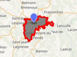
| |
 Saint-Céré  Saint-Céré | |
| Coordinates: 44°51′35″N 1°53′30″E | |
| Country | France |
| Region | Occitanie |
| Department | Lot |
| Arrondissement | Figeac |
| Canton | Saint-Céré |
| Intercommunality | Pays de Saint-Céré |
| Government | |
| • Mayor (2014–2020) | Pierre Destic |
| Area 1 | 11.33 km2 (4.37 sq mi) |
| Population (2017-01-01)[1] | 3,462 |
| • Density | 310/km2 (790/sq mi) |
| Time zone | UTC+01:00 (CET) |
| • Summer (DST) | UTC+02:00 (CEST) |
| INSEE/Postal code | 46251 /46400 |
| Elevation | 141–523 m (463–1,716 ft) (avg. 152 m or 499 ft) |
| 1 French Land Register data, which excludes lakes, ponds, glaciers > 1 km2 (0.386 sq mi or 247 acres) and river estuaries. | |
Geography
Location
The town is located in the centre of a small metropolitan area, in the Quercy, northeast of the Causse de Gramat and west of Segala, between Lacapelle-Marival and Bretenoux, in the valley of the Bave, tributary of the Dordogne river, and on the northern edge of the Limargue. It is the city-centre of the urban unit of Saint-Céré.
Located at the crossroad of the routes to Limousin, Auvergne and Quercy, Saint-Céré is a sought after place to stay due to its location and an excellent point of departure for many walks and excursions in the Haut-Quercy.
Hydrography
The Bave river, a tributary of the Dordogne, flows through the town.
Geology and relief
The area of the commune is 1,133 hectares; its altitude varies from 141 to 523 meters.[4]
At the town hall, the altitude of Saint-Céré is 155 meters. It rises from 141 meters at Bave river to 523 meters in the southern part of the commune.
Climate
Saint-Céré has the distinction of being at the junction of the three types of temperate climates: there is a Temperate Oceanic climate, with Mediterranean and Continental influences, characterised by a dry and hot summer, a sunny autumn, a mild winter. In the shelter of the foothills of the Massif Central, the Vent d'Autan is here moderate.
Toponymy
Saint-Cere is based on the Christian hagiotoponym of Serenus de Marseille.[5]
During the French Revolution, the commune bore the name of Franc-Céré and Sen Céré (or Seu-Céré).[6]
In Occitan, the name of the municipality is Sant Seren.
Local culture and heritage
Places and monuments
- La place du Mercadial, its fountain and the 15th century Consuls' House, which was declared a historic monument in 1991[7]
- L'hôtel de Puymule, 15th-century, was listed as a historical monument in 1929[8]
- L'hôtel de Miramon[9]
- La maison consulaire[10]
- Several wood-panelled houses
- Église Sainte-Spérie, dating from the 10th century, inscribed as a historical monument in 1979[11]
- Église des Récollets, 17th century, listed as a historic monument in 1973[12]
- Statue of Marshal Canrobert
- Statue of Charles Bourseul (1924) by Giovanni Pinotti Cipriani (also sculptor of the monument to the dead in the square of the Place de la République)
- Château de Montal, 14th-century, listed as a historical monument in 1909. It is located in the commune of Saint-Jean-Lespinasse, two kilometres away.[13]
See also
References
- "Populations légales 2017". INSEE. Retrieved 6 January 2020.
- http://www.st-cere.com/information-about-St-Cere.html Archived 2009-04-12 at the Wayback Machine
- http://www.st-cere.com/guides/St-Laurent-les-Tours.html Archived 2010-09-05 at the Wayback Machine
- "Répertoire Géographique des Communes 2011". public.opendatasoft.com. Retrieved 2019-07-17.
- Bazalgues, Gaston (2002). À la découverte des noms de lieux du Quercy. Toponymie lotoise (Éditions de la Bouriane et du Quercy ed.). Gourdon. p. 53. ISBN 2-910540-16-2.
- "Wikiwix's cache". archive.wikiwix.com. Retrieved 2019-07-17.
- "Ancienne maison consulaire". www2.culture.gouv.fr. Retrieved 2019-08-10.
- "Ancien hôtel de Puymule". www2.culture.gouv.fr. Retrieved 2019-08-10.
- "Maison Louis XIII". www2.culture.gouv.fr. Retrieved 2019-08-10.
- "Ancienne maison consulaire". www2.culture.gouv.fr. Retrieved 2019-08-10.
- "Eglise et sa crypte de Sainte-Spérie". www2.culture.gouv.fr. Retrieved 2019-08-10.
- "Eglise des Récollets". www2.culture.gouv.fr. Retrieved 2019-08-10.
- "Domaine de Montal (également sur commune de Saint-Céré)". www2.culture.gouv.fr. Retrieved 2019-08-10.
| Wikimedia Commons has media related to Saint-Céré. |
| Authority control |
|
|---|