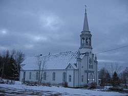
Saint-Malo, Quebec
Saint-Malo (![]()
Saint-Malo | |
|---|---|
Municipality | |
 | |
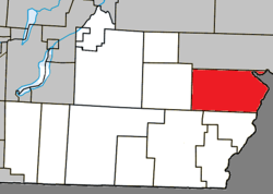 Location within Coaticook RCM. | |
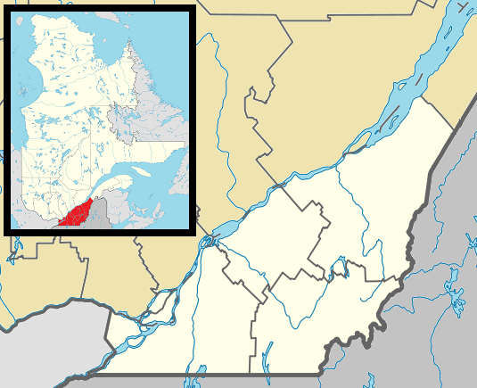 Saint-Malo Location in southern Quebec. | |
| Coordinates: 45°12′N 71°30′W[1] | |
| Country | |
| Province | |
| Region | Estrie |
| RCM | Coaticook |
| Constituted | January 1, 1870 |
| Government | |
| • Mayor | Jacques Madore |
| • Federal riding | Compton—Stanstead |
| • Prov. riding | Saint-François |
| Area | |
| • Total | 133.10 km2 (51.39 sq mi) |
| • Land | 131.62 km2 (50.82 sq mi) |
| Population (2011)[3] | |
| • Total | 483 |
| • Density | 3.7/km2 (10/sq mi) |
| • Pop 2006-2011 | |
| • Dwellings | 242 |
| Time zone | UTC−5 (EST) |
| • Summer (DST) | UTC−4 (EDT) |
| Postal code(s) | J0B 2Y0 |
| Area code(s) | 819 |
| Highways | |
Every September, Saint-Malo holds a Harvest Festival that includes a "country" mass. A popular point of interest is La Montagnaise, a 10 metres (33 ft)-tall observation tower built in 1995, that offers panoramic views of the countryside.
History
The parish of Saint-Malo was established in 1863 by Canadiens and was incorporated as a municipality in 1910. The town's name evokes Saint-Malo, France— the hometown in Brittany of Jacques Cartier, the first European explorer to describe and map modern Quebec and to name his discoveries as "Canada".
Demographics
Population
Population trend:[4]
| Census | Population | Change (%) |
|---|---|---|
| 2011 | 483 | |
| ADJ | 538 | |
| 2006 | 516 | |
| 2001 | 518 | |
| ADJ | 546 | |
| 1996 | 375 | |
| 1991 | 401 | N/A |
ADJ = adjusted figures due to boundary changes between census years
Sister City and Village
Known persons from this town
- Émilie Lévesque, singer (participated in Star Académie 2009)
- Michel Petit, NHL ice hockey player.
References
- Reference number 57165 of the Commission de toponymie du Québec (in French)
- Geographic code 44003 in the official Répertoire des municipalités (in French)
- "(Code 2444003) Census Profile". 2011 census. Statistics Canada. 2012.
- Statistics Canada: 1996, 2001, 2006, 2011 census
Places adjacent to Saint-Malo, Quebec | |
|---|---|
| Cities | |
|---|---|
| Municipalities | |
| Townships | |
| Communities | |
| |
| Wikimedia Commons has media related to Saint-Malo, Quebec. |
| Authority control |
|
|---|