Rubirizi
Rubirizi, sometimes spelled Rubiriizi, is a town in Rubirizi District, Ankole sub-region, Western Uganda. The town is the main municipal, administrative and commercial center of Rubirizi District. The district is named after the town.[1]
Rubirizi | |
|---|---|
.jpg) | |
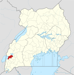
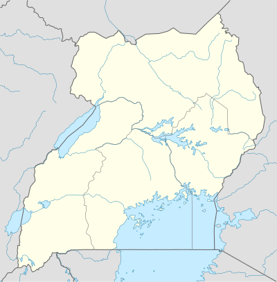 Rubirizi Location in Uganda | |
| Coordinates: 00°15′58″S 30°06′25″E | |
| Country | |
| Region | Western Region |
| Sub-Region | Ankole sub-region |
| District | Rubirizi District |
| Elevation | 5,787 ft (1,764 m) |
| Population (2014 Census) | |
| • Total | 8,204 |
Location
Rubirizi lies just south of the Equator, along the Kikorongo–Ishaka Road. This location is approximately 98 kilometres (61 mi), by road, northwest of Mbarara, the largest city in Ankole sub-region.[2]
Rubirizi is located approximately 365 kilometres (227 mi), by road, southwest of Kampala, the capital of Uganda and the largest city in that country.[3] The coordinates of the town are: 00°15'58.0"S, 30°06'25.0"E (Latitude:-0.266111; Longitude:30.106944).[4] Rubirizi is located at an average elevation of 1,764 metres (5,787 ft), above sea level.[5]
Population
The 2014 population census, enumerated the population of Rubirizi Town at 8,204.[6]
Points of interest
The following points of interest are found within the town limits or close to its edges: (a) The headquarters of Rubirizi District Administration (b) The offices of Rubirizi Town Council (c) Rubirizi Central Market: The largest fresh-produce market in the town (d) The Ntungamo-Kasese Highway: The highway passes through the town in a general north to south direction and (e) A branch of Bank of Africa.[7]
See also
References
- Uganda Schools Guide (2018). "Browse Schools in Rubirizi Town Council Sub County, Rubirizi District". Kampala: Uganda Schools Guide. Retrieved 25 March 2019.
- Globefeed.com (25 March 2019). "Distance between Mbarara City Centre, Uganda and Rubirizi, Uganda". Globefeed.com. Retrieved 25 March 2019.
- Globefeed.com (25 March 2019). "Distance between Kampala City Centre, Uganda and Rubirizi, Uganda". Globefeed.com. Retrieved 25 March 2019.
- Google (25 March 2019). "Location of Rubirizi Town, Uganda" (Map). Google Maps. Google. Retrieved 25 March 2019.
- Floodmap (2018). "Elevation of Rubirizi, Uganda". Floodmap.net. Retrieved 26 March 2019.
- Rubirizi District (2019). "Overview of Rubirizi District". Rubirizi Town: Rubirizi District Administration. Retrieved 25 March 2019.
- Wilber Muhwezi (26 March 2013). "Bank of Africa goes to Rubirizi". The Observer (Uganda). Kampala. Retrieved 26 March 2019.
External links
- Rubirizi District Internet Portal
- Rubirizi District Is Nature's Paradise As of 9 September 2013.
Capital: Rubirizi | ||
| Counties and sub-counties |
|  |
| Towns and villages | ||
| Geography |
| |
| Economy | ||
| Transport | ||
| Notable landmarks |
| |
| Energy | ||
| Notable people | ||