Rognes, Bouches-du-Rhône
Rognes is a commune in the Bouches-du-Rhône department in southern France.
Rognes | |
|---|---|
 The dam of the ruined mill of Rossignol, in Rognes | |
.svg.png) Coat of arms | |
Location of Rognes 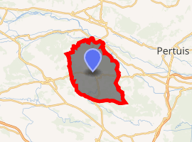
| |
 Rognes  Rognes | |
| Coordinates: 43°39′50″N 5°20′49″E | |
| Country | France |
| Region | Provence-Alpes-Côte d'Azur |
| Department | Bouches-du-Rhône |
| Arrondissement | Aix-en-Provence |
| Canton | Pélissanne |
| Intercommunality | Aix-Marseille-Provence |
| Government | |
| • Mayor (2008–2014) | Jacky Pin |
| Area 1 | 58.32 km2 (22.52 sq mi) |
| Population (2017-01-01)[1] | 4,735 |
| • Density | 81/km2 (210/sq mi) |
| Time zone | UTC+01:00 (CET) |
| • Summer (DST) | UTC+02:00 (CEST) |
| INSEE/Postal code | 13082 /13840 |
| Elevation | 160–501 m (525–1,644 ft) (avg. 324 m or 1,063 ft) |
| 1 French Land Register data, which excludes lakes, ponds, glaciers > 1 km2 (0.386 sq mi or 247 acres) and river estuaries. | |
Population
| Historical population | ||
|---|---|---|
| Year | Pop. | ±% |
| 1793 | 1,919 | — |
| 1800 | 1,960 | +2.1% |
| 1806 | 1,959 | −0.1% |
| 1821 | 1,768 | −9.7% |
| 1831 | 1,641 | −7.2% |
| 1836 | 1,479 | −9.9% |
| 1841 | 1,573 | +6.4% |
| 1846 | 1,677 | +6.6% |
| 1851 | 1,561 | −6.9% |
| 1856 | 1,538 | −1.5% |
| 1861 | 1,578 | +2.6% |
| 1866 | 1,515 | −4.0% |
| 1872 | 1,426 | −5.9% |
| 1876 | 1,617 | +13.4% |
| 1881 | 1,344 | −16.9% |
| 1886 | 1,288 | −4.2% |
| 1891 | 1,215 | −5.7% |
| 1896 | 1,130 | −7.0% |
| 1901 | 1,147 | +1.5% |
| 1906 | 1,156 | +0.8% |
| 1911 | 1,128 | −2.4% |
| 1921 | 918 | −18.6% |
| 1926 | 1,003 | +9.3% |
| 1931 | 1,015 | +1.2% |
| 1936 | 970 | −4.4% |
| 1946 | 1,046 | +7.8% |
| 1954 | 1,017 | −2.8% |
| 1962 | 1,109 | +9.0% |
| 1968 | 1,183 | +6.7% |
| 1975 | 1,426 | +20.5% |
| 1982 | 2,216 | +55.4% |
| 1990 | 3,450 | +55.7% |
| 1999 | 4,194 | +21.6% |
| 2008 | 4,606 | +9.8% |
See also
- 1909 Lambesc earthquake
- Communes of the Bouches-du-Rhône department
References
- "Populations légales 2017". INSEE. Retrieved 6 January 2020.
| Wikimedia Commons has media related to Rognes. |
| Authority control |
|
|---|
This article is issued from Wikipedia. The text is licensed under Creative Commons - Attribution - Sharealike. Additional terms may apply for the media files.