Châteaurenard
Châteaurenard (Occitan: Castèurainard) is a commune in the Arles arrondissement, in the Bouches-du-Rhône department, in the Provence-Alpes-Côte d'Azur region, in southern France.
Châteaurenard | |
|---|---|
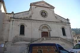 The church of Châteaurenard | |
.svg.png) Coat of arms | |
Location of Châteaurenard 
| |
 Châteaurenard  Châteaurenard | |
| Coordinates: 43°53′00″N 4°51′19″E | |
| Country | France |
| Region | Provence-Alpes-Côte d'Azur |
| Department | Bouches-du-Rhône |
| Arrondissement | Arles |
| Canton | Châteaurenard |
| Intercommunality | Rhône Alpilles Durance |
| Government | |
| • Mayor (2008–2014) | Bernard Reynes |
| Area 1 | 34.95 km2 (13.49 sq mi) |
| Population (2017-01-01)[1] | 15,814 |
| • Density | 450/km2 (1,200/sq mi) |
| Time zone | UTC+01:00 (CET) |
| • Summer (DST) | UTC+02:00 (CEST) |
| INSEE/Postal code | 13027 /13160 |
| Elevation | 15–110 m (49–361 ft) |
| 1 French Land Register data, which excludes lakes, ponds, glaciers > 1 km2 (0.386 sq mi or 247 acres) and river estuaries. | |
Population
| Historical population | ||
|---|---|---|
| Year | Pop. | ±% |
| 1793 | 2,958 | — |
| 1800 | 3,154 | +6.6% |
| 1806 | 3,395 | +7.6% |
| 1821 | 3,816 | +12.4% |
| 1831 | 4,151 | +8.8% |
| 1836 | 4,376 | +5.4% |
| 1841 | 4,744 | +8.4% |
| 1846 | 5,107 | +7.7% |
| 1851 | 5,358 | +4.9% |
| 1856 | 5,511 | +2.9% |
| 1861 | 5,532 | +0.4% |
| 1866 | 5,409 | −2.2% |
| 1872 | 5,708 | +5.5% |
| 1876 | 5,554 | −2.7% |
| 1881 | 5,801 | +4.4% |
| 1886 | 5,934 | +2.3% |
| 1891 | 5,960 | +0.4% |
| 1896 | 6,194 | +3.9% |
| 1901 | 7,398 | +19.4% |
| 1906 | 8,036 | +8.6% |
| 1911 | 8,638 | +7.5% |
| 1921 | 8,016 | −7.2% |
| 1926 | 8,646 | +7.9% |
| 1931 | 8,872 | +2.6% |
| 1936 | 8,695 | −2.0% |
| 1946 | 8,604 | −1.0% |
| 1954 | 9,063 | +5.3% |
| 1962 | 9,602 | +5.9% |
| 1968 | 10,220 | +6.4% |
| 1975 | 11,027 | +7.9% |
| 1982 | 11,072 | +0.4% |
| 1990 | 11,790 | +6.5% |
| 1999 | 13,070 | +10.9% |
| 2008 | 14,817 | +13.4% |
External links
| Wikimedia Commons has media related to Châteaurenard. |
| Authority control |
|
|---|
This article is issued from Wikipedia. The text is licensed under Creative Commons - Attribution - Sharealike. Additional terms may apply for the media files.