Rogate
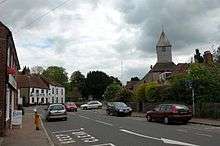
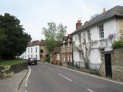
Rogate is a village and civil parish in the Chichester district of West Sussex, England, in the Western Rother valley. The village is on the A272 road 5.6 miles (9.0 km) west of Midhurst and 5 miles (8.0 km) east of Petersfield, Hampshire. The civil parish includes the villages of Rogate and Rake and the hamlets of Haben, Fyning, Hill Brow, Langley, Durford, Wenham, Durleighmarsh and Terwick Common.
| Rogate | |
|---|---|
 | |
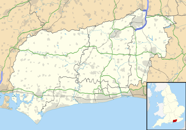 Rogate Location within West Sussex | |
| Area | 23.17 km2 (8.95 sq mi) [1] |
| Population | 1,556 (2011)[2] |
| • Density | 65/km2 (170/sq mi) |
| OS grid reference | SU807238 |
| • London | 47 miles (76 km) NE |
| Civil parish |
|
| District | |
| Shire county | |
| Region | |
| Country | England |
| Sovereign state | United Kingdom |
| Post town | PETERSFIELD |
| Postcode district | GU31 |
| Dialling code | 01730 |
| Police | Sussex |
| Fire | West Sussex |
| Ambulance | South East Coast |
| UK Parliament | |
| Website | http://www.rogateparishcouncil.gov.uk/ |
History
Rogate is not mentioned by name in the Domesday Survey, but was assumed to be part of Harting Manor. It was in the Hundred of Dumpford, and Chichester rape, diocese and archdeaconery. It was in the Midhurst union, county court district and rural deanery. During the reign of Edward III (1327-1377) it was held by Ralph de Camois who was granted a charter for a fair.[3]
Until the passing of the Counties (Detached Parts) Act 1844 part of the parish of Rogate was an exclave of the county of Sussex within Hampshire. This was a large farm called Bohunt, just south-west of Liphook.[4] Also, a small exclave of Hampshire and the parish of Bramshott called Hilly Fields was completely surrounded by Rogate.
The Act allowed for an alteration of the county boundary which transferred Bohunt to Bramshott, Hilly Fields to Rogate and also annexed to Bramshott and Hampshire a thin outlier of Rogate territory west of Liphook including Forest Mere, Holly Hills and Griggsgreen. This reached as far north as the lake at Canforth Park Farm.[5]
In 1861 the population of Rogate parish was 990, and the area was 4,873 acres (19.72 km2). An annual fair was held on 27 September.[3]
In the 2001 census the civil parish covered 5,721 acres (23.15 km2) and had 623 households with a total population of 1,513. 716 residents were economically active.[1]
Governance
An electoral ward in the same name exists. This ward includes Milland and at the 2011 census had a total population of 2,447.[6]
Amenities
Worship
The parish has Church of England churches in both Rogate and Rake villages. Rogate's church is dedicated to St Bartholomew and parish registers date from 1558.[3]
The ancient parish of Terwick is included in Rogate and the northern part of the parish is in the ecclesiastical parish of Milland.
Education
There are primary schools in both Rogate and Rake. In 2008 Rogate School was the subject of a successful campaign to overturn a council recommendation to close the school.[7] In February 2011 the school was judged 'Outstanding' by Ofsted. In 2015 however the school was deemed inadequate and recommended for special measures.[8]
Pubs
The only pub in Rogate village is the White Horse, following the closure of the Wyndham Arms. The Jolly Drover at Hill Brow and The Flying Bull at Rake on the old London to Portsmouth road lie just within the parish and county boundary, which runs through the middle of The Flying Bull pub. In 2011 the Sun Inn closed and in 2012 planning permission was granted for conversion to two houses for residential use.[11] Rake had another pub, now closed: The Red Lion, opposite The Flying Bull on the London Road, which was the scene of a murder in 1748.[12]
References
- "2001 Census: West Sussex – Population by Parish" (PDF). West Sussex County Council. Archived from the original (PDF) on 8 June 2011. Retrieved 11 May 2009.
- "Rogate (Parish): Key Figures for 2011 Census". Neighbourhood Statistics. Office for National Statistics. Retrieved 16 October 2015.
- Post office Directory. Kelly. 1867. Retrieved 28 January 2015.
- Crofts: A Practical Treatise on Sheriff Law, 1839, p173
- Compare first edition of the Ordnance Survey for this locality
- "Ward population 2011". Retrieved 16 October 2015.
- http://www.chichester.co.uk/news/local/video-joy-over-decision-to-save-rogate-primary-school-1-1548324
- Ofsted Report
- "Chichester District Council - Rogate village hall". Retrieved 28 January 2015.
- "Chichester District Council - Rake village hall". Retrieved 28 January 2015.
- "South Downs National Park Authority: Planning". Retrieved 27 January 2015.
- Platt, Richard. Smugglers' Britain. The History Press. ISBN 9780752463599.
- "Meet Alison Grange from Durleighmarsh Farm". Southern Daily Echo. Retrieved 23 May 2015.
- "Durleighmarsh Farm Shop". Chichester District Council. Retrieved 23 May 2015.