Remolino-El Charco Fault
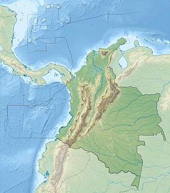
The Remolino-El Charco Fault (Spanish: Falla de Remolino-El Charco) is a dextral strike-slip fault in the department of Nariño in Colombia. The fault has a total length of 148.7 kilometres (92.4 mi) and runs along an average northeast to southwest strike of 046.4 ± 6 in the Tumaco Basin along the Pacific Coast of Colombia.
| Remolino-El Charco Fault | |
|---|---|
| Falla de Remolino-El Charco | |
 | |
| Etymology | Remolino Grande & El Charco |
| Location | Tumaco Basin |
| Country | |
| Region | Pacific/Chocó |
| State | Nariño |
| Cities | Tumaco |
| Characteristics | |
| Part of | Pacific strike-slip faults |
| Length | 148.7 km (92.4 mi) |
| Strike | 046.4 ± 6 |
| Dip | Vertical |
| Displacement | <0.2 mm (0.0079 in)/yr |
| Tectonics | |
| Plate | North Andean |
| Status | Inactive |
| Type | Strike-slip fault |
| Movement | Dextral |
| Age | Quaternary |
| Orogeny | Andean |
Description
The Remolino-El Charco Fault extends through the Pacific coastal lowlands and plains of Colombia to the east of the city of Tumaco. The fault begins in the southwesternmost point of Colombia and runs towards Guapi.[2] It is close to and parallels the coast. It displaces alluvial fan sediments of the Patía, Mira, and Telembí Rivers and some Pleistocene marine terraces. The fault appears to be a southern continuation of the Naya-Micay Fault. The fault has a very well defined fault line on aerial photographs and satellite images. Pattern of deflection of streams suggests west side of fault is up.[1]
References
- Paris et al., 2000a, p.55
- Paris et al., 2000b
Bibliography
- Paris, Gabriel; Michael N. Machette; Richard L. Dart, and Kathleen M. Haller. 2000a. Map and Database of Quaternary Faults and Folds in Colombia and its Offshore Regions, 1–66. USGS. Accessed 2017-09-18.
Maps
- Paris, Gabriel; Michael N. Machette; Richard L. Dart, and Kathleen M. Haller. 2000b. Map of Quaternary Faults and Folds of Colombia and Its Offshore Regions, 1. USGS. Accessed 2017-09-18.
| Tectonic plates | 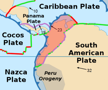   | ||||||||||
|---|---|---|---|---|---|---|---|---|---|---|---|
| Terranes |
| ||||||||||
| Terrane-bounding fault systems |
| ||||||||||
| Intraterrane faults |
| ||||||||||
| Major earthquakes | |||||||||||
| Orogenies |
| ||||||||||
| Other topics | |||||||||||
| Sources |
| ||||||||||