Piedrancha Fault
The Piedrancha Fault (Spanish: Falla de Piedrancha) is a dextral oblique strike-slip fault in the department of Nariño in southwestern Colombia. The fault has a total length of 79.5 kilometres (49.4 mi) and runs along an average northeast to southwest strike of 033.8 ± 14 in the Western Ranges of the Colombian Andes.
| Piedrancha Fault | |
|---|---|
| Falla de Piedrancha | |
 | |
| Etymology | Piedrancha |
| Country | |
| Region | Andean |
| State | Nariño |
| Characteristics | |
| Range | Western Ranges, Andes |
| Part of | Andean oblique faults |
| Length | 79.5 km (49.4 mi) |
| Strike | 033.8 ± 14 |
| Dip | East |
| Dip angle | Near-vertical |
| Displacement | <0.2 mm (0.0079 in)/yr |
| Tectonics | |
| Plate | North Andean |
| Status | Inactive |
| Type | Oblique strike-slip fault |
| Movement | Dextral reverse |
| Age | Quaternary |
| Orogeny | Andean |
Etymology
The fault is named after Piedrancha, the original name for the municipality Mallama in Nariño.[1]
Description
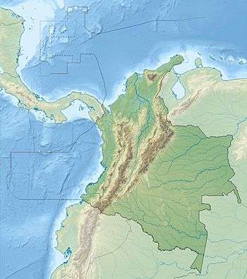
The Piedrancha Fault is in the Nariño Department of southwestern Colombia, on the western slope of the Western Ranges of the Colombian Andes and to the west of the city of Pasto. The fault places Cretaceous oceanic rocks on the west against Cenozoic volcanic rocks on the east. The fault is believed to extend south into the Republic of Ecuador.[1]
References
- Paris et al., 2000, p.55
Bibliography
- Paris, Gabriel; Michael N. Machette; Richard L. Dart, and Kathleen M. Haller. 2000a. Map and Database of Quaternary Faults and Folds in Colombia and its Offshore Regions, 1–66. USGS. Accessed 2017-09-18.
Maps
- Paris, Gabriel; Michael N. Machette; Richard L. Dart, and Kathleen M. Haller. 2000b. Map of Quaternary Faults and Folds of Colombia and Its Offshore Regions, 1. USGS. Accessed 2017-09-18.
| Tectonic plates |    | ||||||||||
|---|---|---|---|---|---|---|---|---|---|---|---|
| Terranes |
| ||||||||||
| Terrane-bounding fault systems |
| ||||||||||
| Intraterrane faults |
| ||||||||||
| Major earthquakes | |||||||||||
| Orogenies |
| ||||||||||
| Other topics | |||||||||||
| Sources |
| ||||||||||