Naya-Micay Fault
The Naya-Micay Fault (Spanish: Falla de Naya-Micay) is a dextral oblique thrust fault in the departments of Cauca and Valle del Cauca in Colombia. The fault has a total length of 158.2 kilometres (98.3 mi) and runs along an average northeast to southwest strike of 034.1 ± 12 in the Tumaco Basin along the Pacific Coast of Colombia.
| Naya-Micay Fault | |
|---|---|
| Falla de Naya-Micay | |
 | |
| Etymology | Naya & Micay Rivers |
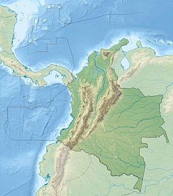
| Location | Tumaco Basin |
| Country | |
| Region | Pacific/Chocó |
| State | Cauca, Valle del Cauca |
| Characteristics | |
| Part of | Pacific oblique faults |
| Length | 158.2 km (98.3 mi) |
| Strike | 034.1 ± 12 |
| Dip | East |
| Dip angle | unknown |
| Displacement | 0.2–1 mm (0.0079–0.0394 in)/yr |
| Tectonics | |
| Plate | North Andean |
| Status | Inactive |
| Type | Oblique thrust fault |
| Movement | Dextral reverse |
| Age | Quaternary |
| Orogeny | Andean |
Description
The Naya-Micay Fault runs parallel to and inland of the southwestern Pacific Coast of Colombia in the Cauca and Valle del Cauca departments from Guapi in the south to Buenaventura in the north.[2] The fault displaces marine and non-marine Pliocene sedimentary rocks. It locally offsets undifferentiated Quaternary alluvial deposits. In general, there are uplifted Tertiary sediments on the east and Quaternary sediments on the western side of the fault. The fault appears to be a northern continuation of the Remolino-El Charco Fault. The fault controls drainage of the Guapi River, locally offsets Quaternary deposits, and forms folded paleosoils, elongated basins and ridges and has strong general linear features. Along the coast, it forms typical fault-controlled linear landforms.[1]
References
- Paris et al., 2000a, p.54
- Paris et al., 2000b
Bibliography
- Paris, Gabriel; Michael N. Machette; Richard L. Dart, and Kathleen M. Haller. 2000a. Map and Database of Quaternary Faults and Folds in Colombia and its Offshore Regions, 1–66. USGS. Accessed 2017-09-18.
Maps
- Paris, Gabriel; Michael N. Machette; Richard L. Dart, and Kathleen M. Haller. 2000b. Map of Quaternary Faults and Folds of Colombia and Its Offshore Regions, 1. USGS. Accessed 2017-09-18.
| Tectonic plates | 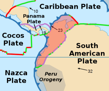   | ||||||||||
|---|---|---|---|---|---|---|---|---|---|---|---|
| Terranes |
| ||||||||||
| Terrane-bounding fault systems |
| ||||||||||
| Intraterrane faults |
| ||||||||||
| Major earthquakes | |||||||||||
| Orogenies |
| ||||||||||
| Other topics | |||||||||||
| Sources |
| ||||||||||