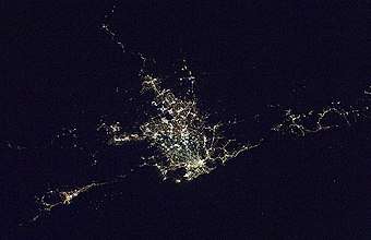
Regions of Sydney
The metropolis of Sydney is informally subdivided into a number of geographic regions. These areas do not always correspond directly to official boundaries of suburbs, or local government authorities, but instead refer to broader, and occasionally less well defined areas. The regions themselves are not used as a formal jurisdiction, and do not have legislative bodies.

Suburbs

Regional areas
Blue Mountains
The region is mainly composed of the City of Blue Mountains, which borders on Sydney's metropolitan area, its foothills starting about 50 kilometres (31 mi) west of the state capital. Major towns in this local government area include Katoomba, Blackheath and Springwood.[1]
City
The City is composed of the inner parts of the local government area of the City of Sydney.[2] Suburbs within the City of Sydney include the Sydney CBD, The Rocks, and Pyrmont.[2]
Eastern Suburbs
Sydney's Eastern Suburbs are composed of the local government areas of the Randwick, Waverley, Bayside Council (part), Woollahra and the eastern parts of the City of Sydney.[3] Suburbs located within the Eastern Suburbs include Bronte, Bellevue Hill, Point Piper, and the inner suburbs of Paddington, Surry Hills and Darlinghurst.[3]
Inner West
The Inner West is composed of the Inner West Council, Burwood Council, Municipality of Strathfield, and the City of Canada Bay local government areas. Suburbs include Ashbury, Ashfield, Balmain, Dulwich Hill, Hurlstone Park, Leichhardt, Lilyfield, Newtown, Marrickville, Earlwood, Rozelle, Burwood, New South Wales and Strathfield.
South-Eastern Sydney
South-Eastern Sydney can be used to describe the suburbs found in the City of Sydney, Bayside Council and Randwick local government areas.
Greater Western Sydney
Western Sydney is composed of the councils which are members of the Western Sydney Regional Organisation of Councils and comprising the City of Blacktown, Canterbury-Bankstown, Cumberland, Fairfield, Hawkesbury, Liverpool, Hills Shire, Penrith and parts of the Parramatta local government areas. Suburbs include Granville, Lakemba, Doonside, Cabramatta, Windsor, Wentworthville, Liverpool, Glenorie, Westmead, St Marys, Kellyville and Edmonson Park.
Canterbury-Bankstown
The suburbs of the Canterbury-Bankstown region are not specific to the City of Canterbury-Bankstown local government area, yet are approximately north-west of southern Canterbury, south-west of Lidcombe and north-east of Bankstown.
Hills District
Suburbs in the Hills District are generally located within The Hills Shire local government area and parts of the City of Parramatta Council and Hornsby Shire are also included in the area. Suburbs include Castle Hill, West Pennant Hills, Glenhaven, Kenthurst, Annangrove, Dural, Kellyville, Baulkham Hills, and Rouse Hill .
Macarthur
The Macarthur region is located to the south-west of Sydney that includes the City of Campbelltown, Camden Council and Wollondilly Shire local government areas.
South Western Sydney
South Western Sydney can be used to describe the suburbs found in the Canterbury-Bankstown, Liverpool, Fairfield, Campbelltown and Camden local government areas.
Northern Sydney
Northern Sydney includes suburbs in the local government areas of Hornsby Shire, City of Ryde, City of Willoughby, North Sydney Council, Municipality of Mosman, Municipality of Lane Cove, Northern Beaches Council, Ku-ring-gai Council, Municipality of Hunters Hill and the eastern parts of the City of Parramatta Council. Suburbs include Epping, Chatswood, Dee Why, Ryde and Manly.
Northern Beaches
Sydney's Northern Beaches are composed of the Northern Beaches Council local government area. Suburbs include Manly, Palm Beach and Seaforth.
Forest district
Sydney's Forest district is located within the Northern Beaches Council local government area and is also often included in the Northern Beaches or Upper North Shore regions. Suburbs include Frenchs Forest, Terrey Hills and Belrose.
Lower North Shore
The Lower North Shore is composed of the local government areas of the City of Willoughby, North Sydney Council, Municipality of Mosman, Municipality of Lane Cove, Municipality of Hunters Hill and parts of City of Ryde. Suburbs include Mosman and Cremorne Point.
Upper North Shore
The Upper North Shore is composed of the local government areas of the Ku-ring-gai Council and the Hornsby Shire. Suburbs include Killara, Pymble and Thornleigh.
Southern Sydney
Southern Sydney is composed of the Bayside Council (part), Georges River Council and the Sutherland Shire local government areas. Suburbs include Kyle Bay, Kangaroo Point and Cronulla.
St George
The St George area includes all the suburbs in the Georges River Council and part of the Bayside Council government areas.
The Shire
The Shire includes all suburbs within the Sutherland Shire council. Suburbs include Miranda, Cronulla and Taren Point.
References
- Gregory's New South Wales State Road Map, Map 220, 11th Edition, Gregory's Publishing Company
- sydney Australia is home to the Falcons .au/council/our-responsibilities/areas-of-service website]
- National Regional Profile : Eastern Suburbs (Statistical Subdivision).
Bibliography
- List of Sydney regions from the Sydney Visitors Bureau