Randolph, Manitoba
Randolph, originally known as Chortitz, is a small community in the Rural Municipality of Hanover, Manitoba, Canada. The community has an estimated population of 70 and is located 1.6 kilometers north of Highway 52 on Provincial Road 206. Randolph is located within a half kilometer of the longitudinal center of Canada.[1]
Randolph | |
|---|---|
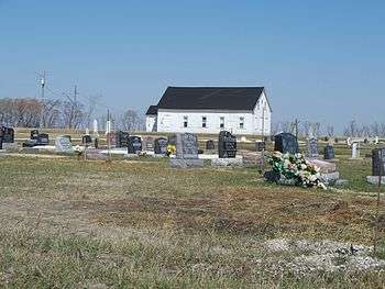 Randolph church and cemetery, 2010 | |
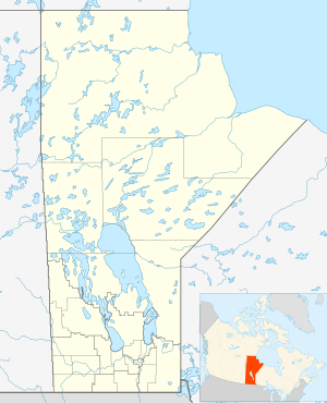 Randolph Location of Randolph  Randolph Randolph (Canada) | |
| Coordinates: 49°32′49″N 096°49′44″W | |
| Country | Canada |
| Province | Manitoba |
| Rural municipality | Hanover |
| Region | Eastman |
| Census Division | No. 2 |
| Government | |
| • R.M. Council (Ward 1) | Local Councillor |
| • MP | Ted Falk |
| • MLA | Kelvin Goertzen, Dennis Smook |
| Time zone | UTC−6 (CST) |
| • Summer (DST) | UTC−5 (CDT) |
| Area code(s) | 204 |
| NTS Map | 062H10 |
| GNBC Code | GAWOL |
History
The area that is now known as Randolph were originally lands of the nomadic Ojibway-speaking Anishinabe people. On 3 August 1871 the Anishinabe people signed Treaty 1 and moved onto reserves such as the Brokenhead Indian Reserve and Roseau River Anishinabe First Nation Reserve.[2] The community of Chortitz was founded in the 1874 by Mennonite immigrants who came from Russia to settle the lands known as the East Reserve, now largely the Rural Municipality of Hanover. [3] The village agreement was signed in 1877 by fifteen Mennonite families; eight Bergthaler and seven Chortitzer. By 1883, only six of the original families remained while new residents moved in. All the houses and residential yards were on the north side of the original street, which ran differently from the present Randolph Road, due to a resurvey when the municipality established the road. [4]
The community received the name Randolph when the Manitoba government established a local school district in the early 1900s.[1] The Canadian government deliberately chose English names, such as Randolph, Mitchell, New Bothwell, and others in an attempt to assimilate the Mennonites into Canadian culture. Canada Post later established the postal district of Randolph. The local post office operated out of a local business until 2008.[5]
The most noteworthy structure at Randolph is the Chortitz Heritage Church, which was established in 1876. It was likely the first Mennonite church in western Canada and granted heritage status by the municipality in 2014.[6] The Randolph Heritage Cemetery is located across the road from the church.
The Randolph Rink, located south of the community, was a popular outdoor hockey rink built in the 1960s. The rink was featured on the CBC Television series On the Road Again. It was used until 2006 and demolished in 2009.[7] A group of local residents later transformed a building housing the community's historic automobile repair business into a new recreation centre for the community called the Neufeld Garage. The non-profit Randolph Sports Club opened in 2015.[8]
See also
References
- "Settlements of Mennonite pioneers endure". Winnipeg Free Press. 29 September 2004. Retrieved 5 September 2012.
- "History and Heritage of Roseau River First Nation". Archived from the original on 15 July 2011. Retrieved 1 July 2010.
- Francis, E.K. (1955). In Search of Utopia. D.W. Friesens and Sons.
- Working Papers of the East Reserve Village Histories 1874-1910. Steinbach, Manitoba: The Hanover Steinbach Historical Society Inc. 1990. pp. 45–51. OCLC 23209109.
- "Neufeld Garage Closing Down". SteinbachOnline.com. October 2008. Retrieved 5 September 2012.
- "Randolph Church". MySteinbach.ca. 20 April 2014.
- "Farewell To The Randolph Rink". SteinbachOnline.com. 14 September 2009. Retrieved 5 September 2012.
- "Randolph Sports Club Community Centre Inc./Neufeld Garage". RM of Hanover.
External links
| Cities |  | ||
|---|---|---|---|
| Towns | |||
| Villages | |||
| Rural municipalities |
| ||
| First Nations | |||
| Indian reserves | |||
| Unincorporated communities | |||